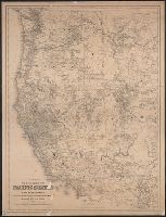
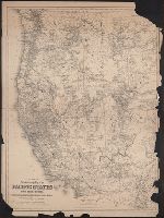
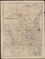
Map of the states and territories from the Mississippi River to the Pacific Ocean
Description:
"Entered according to act of Congress in the year 1874 by G.W. & C.B. Colton ... ", Also shows locations of Indian tribes., Includes text., Prime meridians: Greenwich and Washington., and Relief shown by hachures and spot heights.
Publisher:
G.W. and C.B. Colton,
Subject (Geographic):
Overland Trails--Maps and West (U.S.)--Maps
Subject (Topic):
Indians of North America--Maps and Railroads--West (U.S.)--Maps
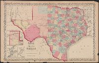
"No.35" and "No.36.", Includes Frio and Zavala counties which were formed in 1858 and which do not appear on Colton map dated 1857., Insets: Plan of the northern part of Te, and Library's copy annotated in pencil "This is in the same state as in the 1859 atlas."
Publisher:
Johnson & Browning,
Subject (Geographic):
Texas Panhandle (Tex.)--Maps, Texas--Administrative and political divisions--Maps, and Texas--Maps
Subject (Name):
De Cordova, Jacob, 1808-1868, J.H. Colton & Co, Johnson & Browning, and Streeter, Thomas W.--(Thomas Winthrop),--1883-1965--Ownership
New topographical map of the eastern portion of the state of North Carolina
Description:
At upper left corner, outside margin & foliate border: No. 11., Cut into 2 sheets, Inset map: Plan of the, Prime meridans: Greenwich and Washington, D.C., Relief shown by hachures., and Shows names of counties, cities, towns, roads, railroads, rivers, and inlets.
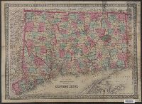
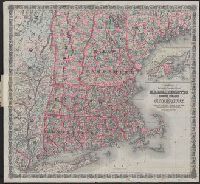
Massachusetts, Rhode Island, and Connecticut and Railroad & township map of Massachusetts, Rhode Island, and Connecticut
Description:
"Entered according to Act of Congress in the Year 1860 by J.H. Colton in the Clerks Office of the District Court for the Southern District of New York.", Inset: British Provinces. Scale [ca. 1:1,850,000]., Prime meridians: Greenwich and Washington, D.C., and Rel
Colton, G. Woolworth (George Woolworth), 1827-1901
Call Number:
771 1869C
Container / Volume:
BRBL_00479
Image Count:
1
Resource Type:
Maps, Atlases & Globes
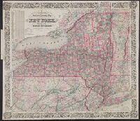
Alternative Title:
Colton's railroad and township map of the state of New York, Railroad & township map of the state of New York with parts of the adjoining states & Canada, and Railroad and township map of the state of New York with parts of the adjoining states and Canada
Description:
"Entered according to Act of Congress in the year 1852, by J.H. Colton, in the clerks office of the dist. court for the southern dist. of N. York.", Includes inset population table., Map within decorative border., Prime meridians: Greenwich and Washington., and R
Publisher:
Published by G.W. & C.B. Colton & Co., 172 William St.,
Subject (Geographic):
New York (State)--Maps.
Subject (Name):
Atwood, John M., approximately 1818- and G.W. & C.B. Colton & Co.
Colton, G. Woolworth (George Woolworth), 1827-1901
Published / Created:
1852
Call Number:
804 1852
Container / Volume:
BRBL_00543
Image Count:
1
Resource Type:
Maps, Atlases & Globes
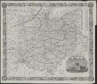
Description:
From: Report on the preliminary surveys made for the Cincinnati, Hillsborough and Parkersburg Railway. Cincinnati : Cincinnati Gazette Co. Print., 1852., Includes view of the "State capitol at Columbus.", Prime meridians: Greenwich and Washington., and Shows rai
Publisher:
J.H. Colton,
Subject (Geographic):
Ohio--Maps
Subject (Name):
Atwood, John M., b. ca. 1818, Cincinnati, Hillsborough and Parkersburg Railroad--Maps, and Colton, J. H. (Joseph Hutchins), 1800-1893