
You Searched For
« Previous
| 1 - 10 of 11 |
Next »
Search Results
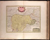
- Creator:
- Valck, G. (Gerard), 1651 or 1652-1726.
- Published / Created:
- [1710?]
- Call Number:
- 1973 Folio 18
- Image Count:
- 1
- Resource Type:
- Maps, Atlases & Globes
- Description:
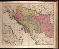
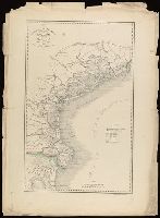
- Backed with paper. Ms. no. "77" in upper right corner. Sheet measures 53.6 x 62.5 cm. No. 71 of 87 maps bound together., Bar scales given in "milliaria Hungarica" and "milliaria Germanica.", Covers Croatia, Bosnia and Hercegovina, Serbia, Montenegro and portions of Italy, Albania, Greece, Macedonia and Hungary., In Latin with place names in Italian., and Relief shown pictorially.
- Publisher:
- Gerardum et Leonardum Valk,
- Subject (Geographic):
- Balkan Peninsula--Maps--Early works to 1800.
- Subject (Name):
- Valck, Leonard, 1675-1746.
- Found in:
- Beinecke Rare Book and Manuscript Library > Dalmatia, Sclavonia, Croatia, Bosnia, Servia, et Istria [cartographic material] : distributa in singulares ditiones et diœceses, una cum Republica Ragusana, et circumjacentibus regionibus, Hungaria, Venetiis, statu ecclesiastico, Napoli et Macedonia / Venundantur per Gerardum et Leonardum Valk, cum Priv.
- Creator:
- Blaeu, Joan, 1596-1673.
- Published / Created:
- 1647?]
- Call Number:
- 1973 Folio 18
- Image Count:
- 1
- Resource Type:
- Maps, Atlases & Globes
- Alternative Title:
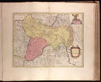
- Dvcato di Parma et di Piacenza
- Description:
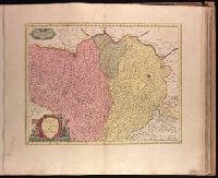
- Bar scale given in "miglia sette.", Relief shown pictorially., and Sheet printed from cracked plate. Backed with paper. Ms. no. "72" in upper right corner. Sheet measures 53.7 x 62.6 cm. No. 67 of 87 maps bound together.
- Publisher:
- Joan Blaeu,
- Subject (Geographic):
- Parma (Italy : Province)--Maps--Early works to 1800. and Piacenza (Italy : Province)--Maps--Early works to 1800.
- Found in:
- Beinecke Rare Book and Manuscript Library > Ducato di Parma et di Piacenza [cartographic material].
- Creator:
- Blaeu, Joan, 1596-1673.
- Published / Created:
- 1647?]
- Call Number:
- 1973 Folio 18
- Image Count:
- 1
- Resource Type:
- Maps, Atlases & Globes
- Alternative Title:
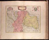
- Dvcato ouero Territorio di Milano
- Description:
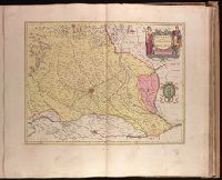
- Backed with paper. Ms. no. "73" in upper right corner. Sheet measures 53.6 x 63.0 cm. No. 68 of 87 maps bound together., Bar scale given in "miglia sette d'Italia.", and Relief shown pictorially.
- Publisher:
- Joan Blaeu,
- Subject (Geographic):
- Milan (Italy : Province)--Maps--Early works to 1800.
- Found in:
- Beinecke Rare Book and Manuscript Library > Ducato ouero Territorio di Milano [cartographic material].
- Published / Created:
- [1852?]
- Call Number:
- 40 V55 1850A
- Image Count:
- 1
- Resource Type:
- Maps, Atlases & Globes
- Description:
- Appears in Giuseppe La Farina's history of Italy published 1851-1852 by Societa editrice italiana. and In lower left: La-Farina : Storia d'Italia dal 1815 al 1850.
- Publisher:
- Dr. Francesco Vallardi ,
- Subject (Geographic):
- Venice (Italy : Province)--Maps.
- Subject (Name):
- Casa editrice dr. Francesco Vallardi.
- Found in:
- Beinecke Rare Book and Manuscript Library > Governo di Venezia, provincia de Venezia.
- Creator:
- Blaeu, Joan, 1596-1673.
- Published / Created:
- 1647?]
- Call Number:
- 1973 Folio 18
- Image Count:
- 1
- Resource Type:
- Maps, Atlases & Globes
- Alternative Title:
- Bellvnese con il Feltrino
- Description:
- Backed with paper. Ms. no. "70" in upper right corner. Sheet measures 53.6 x 63.3 cm. No. 65 of 87 maps bound together., Bar scale given in "miglia cinque.", and Relief shown pictorially.
- Publisher:
- Joan Blaeu,
- Subject (Geographic):
- Belluno (Italy : Province)--Maps--Early works to 1800.
- Found in:
- Beinecke Rare Book and Manuscript Library > Il Bellunese con il Feltrino [cartographic material].
- Creator:
- Blaeu, Joan, 1596-1673.
- Published / Created:
- 1647?]
- Call Number:
- 1973 Folio 18
- Image Count:
- 1
- Resource Type:
- Maps, Atlases & Globes
- Description:
- Backed with paper. Ms. no. "69" in upper right corner. Sheet measures 53.5 x 62.5 cm. No. 64 of 87 maps bound together., Bar scale given in "miglia cinque.", and Relief shown pictorially.
- Publisher:
- Joan Blaeu,
- Subject (Geographic):
- Italy, Northern--Maps--Early works to 1800. and Veneto (Italy)--Maps--Early works to 1800.
- Found in:
- Beinecke Rare Book and Manuscript Library > Il Cadorino [cartographic material].
- Creator:
- Zatta, Antonio, fl. 1757-1797.
- Published / Created:
- 1778
- Call Number:
- 73 1778
- Image Count:
- 1
- Resource Type:
- Maps, Atlases & Globes
- Description:
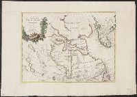
- Appears in the Zatta's Atlante novissimo. 1779-85. v.4. and Relief shown by hachures.
- Publisher:
- Presso Antonio Zatta,
- Subject (Geographic):
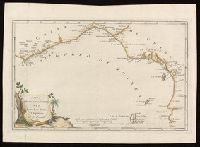
- Canada--Maps--Early works to 1800., Greenland--Maps--Early works to 1800., and Hudson Bay Region--Maps--Early works to 1800.
- Subject (Name):
- Giuliani, G., Pitteri, Giovanni Marco, 1702-1786., and Zatta, Antonio, active 1757-1797. Atlante Novissimo.
- Found in:
- Beinecke Rare Book and Manuscript Library > La Baja d'Hudson, terra di Labrador e Groenlandia con le isole adiacenti di nuova projezione / presso Antonio Zatta, G. Giuliani, inc., G. Pitteri, ser.
- Creator:
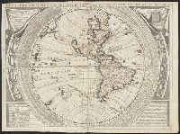
- Coronelli, Vincenzo, 1650-1718, cartographer.
- Published / Created:
- 1691 or 1695]
- Call Number:
- 70 169XC
- Image Count:
- 1
- Resource Type:
- Maps, Atlases & Globes
- Description:
- "Dedicato all illustrissimo, et eccellentissimo Signore Andrea Marcello, Senatore Amplissimo, e Fratello dell' Eccellentiss: Sigr. Federico, Procuratore di S. Marco"., From Coronelli's Atlante Veneto (1691)., Imperfect: mutilated. From the Karpinski-von Wieser Map Collection., Includes text and illustrations.Surrounding map border are "Tauola dell' Ombre Rette, e Meridiane..." and "Gradi di Latitudine, ridotti in Leghe di Germania, a 15 per Grado dell'Equatore" and "Gradi di Latitudine, ridotti in Migtia d'Italia, a 60 per Grado dell'Equatore", and signs of zodiac., Prime meridian: Ferro; coordinates converted by cataloger to express longitude based on Greenwich prime meridian., and Western hemisphere with California as an island on second Sanson model, with only C. Blanco named. Identifies "Terra di Iesso, Scoperta dagli Holland l'Anno 1643" to West, and mentions to North of California "In alcune Carte moderne uiene quiui situato lo Stretto d'Anian".
- Publisher:
- s.n.,
- Subject (Geographic):
- Western Hemisphere--Maps--Early works to 1800.
- Subject (Name):
- Coronelli, Vincenzo, 1650-1718. Atlante Veneto., Karpinski, Louis Charles,--1878-1956--Ownership., Karpinski-von Wieser Map Collection., Sacro Bosco, Joannes de, active 1230., and Wieser, Franz,--Ritter von,--1848-1923--Ownership.
- Found in:
- Beinecke Rare Book and Manuscript Library > Planisfero del mondo nuovo / descritto dal P. Coronelli, cosmografo publico.
- Creator:
- Blaeu, Willem Janszoon, 1571-1638.
- Published / Created:
- [ca. 1631]
- Call Number:
- 1973 Folio 18
- Image Count:
- 1
- Resource Type:
- Maps, Atlases & Globes
- Description:
- Appeared in Blaeu's Atlantis appendix, 1631., Backed with paper. Ms. no. in upper right corner: 16. Sheet measures 53.6 x 63.0 cm. No. 16 of 87 maps bound together., Relief shown pictorially., Scales given in "miglia d'Italia" and "miglia d'Allemagne"., and Watermark.
- Publisher:
- Apud Guiljelmus Blaeuw,
- Subject (Geographic):
- Trento (Italy)--Maps--Early works to 1800.
- Subject (Name):
- Blaeu, Willem Janszoon, 1571-1638. Atlantis appendix.
- Found in:
- Beinecke Rare Book and Manuscript Library > Territorio di Trento [cartographic material].