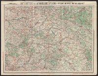
Skip to search
Skip to main content
Skip to first result
Search
You Searched For
Genre
Road maps
Resource Type
Maps, Atlases & Globes
Language
French
New Search
Search Results
Creator:
Published / Created:
[1917]
Call Number:
38gmb P21 1907
Container / Volume:
BRBL_00171
Image Count:
2
Resource Type:
Maps, Atlases & Globes
Alternative Title:
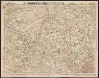
Environs de Paris : and Nouvelle carte de France à l'usage des cyclistes et automobiles.
Description:
"11-17"--Lower right., In French., and Sheet index on panel.
Publisher:
Cartes Taride,
Subject (Geographic):
France, Northern--Maps
Subject (Name):
Cartes Taride (Firm)
Subject (Topic):
Bicycle trails--France, Northern--Maps and Roads--France, Northern--Maps
Found in:
Beinecke Rare Book and Manuscript Library > Carte automobilistes & cyclistes : environs de Paris, nord-ouest / A. Taride, editeur.
Creator:
Published / Created:
[1907]
Call Number:
38gmb P21 1907A
Container / Volume:
BRBL_00171
Image Count:
1
Resource Type:
Maps, Atlases & Globes
Alternative Title:
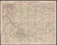
Environs de Paris :
Description:
"08-07"--Lower right., In French., and Sheet index on panel.
Publisher:
Cartes Taride,
Subject (Geographic):
France, Southern--Maps
Subject (Name):
Cartes Taride (Firm)
Subject (Topic):
Bicycle trails--France, Southern--Maps and Roads--France, Southern--Maps
Found in:
Beinecke Rare Book and Manuscript Library > Carte cycliste et automobile des environs de Paris : à l'échelle du 1/100.000e, sud-est / A. Taride, editeur.
Creator:
Published / Created:
[1907]
Call Number:
38gmb P21 1907B
Container / Volume:
BRBL_00171
Image Count:
1
Resource Type:
Maps, Atlases & Globes
Description:
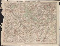
"7-07"--Lower right. and In French.
Publisher:
Cartes Taride,
Subject (Geographic):
France, Southern--Maps
Subject (Name):
Cartes Taride (Firm)
Subject (Topic):
Bicycle trails--France, Southern--Maps and Roads--France, Southern--Maps
Found in:
Beinecke Rare Book and Manuscript Library > Carte cycliste et automobile des environs de Paris : à l'échelle du 1/100.000e, sud-ouest / A. Taride, editeur.
Published / Created:
[1948?]
Call Number:
364gf 1928
Container / Volume:
BRBL_00144
Image Count:
1
Resource Type:
Maps, Atlases & Globes
Description:
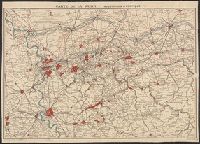
"1-48".
Publisher:
Ed. Blondel la Rougery,
Subject (Geographic):
North Rhine-Westphalia (Germany)--Maps
Found in:
Beinecke Rare Book and Manuscript Library > Carte de la Ruhr : Industrielle et Politique.
Published / Created:
[1910]
Call Number:
36gmb 1910A
Container / Volume:
BRBL_00130
Image Count:
1
Resource Type:
Maps, Atlases & Globes
Description:
Dissected and mounted on linen. and Indicates recommended routes for automobiles and bicycles.
Publisher:
A. Taride,
Subject (Geographic):
Austria--Maps and Germany--Maps
Found in:
Beinecke Rare Book and Manuscript Library > Carte routière de l'Allemagne du Sud, Autriche, Tyrol (Grands itinéraires).
Call Number:
401 1830
Container / Volume:
BRBL_00233
Image Count:
2
Resource Type:
Maps, Atlases & Globes
Alternative Title:
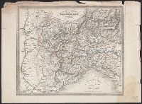
Carta postale dei diversi passaggi delle Alpi e del Piemonte
Description:
Hand colored. and Relief shown by hachures.
Subject (Geographic):
Alps--Maps, Mountain passes--Alps--Maps, Piedmont (Italy)--Maps, Post roads--Alps--Maps, Post roads--Italy--Piedmont--Maps, Post roads--Switzerland--Maps, Road, and Roads--Alps--Maps
Found in:
Beinecke Rare Book and Manuscript Library > Carte routière des différents passages des Alpes et du Piémont = Carta postale dei diversi passaggi delle Alpi e del Piemonte.
Published / Created:
[1917?]
Call Number:
38 1914B
Container / Volume:
BRBL_00155
Image Count:
1
Resource Type:
Maps, Atlases & Globes
Alternative Title:
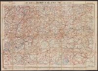
Carte taride pour cyclistes et automobilistes, environs de Paris, nord-est
Description:
"7-17.", "No. 3.", and Relief shown by spot heights.
Publisher:
Charaire à Sceaux,
Subject (Name):
Taride, A
Subject (Topic):
Roads--France--Maps and Roads--France--Paris Region--Maps
Found in:
Beinecke Rare Book and Manuscript Library > Carte routière pour automobilistes & cyclistes, environs de Paris, section nord-est / gravé et imprimé par Charaire à Sceaux.
Creator:
Published / Created:
1909
Call Number:
38gmb 1909
Container / Volume:
BRBL_00170
Image Count:
1
Resource Type:
Maps, Atlases & Globes
Alternative Title:
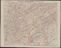
Nouvelle carte de France à l'usage des cyclistes et automobiles.
Description:
"7-09"--Bottom right corner., "No. 10"--Upper left corner., No. 10 in series "Nouvelle carte de France à l'usage des cyclistes et automobiles.", Relief shown by spot heights., Scale of kilometers., and Shows the France-Comté region of eastern France and French speaking western Switzerland from Montbeliard, France in the north to Geneva, Switzerland in the south, and west from Macon, France to Berne, Switzerland in the east. Includes the Jura Mountains, Lake Geneva and Lake of Neuchatel.
Publisher:
A. Taride,
Subject (Geographic):
Franche-Comté (France)--Maps, Jura Mountains (France and Switzerland)--Maps, and Switzerland, French-speaking--Maps
Subject (Name):
Bineteau, P
Subject (Topic):
Bicycle trails--France--Franche-Comté--Maps, Bicycle trails--Jura Mountains (France and Switzerland)--Maps, Bicycle trails--Switzerland, French-speaking--Maps, Roads--France--Franche-Comté--Maps, and Roads--Jura M
Found in:
Beinecke Rare Book and Manuscript Library > Carte routière pour cyclistes & automobiles de l'est de la France : Franche-Comté - Jura - Suisse Française / A. Taride, Éditeur ; P. Bineteau del't.
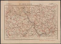
Creator:
Published / Created:
[1918?]
Call Number:
3615 1918F
Image Count:
2
Resource Type:
Maps, Atlases & Globes
Alternative Title:
Carte Routière ; No. 26 and Carte Routière ; No. 26.
Description:
"11-18". and Includes legend.
Publisher:
Cartes Taride,
Subject (Topic):
Roads--Germany--Hesse--Maps and Roads--Germany--North Rhine- Westphalia--Maps
Found in:
Beinecke Rare Book and Manuscript Library > Les Bords du Rhin [cartographic material] : (de Cologne à Mayence) / A. Taride, Éditeur.
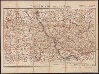
Creator:
Published / Created:
[1909?]
Call Number:
3615 1918D
Container / Volume:
BRBL_00136
Image Count:
1
Resource Type:
Maps, Atlases & Globes
Alternative Title:
Carte Routière ; No. 26 and Carte Routière ; No. 26.
Description:
"9-09". and Includes legend.
Publisher:
Cartes Taride,
Subject (Topic):
Roads--Germany--Hesse--Maps and Roads--Germany--North Rhine- Westphalia--Maps
Found in:
Beinecke Rare Book and Manuscript Library > Les Bords du Rhin [cartographic material] : (de Cologne à Mayence) / A. Taride, Éditeur.
Branch:v1.64.0 ,Deployed:2024-09-11T10:25:40-04:00