Search
You Searched For
Search Results
- Creator:
- Geological Survey (U.S.)
- Published / Created:
- [1897]
- Call Number:
- 75BF 1897
- Container / Volume:
- BRBL_00407A
- Image Count:
- 1
- Resource Type:
- Maps, Atlases & Globes
- Found in:
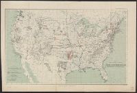
- Beinecke Rare Book and Manuscript Library > Map showing condition and progress of astronomic location, primary triangulation, primary traverse and precise leveling, for the fiscal year 1896-7.
- Creator:
- Geological Survey (U.S.)
- Published / Created:
- [1897]
- Call Number:
- 75BH 1897
- Container / Volume:
- BRBL_00407A
- Image Count:
- 1
- Resource Type:
- Maps, Atlases & Globes
- Found in:
- Beinecke Rare Book and Manuscript Library > Map showing condition and progress of topographic surveys and location of gaging stations for the fiscal year 1896-1897.
- Creator:
- Disturnell, John, 1801-1877
- Published / Created:
- 1935
- Call Number:
- 88 1847H
- Container / Volume:
- BRBL_00645
- Image Count:
- 1
- Resource Type:
- Maps, Atlases & Globes
- Found in:
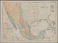
- Beinecke Rare Book and Manuscript Library > Mapa de los Estados Unidos de Méjico / segun lo organizado y definido por las varias actas del Congreso de dicha República y construido por las mejores autoridades ; lo publican, J. Disturnell.
- Creator:
- Maury, Matthew Fontaine, 1806-1873
- Published / Created:
- 1852-[1859?]
- Call Number:
- 11cfk 1850A-2
- Container / Volume:
- BRBL_00767
- Image Count:
- 4
- Resource Type:
- Maps, Atlases & Globes
- Found in:
- Beinecke Rare Book and Manuscript Library > Maury's wind and current chart [cartographic material] : South Pacific / drawn by Lardner Gibbon, P.M. U.S.N.
- Creator:
- Maury, Matthew Fontaine, 1806-1873
- Published / Created:
- 1852-[1859?]
- Call Number:
- 11cfk 1850A-2
- Container / Volume:
- BRBL_00767
- Image Count:
- 1
- Resource Type:
- Maps, Atlases & Globes
- Found in:
- Beinecke Rare Book and Manuscript Library > Maury's wind and current chart [cartographic material] : South Pacific / drawn by Lardner Gibbon, P.M. U.S.N.
- Creator:
- Maury, Matthew Fontaine, 1806-1873
- Published / Created:
- [1854?]-1856.
- Call Number:
- 11cfk 1850A-5
- Container / Volume:
- BRBL_00769
- Image Count:
- 8
- Resource Type:
- Maps, Atlases & Globes
- Found in:
- Beinecke Rare Book and Manuscript Library > Maury's wind and current chart, Indian Ocean [cartographic material].
- Creator:
- U.S. Coast and Geodetic Survey
- Published / Created:
- [1861?]
- Call Number:
- 754 1861C
- Container / Volume:
- BRBL_00416
- Image Count:
- 1
- Resource Type:
- Maps, Atlases & Globes
- Found in:
- Beinecke Rare Book and Manuscript Library > Middle Georgia & South Carolina.
- Creator:
- United States Coast Survey
- Published / Created:
- [ca. 1864]
- Call Number:
- 783hc 1864A
- Container / Volume:
- BRBL_00512
- Image Count:
- 1
- Resource Type:
- Maps, Atlases & Globes
- Found in:
- Beinecke Rare Book and Manuscript Library > Middle Virginia and North Carolina / compiled at the U.S. Coast Survey Office, drawn by H. Lindenkohl ; Chas. G. Krebs, lith.
- Creator:
- Julius Bien & Co
United States. Adjutant-General's Office. Military Information Division
- Published / Created:
- 1898
- Call Number:
- 281 1898
- Container / Volume:
- BRBL_00024
- Image Count:
- 1
- Resource Type:
- Maps, Atlases & Globes
- Found in:
- Beinecke Rare Book and Manuscript Library > Military map of the Isle of Luzon / prepared in the War Department, Adjutant General's Office, Military Information Division ... ; drawn by C.H. Ourand, D.H. Blakelock & E.H. Stück ; Julius Bien & Co., photo. lith., 140 6th Ave. N.Y.
- Creator:
- Freyhold, Edward
- Published / Created:
- 1870
- Call Number:
- 75 1870A
- Container / Volume:
- BRBL_00404
- Image Count:
- 4
- Resource Type:
- Maps, Atlases & Globes
- Found in:
- Beinecke Rare Book and Manuscript Library > Military map of the United States / compiled and drawn by E. Freyhold.