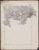
For another copy see entry no. 433., From "39th Cong., 1st Sess. [1866]-Report of the Chief Engineer, U.S.A.", and Legend in the upper left corner contains a brief resume of each day's action while the map shows troop positions, roads, railroads, hachures, drainage, vegetation, and rural houses. Streets and houses of Nashville are not indicated.
Publisher:
s.n.],
Subject (Geographic):
Nashville (Tenn.)--History--Civil War, 1861-1865--Maps
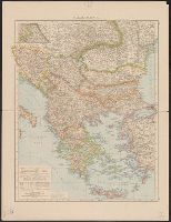
"Fonds dressé par le Service Géographique de L'Armée Britannique.", In lower right: S.G.A. le 9/9/19 ; SGA 196 197., and Legend in French, English, and Italian.
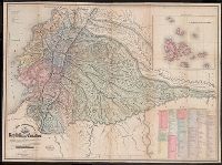
"Delineada en vista de las cartas de Don Pedro Maldonado, el Baron de Humboldt, Mr. Wisse, la de las sontas de las costas por M.M. Filzroy i H. Kellet i las particular, Includes table of names of provinces, cantons, parishes, etc., and Relief shown by hachures.