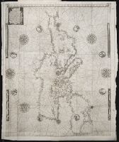
The West-India pilot: containing piloting directions for Port Royal and Kingston harbours in
Image Count:
1
Subject (Geographic):
Atlantic Ocean --Maps --Early works to 1800, Central America --Maps --Early works to 1800, and Honduras --Maps
Subject (Topic):
Harbors --Atlantic Coast (North America) --Maps --Early works to 1800, Nautical charts --Atlantic Coast (North America) --Early works to 1800, Nautical charts --Caribbean Area --Early works to 1800, Nautical charts --West Indies --Early works to 1800, Pilot guides --Atlantic Coast (North America) --Early works to 1800, Pilot guides --Caribbean Area --Early works to 1800, and Pilot guides --West Indies --Early works to 1800
Collection Created:
London : Printed for the author and sold by S. Hooper ..., MDCCLXXI [1771]
Chart of the northwest coast of America and the northeast coast of Asia, explored in the years 1778 and 1779
Description:
Includes notes., No. 34 of 43 maps bound together in composite atlas., Prepared by Lieut. Heny. Roberts, under the immediate inspection of Capt. Cook ; engraved by W. Palmer., Relief shown pictorially. Depths shown by soundings., and Scale [ca. 1:13,500,000].
Publisher:
Wm. Faden, geographer to the King, Charing Cross
Subject (Geographic):
Bering Strait Region --Discovery and exploration --Maps --Early works to 1800, North America --Discovery and exploration --Maps --Early works to 1800, Pacific Coast (North America) --Discovery and exploration --Maps --Early works to 1800, and Russian Far east (Russia) --Discovery and exploration --Maps --Early works to 1800
Subject (Name):
Cook, James, 1728-1779
Subject (Topic):
Discoveries in geography --Maps --Early works to 1800
Navtica mediterranea / di Bartolomeo Crescentio Romano ... Nella quale si mostra la fabrica delle
Image Count:
1
Description:
Map bound in at end., Map cut and folded irregularly., Map done on two separate sheets and pasted together in center., Map has several small gray and black smudges on both the recto and verso that appear to be fingerprints left during the engraving process., Map has several small yellow and brown marks, most notably on verso, although one can be seen on recto in lower right section., and Scale [ca. 1:6,500,000].
Subject (Geographic):
Mediterranean Region --Maps --Early works to 1800 and Mediterranean Sea --Navigation --Early works to 1800
Subject (Topic):
Galleys --Early works to 1800, Navigation --Early works to 1800, and Pilot guides --Mediterranean Sea --Early works to 1800
Gussefeld, F. L. (Franz Ludwig), 1744-1807 Homann Erben (Firm) Schmidt, I. M.
Published / Created:
ao. 1784
Call Number:
1983 Folio 23
Collection Title:
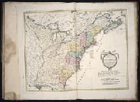
[Atlas factice of 50 maps, primarily by Johann Baptist Homann and/or issued by the Homann Erben
Image Count:
1
Alternative Title:
Treize Etats Unis de l'Amerique septentrionale, d'apress les meilleurs & speciales cartes angloises qui ont parues jusqu'ici and XIII Etats Unis de l'Amerique septentrionale, d'apress les meilleurs & speciales cartes angloises qui ont parues jusqu'ici
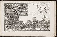
La galerie agreable du monde, où l'on voit en un grand nombre de cartes tres-exactes et de belles
Image Count:
1
Resource Type:
Maps, Atlases & Globes
Alternative Title:
Combat des hommes avec des lions devant le Grand Mogol, pl. 30b, Lachete des officiers de guerre punie par le Grand Mogol, pl. 30b., and Magnifique parure des elephans lors qu'on les presente au Grande Mogol, pl. 30b
Subject (Topic):
Atlases--Early works to 1800 and Geography--Pictorial works
Collection Created:
Le tout mis en ordre & executé à Leide, par Pierre vander Aa [1729?]