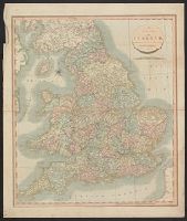
Search
You Searched For
Search Results
- Published / Created:
- 1811
- Call Number:
- 32 1811A
- Container / Volume:
- BRBL_00044
- Image Count:
- 1
- Resource Type:
- Maps, Atlases & Globes
- Description:
- Preliminary record.
- Publisher:
- J. Cary,
- Subject (Geographic):
- England--Maps
- Found in:
- Beinecke Rare Book and Manuscript Library > A new map of England ... by John Cary, Engraver.
- Published / Created:
- 1806
- Call Number:
- 38 1806
- Container / Volume:
- BRBL_00154
- Image Count:
- 1
- Resource Type:
- Maps, Atlases & Globes
- Publisher:
- J. Cary,
- Subject (Geographic):
- France--Maps
- Found in:
- Beinecke Rare Book and Manuscript Library > A new map of France ... division into Provinces as previous to the Revolution ... by John Cary, Engraver.
- Published / Created:
- 1811
- Call Number:
- 38 1811
- Container / Volume:
- BRBL_00154
- Image Count:
- 1
- Resource Type:
- Maps, Atlases & Globes
- Publisher:
- J. Cary,
- Subject (Geographic):
- France--Maps
- Found in:
- Beinecke Rare Book and Manuscript Library > A new map of France ... divison into provinces as previous to the revolution ... John Cary, Engraver.
- Published / Created:
- 1794
- Call Number:
- 38 1794A
- Container / Volume:
- BRBL_00153
- Image Count:
- 1
- Resource Type:
- Maps, Atlases & Globes
- Publisher:
- Laurie & Whittle,
- Subject (Geographic):
- France--Maps--Early works to 1800
- Found in:
- Beinecke Rare Book and Manuscript Library > A new map of France ... in 1790.
- Published / Created:
- 1793
- Call Number:
- 38 1793B
- Container / Volume:
- BRBL_00153
- Image Count:
- 1
- Resource Type:
- Maps, Atlases & Globes
- Description:
- Inset: Environs of Paris.
- Publisher:
- John Andrews,
- Subject (Geographic):
- France--Maps--Early works to 1800
- Found in:
- Beinecke Rare Book and Manuscript Library > A new map of France ... into 83 departments ... all the Post & Cross Roads ... by John Andrews.
- Published / Created:
- 1799
- Call Number:
- 38 1799A
- Container / Volume:
- BRBL_00154
- Image Count:
- 1
- Resource Type:
- Maps, Atlases & Globes
- Publisher:
- J. Cary,
- Subject (Geographic):
- France--Maps
- Found in:
- Beinecke Rare Book and Manuscript Library > A new map of France divided into departments as decreed by the National Assembly, 1790 ... John Cary, Engraver.
- Published / Created:
- 1805
- Call Number:
- 36 1805A
- Container / Volume:
- BRBL_00119
- Image Count:
- 1
- Resource Type:
- Maps, Atlases & Globes
- Publisher:
- Laurie & Whittle,
- Subject (Geographic):
- Germany--Maps
- Found in:
- Beinecke Rare Book and Manuscript Library > A new map of Germany divided into its circles ...
- Published / Created:
- 1799
- Call Number:
- 36 1799
- Container / Volume:
- BRBL_00119
- Image Count:
- 1
- Resource Type:
- Maps, Atlases & Globes
- Publisher:
- J. Cary,
- Subject (Geographic):
- Germany--Maps--Early works to 1800
- Found in:
- Beinecke Rare Book and Manuscript Library > A new map of Germany divided into its circles ... with the Kingdom of Bohemia etc ... John Cary, Engraver.
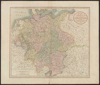
- Creator:
- Cary, John, ca. 1754-1835
- Published / Created:
- April 28, 1811.
- Call Number:
- 36 1811
- Container / Volume:
- BRBL_00119
- Image Count:
- 1
- Resource Type:
- Maps, Atlases & Globes
- Description:
- Pg. no. on verso: 21.
- Publisher:
- Printed for J. Cary, engraver & map-seller, No. 181 Strand,
- Subject (Geographic):
- Germany--Maps
- Found in:
- Beinecke Rare Book and Manuscript Library > A new map of Germany, divided into its circles : viz. the upper and lower Rhine, Swabia, Austria, Bavaria, upper and lower Saxony, Franconia and Westphalia, with the Kingdom of Bohemia &c. From the latest authorities / by John Cary, engraver, 1811.
- Published / Created:
- 1811
- Call Number:
- 59 1811A
- Container / Volume:
- BRBL_00316
- Image Count:
- 1
- Resource Type:
- Maps, Atlases & Globes
- Description:
- Inset: Ceylon.
- Publisher:
- J. Cary,
- Subject (Geographic):
- India--Maps
- Found in:
- Beinecke Rare Book and Manuscript Library > A new map of Hindoostan ... By John Cary, Engraver.