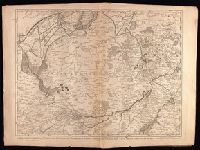
Crépy, Etienne Louis, printer Fricx, Eugène-Henri, d. 1733 Fricx, Eugène-Henri, d. 1733. Cartes des provinces des Pays Bas
Published / Created:
[1743]
Call Number:
1977 Folio 177
Image Count:
2
Resource Type:
Maps, Atlases & Globes
Description:
"No. 7" in lower right corner., Bar scales given in "echelle de deux Lieues et demie com[m]une de France" and "echelle de deux Lieues de Brabant"., From Fricx's Cartes des provinces des Pays Bas, 1744., Relief shown by hachures., Sheet measures 54.7 x 73.6 cm. No. 17 of 34 maps bound together., and Watermark.
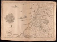
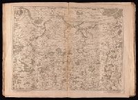
Crépy (Firm) Fricx, Eugène-Henri, d. 1733 Fricx, Eugène-Henri, d. 1733. Cartes des provinces des Pays Bas
Published / Created:
1743
Call Number:
1977 Folio 177
Image Count:
2
Resource Type:
Maps, Atlases & Globes
Description:
"No. 13" in lower right corner, outside of neat line., Bar scales given in "echelle de deux lieues et demie communes de France" and "echelle de deux lieues de Brabant"., From Fricx's Cartes des provinces des Pays Bas, 1744., Prime meridian: Ferro., Relief shown by hachures., Sheet measures 55.3 x 72.3 cm. No. 33 of 34 maps bound together., and Watermark.
Publisher:
Chez Crepy rue S. Jacques a limage S. Pierre,
Subject (Geographic):
Nord-Pas-de-Calais (France)--Maps--Early works to 1800
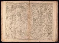
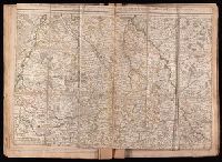
Crépy, Etienne Louis, printer Fricx, Eugène-Henri, d. 1733 Fricx, Eugène-Henri, d. 1733. Cartes des provinces des Pays Bas
Published / Created:
[1744]
Call Number:
1977 Folio 177
Image Count:
2
Resource Type:
Maps, Atlases & Globes
Description:
"11" in lower right corner., From Fricx's Cartes des provinces des Pays Bas, 1744., Relief shown by hachures., Sheet measures 54.6 x 72.5 cm. No. 19 of 34 maps bound together., and Watermark.
Bar scale given in "milles d'Allemagne 15 au degré"., Prime meridian: Ferro., Relief shown pictorially., Stamp on verso: 286. Ms. title on verso. Sheet measures 54.3 x 68.7 cm. No. 31 of 34 maps bound together., Watermark., and With privilege "A.P.D.R."
Publisher:
Par et chez le Sr. le Rouge ingenieur geographe du roi rüe des grand.s Augustins vis a vis le panier fleuri,
Subject (Geographic):
Saxony (Germany)--Maps--Early works to 1800, Saxony-Anhalt (Germany)--Maps--Early works to 1800, and Thuringia (Germany)--Maps--Early works to 1800
Subject (Topic):
Post roads--Germany--Saxony--Maps--Early works to 1800
Imperfect: mutilated along dissection, with some loss of text. Stamp on verso: 229. Ms. notes on verso. Dissected and backed with linen. Sheet measures 50.9 x 70.7 cm. No. 26 of 34 maps bound together., Prime meridian: Ferro., and Relief shown pictorially.
Publisher:
Chez l'Auteur,
Subject (Geographic):
Cologne (Electorate)--Maps--Early works to 1800 and North Rhine-Westphalia (Germany)--Maps--Early works to 1800
"Dedié au roy, parson tres humb', tres-obeissa[n]t, tres fidele sujet et serviteur Hubert Iaillot.", "S[imonneau] f[ecit].", Appears in Jaillot's Atlas françois; cf. Pastoureau, M. Les atlas français, A.-H. Jaillot, II A 94 (with map date 169[-])., Includes five bar scales., Prime meridian: Ferro., Relief shown pictorially., and Stamps on verso: 205 [crossed out]; 337. Stamped title on verso. Backed with linen. Sheet measures 51.4 x 70.5 cm. No. 25 of 34 maps bound together.
Publisher:
Chez H. Iaillot geographe ordinaire du roy proche les grands Augustins aux 2. globes, avec privilege de S. Maj[es]té,
Appears in Jaillot's Atlas françois; cf. Pastoureau, M. Les atlas français, A.-H. Jaillot, II B 123 (with map date 1696)., Bar scale given in "échelle de lieues d'une heure de Chemin"., Place names in French and German., Prime meridian: Ferro., Relief shown pictorially., and Stamp on verso: 204. Title in ms. on verso. Backed with linen. Sheet measures 50.7 x 66.4 cm. No. 23 of 34 maps bound together.
Publisher:
Chez l'auteur joignant les grands Augustins aux deux globes,
Subject (Geographic):
Rhineland-Palatinate (Germany)--Maps--Early works to 1800
Bar scales given in "lieues d'une heure de chemin" and "miles d'Allemagne 16 au degré"., Imperfect: portions of cartouche cut-out, with some loss of text. Sheet measures 54.5 x 70.0 cm. No. 27 of 34 maps bound together., Inset: Plan de Breslaw, Capitale de la Silesie, scale [ca. 1:11,000], 15 x 21.4 cm., Prime meridian: Ferro., Relief shown pictorially., and Watermark.
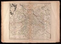
Crépy (Firm) Fricx, Eugène-Henri, d. 1733 Fricx, Eugène-Henri, d. 1733. Cartes des provinces des Pays Bas
Published / Created:
en 1744.
Call Number:
1977 Folio 177
Image Count:
2
Resource Type:
Maps, Atlases & Globes
Description:
"No. 15" in lower right corner, outside of neat line., Bar scales given in "echelle de deux lieues et demie comune de France" and "echelle de deux lieues de Brabant"., From Fricx's Cartes des provinces des Pays Bas, 1744., Prime meridian: Ferro., Relief shown by hachures., Sheet measures 55.3 x 72.3 cm. No. 32 of 34 maps bound together., Title devised by cataloger., and Watermark.
Publisher:
Chez Crepy rue S. Jacques a limage S. Pierre,
Subject (Geographic):
Luxembourg (Belgium)--Maps--Early works to 1800 and Luxembourg (Luxembourg)--Maps--Early works to 1800