Skip to search
Skip to main content
Skip to first result
Search
You Searched For
Format
cartographic
Genre
Maps
Publication Place
[S.l. :
New Search
Search Results
Published / Created:
1770]
Call Number:
36 1770A
Container / Volume:
BRBL_00118
Image Count:
1
Resource Type:
Maps, Atlases & Globes
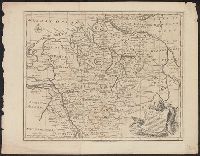
Description:
By Eman. Bowen.
Publisher:
s. n. ,
Subject (Geographic):
Germany--Maps--Early works to 1800
Found in:
Beinecke Rare Book and Manuscript Library > A correct map of the north west part of Germany...
Published / Created:
1770]
Call Number:
36 1770B
Container / Volume:
BRBL_00118
Image Count:
1
Resource Type:
Maps, Atlases & Globes
Description:
By Eman. Bowen.
Publisher:
s. n. ,
Subject (Geographic):
Germany--Maps--Early works to 1800
Found in:
Beinecke Rare Book and Manuscript Library > A correct map of the north west part of Germany...
Published / Created:
1770]
Call Number:
36 1770F
Container / Volume:
BRBL_00118
Image Count:
1
Resource Type:
Maps, Atlases & Globes
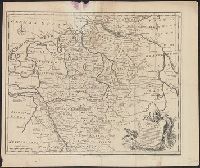
Description:
By Eman. Bowen.
Publisher:
s. n. ,
Subject (Geographic):
Germany--Maps--Early works to 1800
Found in:
Beinecke Rare Book and Manuscript Library > A correct map of the south east part of Germany...
Published / Created:
1770]
Call Number:
36 1770E
Container / Volume:
BRBL_00118
Image Count:
1
Resource Type:
Maps, Atlases & Globes
Description:
By Eman. Bowen.
Publisher:
s. n. ,
Subject (Geographic):
Germany--Maps--Early works to 1800
Found in:
Beinecke Rare Book and Manuscript Library > A correct map of the south east part of Germany...
Published / Created:
1860?]
Call Number:
796gme 1860
Container / Volume:
BRBL_00531
Image Count:
1
Resource Type:
Maps, Atlases & Globes
Alternative Title:
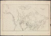
Red River, Sabine & Western Railway and Red River, Sabine and Western Railway
Description:
"I.[?] C. Terry, Chf. Eng.", Covers Texas and Louisiana, and parts of New Mexico, Indian Territory, Arkansas, Mississippi, and northern Mexico., From the Streeter collection., and Library's copy imperfect: Holes in center.
Publisher:
s.n.,
Subject (Name):
Red River, Sabine and Western Railway--Maps and Streeter, Thomas W.--(Thomas Winthrop),--1883-1965--Ownership
Subject (Topic):
Coal--Texas--Maps, Forests and forestry--Louisiana--Maps, Forests and forestry--Texas--Maps, Iron--Texas--Maps, Petroleum--Texas--Maps, Railroads--Louisiana--Maps, and Railroads--Texas--Maps
Found in:
Beinecke Rare Book and Manuscript Library > A geographically correct map of the Red River, Sabine & Western Railway (under construction) and connections : showing distribution of pine forests (compiled from maps of U.S. government), also location of coal, iron, and oil deposits.
Published / Created:
178-?]
Call Number:
71 1780C
Container / Volume:
BRBL_00366
Image Count:
1
Resource Type:
Maps, Atlases & Globes
Description:
Part of imprint is faintly visible in bottom margin: [?]acKen[?] No. 38 No[?]folk Street Strand., Relief shown by hachures., and Rivers and lakes in the Pacific Northwest and British Columbia are in manuscript, pen-and-ink.
Publisher:
s.n.,
Subject (Geographic):
Canada--Maps--Early works to 1800
Subject (Name):
North West Company--Maps--Early works to 1800
Subject (Topic):
Fur trade--Canada--Maps--Early works to 1800
Found in:
Beinecke Rare Book and Manuscript Library > A map of America between latitudes 40 and 70 north, and longitudes 45 and 180 west : exhibiting the principal trading stations of the North West Company.
Creator:
Published / Created:
17--?]
Call Number:
71 1769A
Container / Volume:
BRBL_00364
Image Count:
1
Resource Type:
Maps, Atlases & Globes
Description:
Includes text and inset of Hudson and Baffin bays. and Relief shown pictorially.
Publisher:
s.n.,
Subject (Geographic):
North America--Maps--Early works to 1800
Found in:
Beinecke Rare Book and Manuscript Library > A map of North America : from D'Anville, 1769.
Published / Created:
ca 1810]
Call Number:
773 J487 1810
Container / Volume:
BRBL_00496
Image Count:
1
Resource Type:
Maps, Atlases & Globes
Publisher:
s.n. ,
Subject (Geographic):
New Jersey--Maps
Found in:
Beinecke Rare Book and Manuscript Library > A map of that part of the town of Jersey, commonly called Aharsimus.
Published / Created:
1770]
Call Number:
36 1770D
Container / Volume:
BRBL_00118
Image Count:
1
Resource Type:
Maps, Atlases & Globes
Description:
By Eman. Bowen.
Publisher:
s. n. ,
Subject (Geographic):
Germany--Maps--Early works to 1800
Found in:
Beinecke Rare Book and Manuscript Library > A new and correct map of the south west part of Germany...
Published / Created:
1770]
Call Number:
36 1770C
Container / Volume:
BRBL_00118
Image Count:
1
Resource Type:
Maps, Atlases & Globes
Description:
By Eman. Bowen.
Publisher:
s. n. ,
Subject (Geographic):
Germany--Maps--Early works to 1800
Found in:
Beinecke Rare Book and Manuscript Library > A new and correct map of the south west part of Germany...
Branch:v1.61.6 ,Deployed:2024-06-12T09:55:33-04:00