Skip to search
Skip to main content
Skip to first result
Search
You Searched For
Date
1600 - 1799
Publication Place
London :
Date Created
1600 to 1799
New Search
Search Results
Published / Created:
[1775?]
Call Number:
76cea 1775A
Container / Volume:
BRBL_00446
Image Count:
1
Resource Type:
Maps, Atlases & Globes
Description:
Insets: The Town of Boston in New England. A Chart of the Atlantic Ocean shewing the situation of Nova Scotia with respect to the British Isles.
Publisher:
I. Mount & T. Page & W. Mount, Tower Hill,
Subject (Geographic):
New England--Maps--Early works to 1800
Found in:
Beinecke Rare Book and Manuscript Library > A Map of the Coast of New England from Staten Island to the Island of Breton; as it was actualy survey'd by Capt Cyprian Southback.
Published / Created:
1757
Call Number:
36hc P88 1756
Container / Volume:
BRBL_00134
Image Count:
1
Resource Type:
Maps, Atlases & Globes
Alternative Title:
Plan of the city of Prague ...
Description:
Includes "Extract from several Authentic Letters from Berlin, giving an Account of the Battle fought between the Prussians and Austrians near Prague, May 6, 1757."
Publisher:
T. Jefferys,
Subject (Geographic):
Germany--Maps--Early works to 1800
Found in:
Beinecke Rare Book and Manuscript Library > A Map of the country round Prague ... : A Plan of the city of Prague ...
Published / Created:
1798
Call Number:
27cea 1798
Container / Volume:
BRBL_00700
Image Count:
1
Resource Type:
Maps, Atlases & Globes
Description:
Original manuscript map.
Publisher:
Laurie & Whittle,
Subject (Geographic):
Indonesia--Maps, Manuscript--Early works to 1800
Found in:
Beinecke Rare Book and Manuscript Library > A New Chart of the Eastern Straits or the Straits of the East of Java, with a part of the Banda Sea; corrected and improved chiefly from the observation of Captn. - Williams.
Published / Created:
1794
Call Number:
11 1794A
Container / Volume:
BRBL_00006
Image Count:
1
Resource Type:
Maps, Atlases & Globes
Publisher:
Laurie & Whittle,
Subject (Geographic):
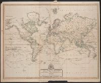
World--Maps--Early works to 1800
Found in:
Beinecke Rare Book and Manuscript Library > A New Chart of the World ... with the tracks of the British Circumnavigators Bryon, Wallis, Carteret and Cook, &c.
Published / Created:
1792
Call Number:
326 1792
Container / Volume:
BRBL_00069
Image Count:
1
Resource Type:
Maps, Atlases & Globes
Description:
Directions and Rules for Playing.
Publisher:
J. Wallis & E. Newbery,
Subject (Geographic):
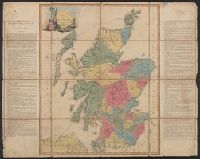
Scotland--Maps--Early works to 1800
Found in:
Beinecke Rare Book and Manuscript Library > A New Geographical Game exhibiting a complete Tour through Scotland and the Western Isles. Neele Sc.
Published / Created:
1750
Call Number:
3218 1750A
Container / Volume:
BRBL_00057
Image Count:
1
Resource Type:
Maps, Atlases & Globes
Description:
Preliminary record.
Publisher:
J. Hinton,
Subject (Geographic):
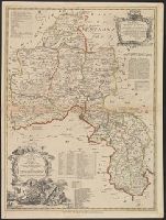
Oxfordshire (England)--Maps--Early works to 1800
Found in:
Beinecke Rare Book and Manuscript Library > A New Improved Map of Oxfordshire ... Thos. Kitchin ... 1750.
Published / Created:
1794
Call Number:
534 1794
Container / Volume:
BRBL_00289
Image Count:
1
Resource Type:
Maps, Atlases & Globes
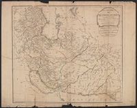
Description:
Copy 2 is colored and in good condition.
Publisher:
Laurie & Whittle,
Subject (Geographic):
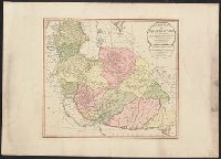
Iran--Maps--Early works to 1800
Found in:
Beinecke Rare Book and Manuscript Library > A New Map of the Empire of Persia from Monsr. DAnville ... with several Additions and Emendations.
Published / Created:
1794
Call Number:
534 1794
Container / Volume:
BRBL_00289
Image Count:
1
Resource Type:
Maps, Atlases & Globes
Publisher:
Laurie & Whittle,
Subject (Geographic):
Iran--Maps--Early works to 1800
Found in:
Beinecke Rare Book and Manuscript Library > A New Map of the Empire of Persia from Monsr. DAnville ... with several Additions and Emendations.
Published / Created:
[ca. 1789]
Call Number:
6555cea 1789
Container / Volume:
BRBL_00708
Image Count:
3
Resource Type:
Maps, Atlases & Globes
Description:
A plan of the Cove at Bassa with the adjacent roads., Entrace of the River Serra Leone vulgo Sierra Leon, 1775., Insets: Lagos and its Channels by Capt. Horsely of Liverpool 1789., and The Course of Gato or Regio Creek with the Entrance of River Benin by Capt. Archd. Dalzel, 1785.
Publisher:
Robert Sayer,
Subject (Geographic):
Ghana--Maps, Manuscript--Early works to 1800
Found in:
Beinecke Rare Book and Manuscript Library > A New Survey of that part of the Coast of Africa comprised between Cape Verga and Cape Formoso, including chiefly the Windward and Gold Coasts in which the Latitudes of all the Principal Places are determined by Actual observations, the bearings and cours
Published / Created:
1794
Call Number:
755cea 1794
Container / Volume:
BRBL_00441
Image Count:
4
Resource Type:
Maps, Atlases & Globes
Description:
From the North American pilot. A new ed. much enlarged of the second part of the North Am. Pilot. fol. London, R. Laurie & J. Whittle, 1800. and Insets: 1. Plan of Hell Gate with view of Hell Gate by W.A. Williams 1777. 2. The Rivers Kennebeck and Sheepcut by
Publisher:
Laurie & Whittle,
Subject (Geographic):
Canada--Maps--Early works to 1800 and East (U.S.)--Maps--Early works to 1800
Found in:
Beinecke Rare Book and Manuscript Library > A New and Correct Chart of the Coast of New England and New York with the adjacent parts of Nova Scotia and New Brunswick from Cape Sable to the entrance of Hudsons or North River by Captain Holland.
Branch:v1.61.8 ,Deployed:2024-06-20T11:15:02-04:00