Search
You Searched For
Search Results
- Published / Created:
- [1730?]
- Call Number:
- 894 1730
- Container / Volume:
- BRBL_00659
- Image Count:
- 1
- Resource Type:
- Maps, Atlases & Globes
- Found in:
- Beinecke Rare Book and Manuscript Library > ... This draught. being part of ye Spanish & Musketor Shore & the Bay of Honduras with. ye Islands adjacent; ... by ... Samuel Penthalow.
- Published / Created:
- 1782
- Call Number:
- 21cea 1782
- Container / Volume:
- BRBL_00016
- Image Count:
- 1
- Resource Type:
- Maps, Atlases & Globes
- Found in:
- Beinecke Rare Book and Manuscript Library > A Chart of the Atlantic Ocean.
- Published / Created:
- 1746
- Call Number:
- 307cea 1746
- Container / Volume:
- BRBL_00036
- Image Count:
- 1
- Resource Type:
- Maps, Atlases & Globes
- Found in:
- Beinecke Rare Book and Manuscript Library > A Chart of the English Channel, the Bay of Biscay, with part of the Ocean and Mediterranean ... By T. Kitchin.
- Published / Created:
- 1779
- Call Number:
- 771 1779A
- Container / Volume:
- BRBL_00477
- Image Count:
- 3
- Resource Type:
- Maps, Atlases & Globes
- Found in:
- Beinecke Rare Book and Manuscript Library > A Chorographical map of the Province of New York ... Mayor General William Tryon, by Claude Joseph Sauthier Esqr.
- Published / Created:
- 1732
- Call Number:
- NZ Z732c
- Image Count:
- 42
- Resource Type:
- Books, Journals & Pamphlets
- Found in:
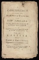
- Beinecke Rare Book and Manuscript Library > A Comparison between the British sugar colonies and New England, as they relate to the interest of Great Britain : with some observations on the state of the case of New England; to which is added A letter to a member of Parliament.
- Published / Created:
- 1770
- Call Number:
- 785 1770
- Container / Volume:
- BRBL_00513
- Image Count:
- 1
- Resource Type:
- Maps, Atlases & Globes
- Found in:
- Beinecke Rare Book and Manuscript Library > A Compleat Map of North-Carolina from an actual Survey. By Capnt. [John A. ] Collet, Governor of Fort Johnson, Engraved by I. Bayly. Published according to Act of Parliament May the 1st. 1770, by S. Hooper Nọ 25 Ludgate Hill, London.
- Published / Created:
- 1776
- Call Number:
- 755 1776A
- Container / Volume:
- BRBL_00430
- Image Count:
- 1
- Resource Type:
- Maps, Atlases & Globes
- Found in:
- Beinecke Rare Book and Manuscript Library > A General Map of the Southern British Colonies in America, comprehending North and South Carolina, Georgia, East and West Florida, with the Neighboring Indian Countries ... by B. Romans, 1776.
- Published / Created:
- 1787
- Call Number:
- 11 1787
- Container / Volume:
- BRBL_00006
- Image Count:
- 2
- Resource Type:
- Maps, Atlases & Globes
- Found in:
- Beinecke Rare Book and Manuscript Library > A General Map of the World or Terraqueous globe with all the new discoveries ... by Sam'l Dunn ...
- Published / Created:
- [1750?]
- Call Number:
- 3211cea 1750
- Container / Volume:
- BRBL_00055
- Image Count:
- 2
- Resource Type:
- Maps, Atlases & Globes
- Found in:
- Beinecke Rare Book and Manuscript Library > A Large Chart of the Channel between England and France ... by Capt. Edmund Halley ...
- Published / Created:
- 1774
- Call Number:
- 62 1774
- Container / Volume:
- BRBL_00333
- Image Count:
- 1
- Resource Type:
- Maps, Atlases & Globes
- Found in:
- Beinecke Rare Book and Manuscript Library > A Map of Abyssinia and Nubia, By Samuel Dunn.