Skip to search
Skip to main content
Skip to first result
Search
You Searched For
Extent of Digitization
Completely digitized
Language
French
Publication Place
Paris :
New Search
Search Results
Published / Created:
1721
Call Number:
50cea C27 1721
Container / Volume:
BRBL_00274
Image Count:
1
Resource Type:
Maps, Atlases & Globes
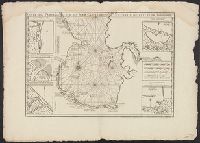
Description:
2 copies of the southern half of the map., Insets: Mouth of the Koura river, Zalif Bakinskaia, Golfe de Baka., and Insets: Mouths of river D'Astaré, river Seb doura, river Kroudosel, Golfe de Sinsilen, Golfe D'Astrabat.
Publisher:
Sr. Delisle,
Subject (Geographic):
Asia--Maps--Early works to 1800
Found in:
Beinecke Rare Book and Manuscript Library > Carte Marine de la Mer Caspiene ... Coste de Pesse Sur la Mer Caspiene et Partie de Celles de Tartarie. Par Mr. Carl Vanverden en 1719, 1720, et 1721 ... Par Guillaume Delisle ...
Published / Created:
1721
Call Number:
50cea C27 1721
Container / Volume:
BRBL_00274
Image Count:
1
Resource Type:
Maps, Atlases & Globes
Description:
2 copies of the southern half of the map., Insets: Mouth of the Koura river, Zalif Bakinskaia, Golfe de Baka., and Insets: Mouths of river D'Astaré, river Seb doura, river Kroudosel, Golfe de Sinsilen, Golfe D'Astrabat.
Publisher:
Sr. Delisle,
Subject (Geographic):
Asia--Maps--Early works to 1800
Found in:
Beinecke Rare Book and Manuscript Library > Carte Marine de la Mer Caspiene ... Coste de Pesse Sur la Mer Caspiene et Partie de Celles de Tartarie. Par Mr. Carl Vanverden en 1719, 1720, et 1721 ... Par Guillaume Delisle ...
Published / Created:
1777
Call Number:
755 1777A
Container / Volume:
BRBL_00431
Image Count:
1
Resource Type:
Maps, Atlases & Globes
Description:
Inset: Atlantic Ocean.
Publisher:
Chez le Sr. Moithey, ingénieur-géographe,
Subject (Geographic):
Canada--Maps--Early works to 1800 and East (U.S.)--Maps--Early works to 1800
Found in:
Beinecke Rare Book and Manuscript Library > Carte Nouvelle Des Posséssions Angloises en Amérique dressée pour l'intelligence de la guerre présente et divisée suivant les prétentions des Anglois ... Traduite de l'Anglois d'aprés Thos. Gefferys, géographe du prince de Galles.
Published / Created:
1780
Call Number:
755 1780C
Container / Volume:
BRBL_00433
Image Count:
1
Resource Type:
Maps, Atlases & Globes
Description:
Inset: Carte de l'Ocean Occidental ... shows Territory covered by early United States. and Preliminary record.
Publisher:
Moithey,
Subject (Geographic):
Canada--Maps--Early works to 1800 and East (U.S.)--Maps--Early works to 1800
Found in:
Beinecke Rare Book and Manuscript Library > Carte Nouvelle des possessions Angloises en Amerique ... traduite de l'Anglois d'après Thos. Jefferys, revue et corrigée par M. Moithey ... 1780.
Published / Created:
[1750?]
Call Number:
3897 1750
Container / Volume:
BRBL_00183
Image Count:
1
Resource Type:
Maps, Atlases & Globes
Description:
Text on margin.
Publisher:
Chez Daumont,
Subject (Geographic):
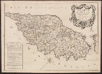
Corsica (France)--Maps--Early works to 1800
Found in:
Beinecke Rare Book and Manuscript Library > Carte Particuliere de L'Isle de Corse ... Dezauche Sculp Par le S. Pruvost I.G.
Published / Created:
[1898?]
Call Number:
38 1898
Container / Volume:
BRBL_00155
Image Count:
1
Resource Type:
Maps, Atlases & Globes
Publisher:
E. Lanée,
Subject (Geographic):
France--Maps
Found in:
Beinecke Rare Book and Manuscript Library > Carte Physique, Politique et Administrative de la France, avec le tracé des Chemins de Fer, sous la direction de L. Bonnefont ... Dressée par A. Vuillemin.
Published / Created:
[1849?]
Call Number:
38345 1849
Container / Volume:
BRBL_00178
Image Count:
1
Resource Type:
Maps, Atlases & Globes
Publisher:
Engelmann & Comp.,
Subject (Geographic):
Bas-Rhin (France)--Maps
Found in:
Beinecke Rare Book and Manuscript Library > Carte Physique, Statisque, Administrative et routére du departement du Haut-Rhin (Haute Alsace) dressée par J. G. Heck ...
Published / Created:
[1904?]
Call Number:
335 1904
Container / Volume:
BRBL_00086
Image Count:
1
Resource Type:
Maps, Atlases & Globes
Publisher:
A. Taride, Editeur,
Subject (Geographic):
Belgium--Maps
Found in:
Beinecke Rare Book and Manuscript Library > Carte Pour Cyclistes & Automobiles de la Belgique Section est.
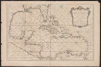
Published / Created:
1749
Call Number:
85 1749
Container / Volume:
BRBL_00636
Image Count:
1
Resource Type:
Maps, Atlases & Globes
Publisher:
chez Mr. Bellin,
Subject (Geographic):
Mexico, Gulf of--Maps--Early works to 1800
Found in:
Beinecke Rare Book and Manuscript Library > Carte Reduite de Golphe du Mexique et des isles de L' Amerique ...
Creator:
Published / Created:
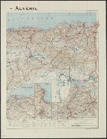
[1928?]
Call Number:
68 1928
Container / Volume:
BRBL_00349
Image Count:
2
Resource Type:
Maps, Atlases & Globes
Description:
"328" in bottom right corner beneath scale statement., "Imp. Gaillac-Monrocq et Cie. 3 Rue Suger, Paris.", Includes glossary of important Arabic terms., Insets: Région d'Oran. Scale 1:450,000 -, and Shows roads, railroads, waterways, capitols, cities, and towns.
Publisher:
Taride,
Subject (Geographic):
Algeria--Maps
Subject (Name):
Peltier, Georges
Found in:
Beinecke Rare Book and Manuscript Library > Carte Taride - Algérie / Cartes Taride ; G. Peltier, cartographer.
Branch:v1.61.6 ,Deployed:2024-06-12T09:55:31-04:00