Skip to search
Skip to main content
Skip to first result
Search
You Searched For
Resource Type
Maps, Atlases & Globes
Language
Greek, Modern (1453-)
New Search
Search Results
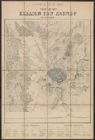
Creator:
Published / Created:
[1870]
Call Number:
48 AT42 1863
Container / Volume:
BRBL_00264
Image Count:
1
Resource Type:
Maps, Atlases & Globes
Description:
In French and Greek., Indices on verso., Profile below neat line: Τομὴ κατα α β., Relief shown by hachures., and Title panel on verso.
Publisher:
Imp. Lemercier,
Subject (Geographic):
Athens (Greece)--Maps
Subject (Name):
Erhard (Firm) and Imprimerie Lemercier et cie
Found in:
Beinecke Rare Book and Manuscript Library > Athènes et ses environs [cartographic material] / exécuté par Emmanuel Kalergis, Élève de St. Cyr et de L'École Impériale d'État-Major de France ; gravé chez Erhard.
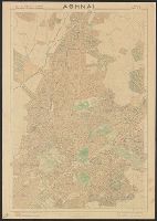
Published / Created:
1941
Call Number:
48 AT42 1941
Container / Volume:
BRBL_00264
Image Count:
1
Resource Type:
Maps, Atlases & Globes
Publisher:
Topographical service of the ministry of communication],
Subject (Geographic):
Athens (Greece)--Maps
Found in:
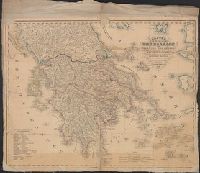
Beinecke Rare Book and Manuscript Library > Athēnai.
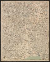
Published / Created:
1890
Call Number:
4865 1890
Container / Volume:
BRBL_00265
Image Count:
2
Resource Type:
Maps, Atlases & Globes
Publisher:
Chartografikē Ypēresua stratou,
Subject (Geographic):
Peloponnēsos (Greece)--Maps
Found in:
Beinecke Rare Book and Manuscript Library > Chartēs Peloponnēsou.
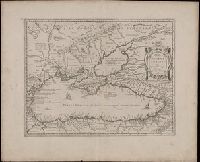
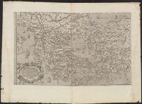
Creator:
Published / Created:
[1652?]
Call Number:
BrSides Double Folio 2019 66
Image Count:
1
Resource Type:
Maps, Atlases & Globes
Alternative Title:
Pontus Euxinus and Pontvs Euxinvs
Description:
Relief shown pictorially., Verso blank., and Watermark. Manuscript number in upper left corner: 35.
Publisher:
[Jan Jansson],
Subject (Geographic):
Black Sea Region and Black Sea Region--History--Maps--Early works to 1800.
Subject (Name):
Jansson, Jan, 1588-1664 and Ortelius, Abraham, 1527-1598
Found in:
Beinecke Rare Book and Manuscript Library > Pontos Euxeinos = Pontus Euxinus : æquor Iasonio pulsatum remige primum / ex conatibus Abrahami Ortelii ; Petrus Kaerius caelavit.
Creator:
Published / Created:
[between 1652 and 1684]
Call Number:
BrSides Double Folio 2019 57
Image Count:
1
Resource Type:
Maps, Atlases & Globes
Alternative Title:
Thraciae veteris typus and Thraciae veteris typvs
Description:
Appeared in various editions of Jan Jansson's Accuratissima orbis antiqui delineatio., Descriptive text in lower right cartouche beginning "Thraciae aliquot incogniti situs loca ...", Manuscript number in upper left corner: 22., Relief shown pictorially., Title in Greek and Latin; text in Latin., and Verso blank.
Publisher:
[Jan Jansson],
Subject (Geographic):
Bulgaria--Maps--Early works to 1800., Thrace--Maps--Early works to 1800., and Turkey--Maps--Early works to 1800.
Subject (Name):
Jansson, Jan, 1588-1664. Accuratissima orbis antiqui delineatio. and Ortelius, Abraham, 1527-1598
Found in:
Beinecke Rare Book and Manuscript Library > Thrakē = Thraciae veteris typus / ex conatibus geographicis Abrah. Ortelij. ; Petrus Kaerius caelavit.
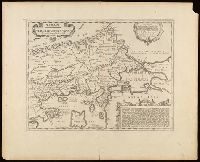
Creator:
Published / Created:
1564
Call Number:
48 1564
Container / Volume:
BRBL_00262
Image Count:
1
Resource Type:
Maps, Atlases & Globes
Alternative Title:
Totivs Graeciae descriptio
Description:
Covers Greece and western Turkey., Includes text, ill., Relief shown pictorially., Sheet measures 54 x 75 cm., Shows locations mentioned in Herodotus, Thucydides, etc., and Some place names in Latin and Greek.
Publisher:
[F. Bertelli?],
Subject (Geographic):
Greece--Historical geography--Maps--Early works to 1800, Greece--Maps--Early works to 1800, Thrace, Eastern (Turkey)--Historical geography--Maps--Early works to 1800, and Thrace, Eastern (Turkey)--Maps--Early works to 1800
Subject (Name):
Zenoi, Domenico, fl. 1560-1580
Found in:
Beinecke Rare Book and Manuscript Library > Totius Graeciae descriptio / Ferdinando Bertelli aereis formis ; Dominicus Zenoi Venetus excudebat.
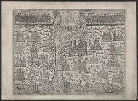
Published / Created:
c1780.
Call Number:
4827 1780
Container / Volume:
BRBL_00265
Image Count:
1
Resource Type:
Maps, Atlases & Globes
Description:
Pictorial map with religious imagery.
Subject (Geographic):
Athos (Greece)--Maps--Early works to 1800
Found in:
Beinecke Rare Book and Manuscript Library > [A panoramic view of Mount Athos.]
Published / Created:
1842
Call Number:
48 1842
Container / Volume:
BRBL_00264
Image Count:
1
Resource Type:
Maps, Atlases & Globes
Description:
In Greek. and Preliminary record.
Subject (Geographic):
Greece--Maps
Found in:
Beinecke Rare Book and Manuscript Library > [Map of Greece].
Branch:v1.62.0 ,Deployed:2024-06-26T09:57:02-04:00