
You Searched For
1 - 10 of 10
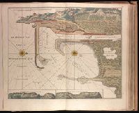
Search Results

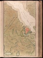
2.
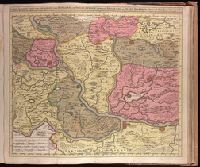
- Creator:
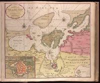
- Keulen, Gerard van.
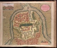
- Published / Created:
- [ca. 1734?]
- Call Number:
- 1973 Folio 18
- Image Count:
- 1
- Resource Type:
- Maps, Atlases & Globes
- Description:
- "Aen de nieuwen brugh met previlegi"., Backed with paper. Ms. no. "58" in upper right-hand corner. Sheet measures 53.7 x 62.3 cm. No. 53 of 87 maps bound together., Bar scale given in "Duytsche Myl"., Relief shown pictorially; depths shown by soundings., With north oriented towards the right., and With two inset maps at bottom: "Caap Cette N W ten N4" and "Caap Cette N W ten W 3."
- Publisher:
- By Gerard van Keulen,
- Subject (Geographic):
- Sète (France)--Maps--Early works to 1800.
- Subject (Topic):
- Nautical charts--France--Sète--Early works to 1800.
- Found in:
- Beinecke Rare Book and Manuscript Library > De Haven van Cette in de Middelandse Zee in Langedoc [cartographic material].
3.
- Creator:
- Keulen, Gerard van.
- Published / Created:
- [1734]
- Call Number:
- 1973 Folio 18
- Image Count:
- 1
- Resource Type:
- Maps, Atlases & Globes
- Description:
- Backed with paper. Ms. no. "13" in upper right-hand corner. Sheet measures 53.6 x 35.5 cm. No. 13 of 87 maps bound together., Bar scale given in "Duytsche Mylen"., Relief shown pictorially; depths shown by soundings., Shows troop positions during siege of Stralsund during the Northern War, ca. 1715., and Title derived from place locations on map.
- Publisher:
- By Gerard van Keulen ...,
- Subject (Geographic):
- Rügen Island (Germany)--Maps--Early works to 1800. and Stralsund (Germany)--Maps--Early works to 1800.
- Subject (Name):
- Anse, Luggert van, fl. 1690-1716, engraver.
- Subject (Topic):
- Nautical charts--Baltic Sea--Early works to 1800. and Northern War, 1700-1721--Maps.
- Found in:
- Beinecke Rare Book and Manuscript Library > De kust van Pomeren, hey eyland Rugen [cartographic material].
4.
- Creator:
- Keulen, Gerard van.
- Published / Created:
- [1716]
- Call Number:
- 1973 Folio 18
- Image Count:
- 1
- Resource Type:
- Maps, Atlases & Globes
- Description:
- Backed with paper. Ms. no. "78" in upper right-hand corner. Sheet measures 53.6 x 62.8 cm. No. 72 of 87 maps bound together., Includes four bar scales., and Relief shown pictorially.
- Publisher:
- By Gerard van Keulen, met privel,
- Subject (Geographic):
- Serbia--Maps--Early works to 1800.
- Subject (Name):
- Keyser, Jacob, fl. 1704-1738, engraver.
- Subject (Topic):
- Austro-Turkish War, 1716-1718--Maps.
- Found in:
- Beinecke Rare Book and Manuscript Library > Nieuwe accurate kaert van een gedeelte van Hongarie en Donau Stroom vertonende Belgrado en Peter Wardein, alwaer de Batalje is Voor gevallen tussen de Kyser en Groote Turk, den 5 Augustus 1716, als ook de Stad Temeswar nu door den Kyser ingenomen [cartographic material] : nevens de Daar omtrent geleegenen Provintien en Steeden / J. Keyser sculp.
5.
- Creator:
- Keulen, Gerard van.
- Published / Created:
- [ca. 1734]
- Call Number:
- 1973 Folio 18
- Image Count:
- 1
- Resource Type:
- Maps, Atlases & Globes
- Alternative Title:
- Haven en Stad Wismar and Stad Wismar met alles desselfs Sterktens.
- Description:
- "Aen de niuwe brugh met previlegie"., Appeared in Gerard van Keulen's Nieuwe groote ligtende Zee-Fakkel ... 1734; cf. Koeman, C. Atlantes Neerlandici, IV, Keu 45, map 22., Backed with paper. Ms. no. "9" [partially trimmed] in upper right-hand corner. Sheet measures 53.5 x 62.5 cm. No. 8 of 87 maps bound together., Bar scale given in "Duytsche Myl"., Includes inset map "De stad Wismar met alles desselfs Sterktens"., Relief shown pictorially; depths shown by soundings., and Watermark.
- Publisher:
- By Gerard van Keulen,
- Subject (Geographic):
- Wismar (Germany)--Maps--Early works to 1800.
- Subject (Name):
- Keulen, Gerard van. Nieuwe groote lichtende zee-fakkel.
- Subject (Topic):
- Nautical charts--Germany--Wismar Bay--Early works to 1800.
- Found in:
- Beinecke Rare Book and Manuscript Library > Nieuwe afteekening van de Haven en Stad Wismar [cartographic material] : met desselfs inkoomende Zee Gaatten soo beoosten als bewesten Poel Eyland en beleegering van dito Stad.
6.
- Creator:
- Keulen, Gerard van.
- Published / Created:
- [1717]
- Call Number:
- 1973 Folio 18
- Image Count:
- 1
- Resource Type:
- Maps, Atlases & Globes
- Description:
- Backed with paper. Ms. no. "79" in upper right-hand corner. Sheet measures 53.6 x 62.5 cm. No. 73 of 87 maps bound together., Bar scale given in "Schaale van 200 Klaffter Turckse Maet.", Relief shown pictorially., and With inset bird's-eye view of Belgrade in upper left corner.
- Publisher:
- By Gerard van Keulen, aen de Nieuwen Brug,
- Subject (Geographic):
- Belgrade (Serbia)--Maps--Early works to 1800.
- Subject (Topic):
- Austro-Turkish War, 1716-1718--Maps.
- Found in:
- Beinecke Rare Book and Manuscript Library > Nieuwe afteekening van de sterke stad Belgrado met desselfs Kasteel en alle de Buyten Werken in syn platte Grond ... berent den 24 Juny 1717 [cartographic material].
7.
- Creator:
- Keulen, Gerard van.
- Published / Created:
- [1734]
- Call Number:
- 1973 Folio 18
- Image Count:
- 1
- Resource Type:
- Maps, Atlases & Globes
- Description:
- "Met previlegie.", Appeared in Gerard van Keulen's Nieuwe groote ligtende Zee-Fakkel ... 1734; cf. Koeman, C. Atlantes Neerlandici, IV, Keu 45, map 26., Backed with paper. Ms. no. "13" in upper right-hand corner. Sheet measures 53.6 x 62.8 cm. No. 12 of 87 maps bound together., Bar scale given in "Duytsche Mylen"., Includes inset map: De stad Straalsund / L. v. Ansée s., Relief shown pictorially; depths shown by soundings., and Watermark.
- Publisher:
- By Gerard van Keulen ...,
- Subject (Geographic):
- Rügen Island (Germany)--Maps--Early works to 1800. and Stralsund (Germany)--Maps--Early works to 1800.
- Subject (Name):
- Anse, Luggert van, fl. 1690-1716, engraver.
- Subject (Topic):
- Nautical charts--Baltic Sea--Early works to 1800.
- Found in:
- Beinecke Rare Book and Manuscript Library > Nieuwe afteekening van het eyland Rugen en de Straalsond [cartographic material] : als mede de stad Straalsond en t Nieuwe diep met alle desselfs gelegentheden int groot.
8.

- Creator:
- Keulen, Gerard van.
- Published / Created:
- [ca. 1720?]
- Call Number:
- 1973 Folio 18
- Image Count:
- 1
- Resource Type:
- Maps, Atlases & Globes
- Description:
- Backed with paper. Ms. no. "66" in upper right-hand corner. Sheet measures 53.7 x 62.3 cm. No. 61 of 87 maps bound together., Includes four bar scales., Relief shown pictorially; depths shown by soundings., and With north oriented to the left.
- Publisher:
- By Gerard van Keulen, aen de nieuwe Brug met privilegie,
- Subject (Geographic):
- Sardinia (Italy)--Maps--Early works to 1800.
- Subject (Topic):
- Nautical charts--Mediterranean Sea--Early works to 1800.
- Found in:
- Beinecke Rare Book and Manuscript Library > Nieuwe en nette afteekening van het eyland of Koninkryk Sardinia vertoonende alle desselfs zee havenen anker plaetsen rivieren dieptens klippen steeden en vastigheeen als mede de Straet van Bonifacio aent eyland Corsica [cartographic material] / J. Keyser sculp.
9.
- Creator:
- Lynslager, Hendrik, 1693-1768
- Published / Created:
- [1727]
- Call Number:
- 399 1727
- Container / Volume:
- BRBL_00195
- Image Count:
- 1
- Resource Type:
- Maps, Atlases & Globes
- Description:
- Hand col. Mounted on linen. Stamp on verso: Gift of W. Redmond Cross., Includes text and decorative cartouche with coat of arms., Oriented with north to the left., and Relief shown pictorially. Depths shown by soundings.
- Publisher:
- And. en Hend. de Leth, op de Beurs Sluys in de Visser,
- Subject (Geographic):
- Gibraltar, Strait of--Maps--Early works to 1800
- Subject (Name):
- Aerssen, François van, d. 1740, Leth, Andries de, 1662-1731, and Leth, Hendrik de, 1703-1766
- Subject (Topic):
- Coasts--Morocco--Maps--Early works to 1800 and Coasts--Spain--Cádiz (Province)--Maps--Early works to 1800
- Found in:
- Beinecke Rare Book and Manuscript Library > Nieuwe paskaart van t naauw van de Straat : opgedragen aan den Hoog Edel:geboren Heer F. van Aerssen van Sommelsdyk ... / door syn onderdanige dienaar Hendrik Lynslager, capityn ter zee, anno 1726 ; H. de Leth fecit.
10.
- Creator:
- Keulen, Gerard van.
- Published / Created:
- [ca. 1702?]
- Call Number:
- 1973 Folio 18
- Image Count:
- 2
- Resource Type:
- Maps, Atlases & Globes
- Description:
- Appeared in various editions of Gerard van Keulen's Groote nieuwe Vermeerderde Zee-Atlas ofte Water-Werelt and Nieuwe groote ligtende Zee-Fakkel., Bar scales given in "Duytsche Mylen" and "Engelse en France Mylen.", Imperfect: stains at bottom, with no loss of text. Backed with paper. Ms. no. "94" in upper right-hand corner. Joined sheets measure 53.5 x 65.0 sm. or smaller. No. 84 of 87 maps bound together., Includes illustrations and decorative cartouche., Includes inset: "Afteekening van t'inkomen van de rivier van Suriname...", Oriented with south at the top., Relief shown pictorially; depths shown by soundings., and With north oriented towards the bottom.
- Publisher:
- By Gerard van Keulen,
- Subject (Geographic):
- Suriname--Maps--Early works to 1800.
- Subject (Name):
- Keulen, Gerard van. Groote nieuwe vermeerderde zee-atlas ofte water-waereld. and Keulen, Gerard van. Nieuwe groote lichtende zee-fakkel.
- Subject (Topic):
- Coasts--Suriname--Maps--Early works to 1800., Nautical charts--Suriname--Early works to 1800., and Rivers--Suriname--Maps--Early works to 1800.
- Found in:
- Beinecke Rare Book and Manuscript Library > Pas-kaart vande rivieren Commewini, Suriname, Suramaca, Cupanama en Courantin [cartographic material] : vertoonende alle desselfs plantagie en wie deselve bezitten, alles opt naukeurigste opgestelt.