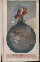
At head of map: Asia distinguished into its principall parts viz. Turky in Asia, Arabia, Persia, India, China, Tartaria, the islands of Japan, of the Philippines, of the Moluckes, of the Sundaes, of Ceylan, and of the Maldivies, where are set down the empires, monarchies, kingdoms, and states which are found there at present., Dedication in cartouche: To the most serene and most sacred majesty of Charles II by the grace of God, King of Great Brittain, France and Ireland. This map of Asia is humbly dedicated, and presented by your majesties loyal subject, and servant William Berry., Map of Asia from Saudi Arabia, Russia, India, China, Japan to Southeast Asia. Relief shown pictorially., No. 49 of 69 maps bound together in composite atlas., and Scale [ca. 1:12 165 120].
Publisher:
Sold by William Berry at the signe of the Globe between Charing-Cross and White-Hall
Subject (Geographic):
Asia --Maps --Early works to 1800, Asia, Central --Maps --Early works to 1800, South Asia --Maps --Early works to 1800, and Southeast Asia --Maps --Early works to 1800
Boehm, Augustus Gottlieb Hase, Johann Matthias, 1684-1742 Homann Erben (Firm)
Published / Created:
1744
Call Number:
1975 Folio 31
Collection Title:
[Atlas factice of 42 maps, produced by the Homann Erben firm]
Image Count:
1
Alternative Title:
Asia secundum legitimas projectionis stereographicae regulas et juxta recentissimas observationes and Carte de l’Asie, projettee stereographiquement, tiree des relations et observations
Colophon: Amstelodami, apud Theodorus Danckerts ..., Engraved t.-p., col., with imprint on mounted slip; imprint on verso of t.-p.: Amstelodami, apud Fredericum de Wit ..., and Maps signed by Justus, Cornelis, Theodore or Johann Danckerts, Frederick de Wit and others.
Publisher:
Bij Iustus Danckers in de Calverstraet in de Dancbaerheijt
Autograph of Gravely. Autograph of Baldock. Autograph of Aston. Autograph of W. Alington. and Teaching resource: Professor John Mack Faragher, History 141: The American West.
Publisher:
Printed for Thomas Bowles, next to the Chapter-house in St. Paul’s Church-yard, and John Bowles, at the Black Horse in Cornhill ...,
Ferro meridian., From Bleau's Atlas major (German ed.). Zu Amsterdam : Bey Johannem Blaeu, [ca. 1670]., No. 58 of 69 maps bound together in composite atlas., Relief shown pictorially., and Scale [ca. 1:4 000 000].
Homann Erben (Firm) Mayer, Tobias, 1723-1762 Schneider, R. A.
Published / Created:
1747 [i.e. 1748?]
Call Number:
1975 Folio 31
Collection Title:
[Atlas factice of 42 maps, produced by the Homann Erben firm]
Image Count:
1
Alternative Title:
Carte des XVII. provinces ou de l’Allemagne inferievre, dressee suivant la projection stereographique, et appueyee par les mesures faites de Mess. Cassini, Snellius et Mouschenbrok, par Mr. Tob. Majer de la Societe geographique, et publiee par les Heritiers de Homann, l’An 1748
Publisher:
Cura et Studio Homannianorum Heredum
Subject (Geographic):
Belgium --Maps --Early works to 1800, Benelux countries --Maps --Early works to 1800, Luxembourg --Maps --Early works to 1800, and Netherlands --Maps --Early works to 1800
[Atlas factice of 32 maps and 1 distance table, produced by the Homann Erben firm]
Image Count:
2
Alternative Title:
Carte des XVII. provinces ou de l’Allemagne inferievre, dressee suivant la projection stereographique, et appueyee par les mesures faites de Mess. Cassini, Snellius et Mouschenbrok, par Mr. Tob. Majer de la Societe geographique, et publiee par les Heritiers de Homann, l’An 1748
Publisher:
Cura et Studio Homannianorum Heredum
Subject (Geographic):
Belgium --Maps --Early works to 1800, Benelux countries --Maps --Early works to 1800, Luxembourg --Maps --Early works to 1800, and Netherlands --Maps --Early works to 1800
[Atlas factice of 42 maps, produced by the Homann Erben firm]
Image Count:
1
Resource Type:
Maps, Atlases & Globes
Alternative Title:
Belgium Catholicum seu decem provinciae Germaniae inferioris and Carte des Pais Bas catholiques ou des X provinces de l’Allegmagne inferieure, etc. dessinee au juste selon les exactes observations astronomiques et operations geometriques des Messur. Cassini, Snellius, Muschenbrok, etc. dressee par Sr. Tobias Maier, mathematicien; aux depens des Heritiers de Homann
Publisher:
Edentibus Homannianis heredib
Subject (Geographic):
Belgium --Maps --Early works to 1800 and Luxembourg --Maps --Early works to 1800