Skip to search
Skip to main content
Skip to first result
Search
You Searched For
Resource Type
Maps, Atlases & Globes
Language
Italian
New Search
Search Results
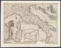
Creator:
Published / Created:
1750]
Call Number:
40 1760A
Container / Volume:
BRBL_00197
Image Count:
1
Resource Type:
Maps, Atlases & Globes
Description:
Appears in Guillaume de l'Isle's Atlante novissimo, vol. 2, pl. 17 (plate only num, Imperfect: Mutilated, with some loss of text. Mounted on linen. Sheet measures 38 x 49 cm. dgvmp2008., Includes scale in Italian miles., and Inset: Il regno di Sicilia.
Publisher:
Giambatista Albrizzi q. Girol.,
Subject (Geographic):
Italy--Maps--Early works to 1800
Found in:
Beinecke Rare Book and Manuscript Library > Carta geografica generale dell' Italia.
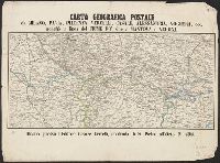
Published / Created:
[1858?]
Call Number:
40 M59 1858
Container / Volume:
BRBL_00211
Image Count:
1
Resource Type:
Maps, Atlases & Globes
Publisher:
Cesare Crivelli,
Subject (Geographic):
Italy, Northern--Maps
Found in:
Beinecke Rare Book and Manuscript Library > Carta geografica postale da Milano, Pavia, Piacenza, Vercelli, Casale, Alessandria, Voghera, ecc. : nonchè la linea del fiume po' sino a Mantova e Verona.
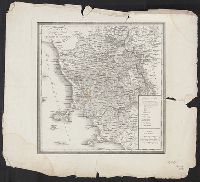
Published / Created:
[1835?]
Call Number:
405 1835
Container / Volume:
BRBL_00235
Image Count:
1
Resource Type:
Maps, Atlases & Globes
Publisher:
Presso Luigi Demicheli,
Subject (Geographic):
Tuscany (Italy)--Maps
Subject (Topic):
Post roads--Italy--Tuscany--Maps
Found in:
Beinecke Rare Book and Manuscript Library > Carta geografica postale del gran ducato di Toscana.
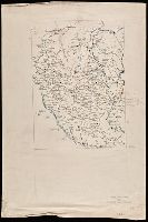
Published / Created:
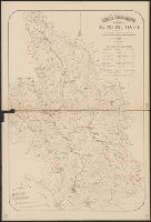
[between 1840 and 1849?]
Call Number:
BrSides Double Folio 2018 104
Image Count:
1
Resource Type:
Maps, Atlases & Globes
Description:
Cartographer's name in lower right corner illegible., Coordinates not present on map and are approximated., Manuscript number at bottom: 334., and Manuscript number on verso: 2170.
Subject (Geographic):
Lombardy (Italy)--Maps.
Found in:
Beinecke Rare Book and Manuscript Library > Carta geographia della provincia di Milano.
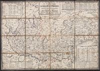
Published / Created:
1880
Call Number:
40cbj T433 1880
Container / Volume:
BRBL_00229
Image Count:
2
Resource Type:
Maps, Atlases & Globes
Description:
Includes table showing areas of subbasins. and Relief shown by spot heights.
Subject (Geographic):
Tiber River Watershed (Italy)--Maps
Subject (Topic):
Hydrology--Italy--Tiber River Watershed--Maps
Found in:
Beinecke Rare Book and Manuscript Library > Carta idrografica del Bacino del Tevere : con l'indicazione dei bacini dei principali affluenti non che delle stazioni meteorologiche pluvometriche ed idrometriche.
Call Number:
402 1832
Container / Volume:
BRBL_00233
Image Count:
1
Resource Type:
Maps, Atlases & Globes
Description:
Hand colored. Dissected and mounted on linen. Stamp: Karpinski-von Wieser Map Collection.
Subject (Geographic):
Lombardo-Venetian Kingdom--Maps
Found in:
Beinecke Rare Book and Manuscript Library > Carta itineraria del Regno Lombardo-Veneto indicante tutte le stazioni postali e militari ... / Ant. Magnarón incise.
Creator:
Call Number:
39hc 1823A
Container / Volume:
BRBL_00192
Image Count:
1
Resource Type:
Maps, Atlases & Globes
Description:
"Tav. II"--Verso. and Relief shown by hachures.
Subject (Geographic):
Catalonia (Spain)--History, Military--19th century--Maps and Catalonia (Spain)--Maps
Subject (Name):
Bordiga, Giovanni Battista, 1799-
Subject (Topic):
Peninsular War, 1807-1814--Maps
Found in:
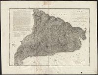
Beinecke Rare Book and Manuscript Library > Carta militare della Catalogna : per servire alla storia delle truppe italiane nelle diverse posizioni e spedizioni di più eserciti dal 1808 al 1813 ... / Cre. Vacani disegno ; Gio. Bordiga incise.
Published / Created:
[1844?]
Call Number:
401 1844
Container / Volume:
BRBL_00233
Image Count:
1
Resource Type:
Maps, Atlases & Globes
Description:
In upper margin: Atlante geografico dell'Italia ; Stati Sardi Italiani di Terraferma.
Publisher:
Vallardi,
Subject (Geographic):
France--Maps and Italy--Maps
Subject (Name):
Zuccagni-Orlandini, Attilio, 1783-1872. Atlante geografico degli stati italiani
Found in:
Beinecke Rare Book and Manuscript Library > Carta moderna degli State Sarde di Terraferma [cartographic material] / V. Stanghi e G. Maina Inc. ; G Pozzi scrisse.
Published / Created:
[1850?]
Call Number:
403 1850
Container / Volume:
BRBL_00234
Image Count:
1
Resource Type:
Maps, Atlases & Globes
Description:
In upper margin: Carta Geografico dell'Italia ; Regno Lombardo Veneto.
Publisher:
Dott. Francesco Vallardi,
Subject (Geographic):
Veneto (Italy)--Maps
Found in:
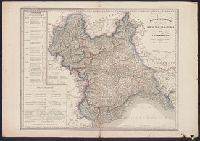
Beinecke Rare Book and Manuscript Library > Carta moderna del Regno Veneto / G. Maina e F. Stanghi inc. ; G. Pozzi scrisse.
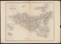
Published / Created:
1865
Call Number:
408 1860
Container / Volume:
BRBL_00238
Image Count:
1
Resource Type:
Maps, Atlases & Globes
Description:
Inset map: [1.] [Malta].
Publisher:
Francesco Vallardi,
Subject (Geographic):
Sicily (Italy)--Maps
Found in:
Beinecke Rare Book and Manuscript Library > Carta moderna dell'Isola di Sicilia e delle isole minori circonvicine / G. Maina e V. Stanghi inc. ; G Pozzi scrisse.
Branch:v1.61.6 ,Deployed:2024-06-12T09:55:19-04:00