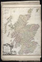
Delarochette, L. (Louis), 1731-1802, creator Faden, William, 1749-1836 Meta, C. Palmer, W. (William), 1739-1812
Published / Created:
1790 January 1
Call Number:
1982 Folio 10
Image Count:
1
Description:
Also appeared in Faden's [General atlas. London : William Faden, 1811?]., Includes illustrated cartouche C. Meta fec., No. 28 of 43 maps bound together in composite atlas., Relief shown pictorially., and Scale [ca. 1:1,350,000].
Publisher:
Willm. Faden
Subject (Geographic):
Greece --Maps --Early works to 1800 and Turkey --Maps --Early works to 1800
Bar scales given in Italian miles and com[m]on leagues of France., I. Harris, sc., Longitude east from London., No. 18 of 69 maps bound together in composite atlas., Relief shown pictorially., and Scale [ca. 1:2 300 000].
Publisher:
Improved and sold by Robt. Morden and Christopr. Browne at the Atlas in Cornhill and the Globe ye Westend of St. Pauls
Subject (Geographic):
Italy --History --1559-1789 --Maps and Italy --Maps --Early works to 1800
Italy divided according as its severall principalities extend, which are the territories of the Church, of the Catholick king, which contain the kingdomes of Naples, Sicily, Sardinia, and the Dukedome of Millain ... described by Sanson, corrected and amended by Will. Berry
Description:
Bar scales given in Italian miles, common leagues of Germany, great German leagues, common leagues of France, great French leagues, and common leagues of Spain., Dedicated To the most serene and most sacred majesty of Charles II ... by William Berry., No. 16 of 69 maps bound together in composite atlas., Relief shown pictorially., and Scale [ca. 1:2 300 000].
Publisher:
Sold by William Berry at the signe of the Globe between Charing-Cross and White Hall
Mediterranean Sea divided into the eastern and western seas, subdivides into its principal parts or seas ... described by Sanson, corrected and amended by William Berry
Description:
Based on La Mer Mediterranee divisee enses Principales Parties, ou Mers by Nicolas Sanson., Dedicated To the most serene and most sacred majesty James II ... by William Berry., Ms. mathematical annotations in left margin., No. 23 of 69 maps bound together in composite atlas., Relief shown pictorially., and Scale [ca. 1:610 000].
Publisher:
Sold by William Berry at the signe of the Globe between Charing-Cross and White-Hall
Eastern old world hemisphere has imprint: London ... Dec. 1st, 1786 by William Faden., No. 2 of 43 maps bound together in composite atlas., Scale [1:60,000,000]., and Shows western and eastern hemispheres separately.
Ed. statement appears on Northern Hemisphere map only., No. 3 of 43 maps bound together in composite atlas., Relief shown pictorially., Scale [ca. 1:41,000,000. At equator]., and Shows tracks of various ocean voyages.
Publisher:
William Faden
Subject (Geographic):
Northern Hemisphere --Maps --Early works to 1800 and Southern Hemisphere --Maps --Early works to 1800
Part of the circle of Austria in which are the Dukedomes of Stiria, and Carinthia, of Carniola, in which are comprehended the countys of Chilley, and of Gorice, Windis-Marke, or Marquisat of Windes, described by Sanson, corrected and amended by William Berry
Description:
Bar scales in Italian miles, common leagues of Germany, great leagues of Germany, leagues of Hungary, common leagues of France, and great leagues of France or one hours travelling., Dedicated to The most high mighty and most excellent prince ----------------- prince of England, Scotland, France and Ireland, and Duke of Cornwall by William Berry, Ferro meridian., No. 28 of 69 maps bound together in composite atlas., Relief shown pictorially., and Scale [ca. 1:660 000].
Publisher:
Sold by William Berry at the sign of the Globe between Charing-Cross, and White-Hall
Part of the circle of Austria viz. the Archdukedom of Austria divided into the higher above the river Ens, and the lower below the Ens ... described by Sanson, corrected and amended by William Berry
Description:
Bar scales in Italian miles, common leagues of Germany, great leagues of Germany, leagues of Hungary, common leagues of France, and leagues of one hours travelling., Dedicated To the most serene and most sacred majesty James II ... by William Berry., Ferro meridian., No. 27 of 69 maps bound together in composite atlas., Relief shown pictorially., and Scale [ca. 1:510 000].
Publisher:
Sold by William Berry at the sign of the Globe between Charing-Cross, and White-Hall