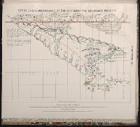
Maps of the Orinoco-Essequibo region, South America. Compiled for the Commission appointed by the
Image Count:
1
Resource Type:
Maps, Atlases & Globes
Subject (Geographic):
Amazon River--Discovery and exploration--Spanish, Amazon River--Maps, Caribbean Area--Maps--Early works to 1800, Colombia --Maps, Guyana --Maps, Orinoco River Valley (Venezuela and Colombia) --Maps, and Venezuela --Maps
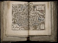
[Atlas factice of 96 maps by Blaeu, Visscher, Jansson, Hondius and others]
Image Count:
2
Description:
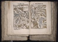
A set of 9 maps (no. IIII-XII) are from the Stumpf-Chronik., Hand col. Sheet measures 38.8 x 50 cm. Ms. notes in 19th century hand at bottom. Reinforced along edges with manuscript waste. No. 45 of 92 maps bound together., and Numbered 49 on verso.
Publisher:
[Christoffel Froschauer]
Subject (Geographic):
Germany, Southern --Maps --Early works to 1800 and Switzerland --Maps --Early works to 1800
Froschauer, Christoph, d. 1564, printer Stumpf, Johannes, 1500-1576?
Published / Created:
[ca. 1556?]
Call Number:
1983 Folio 19
Collection Title:
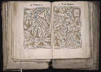
[Atlas factice of 96 maps by Blaeu, Visscher, Jansson, Hondius and others]
Image Count:
1
Description:
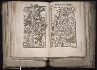
Each map hand col. Sheet measures 39 x 47.7 cm. Reinforced along edges with manuscript waste. No. 48 of 92 maps bound together.
Publisher:
Christoffel Froschauer
Subject (Geographic):
Graubunden (Switzerland)--Maps--Early works to 1800, Rhaetian Alps--Maps--Early works to 1800, Switzerland--Maps--Early works to 1800, and Ticino (Switzerland) --Maps--Early works to 1800
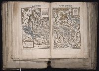
[Atlas factice of 96 maps by Blaeu, Visscher, Jansson, Hondius and others]
Image Count:
1
Description:
Each map hand col. Sheet measures 38.8 x 48 cm. Reinforced along edges with manuscript waste. No. 46 of 92 maps bound together. and Numbered 50 on verso.
Publisher:
Christoffel Froschauer
Subject (Geographic):
Zurich (Switzerland : Canton) --Maps --Early works to 1800
Froschauer, Christoph, d. 1564, printer Stumpf, Johannes, 1500-1576?
Published / Created:
[ca. 1556?]
Call Number:
1983 Folio 19
Collection Title:
[Atlas factice of 96 maps by Blaeu, Visscher, Jansson, Hondius and others]
Image Count:
1
Description:
Each map hand col. Sheet measures 38.5 x 47.9 cm. Reinforced along edges with manuscript waste. No. 47 of 92 maps bound together. and Numbered 51 on verso.
Froschauer, Christoph, d. 1564, printer Stumpf, Johannes, 1500-1576?
Published / Created:
[ca. 1556?]
Call Number:
1983 Folio 19
Collection Title:
[Atlas factice of 96 maps by Blaeu, Visscher, Jansson, Hondius and others]
Image Count:
1
Description:
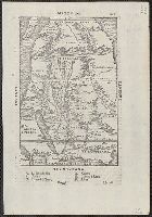
Each map hand col. Sheet measures 38.8 x 47.5 cm. Reinforced along edges with manuscript waste. No. 49 of 92 maps bound together. and Numbered 52 on verso.
Publisher:
Christoffel Froschauer
Subject (Geographic):
Basel (Canton) (Switzerland) --Maps--Early works to 1800 and Valais (Switzerland)--Maps--Early works to 1800
Appears in the author's Delle navigationi et viaggi., Covers Africa, except for the western bulge and southern tip., Has watermark., Includes text on verso., Oriented with north to the bottom., Pg. no. in upper right margin: 261., Relief shown pictorially., and Titl
Publisher:
G.B. Ramusio,
Subject (Geographic):
Africa--Maps--Early works to 1800
Subject (Name):
Ramusio, Giovanni Battista, 1485-1557. Delle navigationi et viaggi
Qazwīnī, Zakarīyā ibn Muḥammad, 1208 or 9-1283 or 4.
Published / Created:
[15--?]
Call Number:
Arabic MSS 575
Image Count:
2
Resource Type:
Maps, Atlases & Globes
Abstract:
In the center of the map is Mecca; the ocean is located on each side along the outer edge of the sheet with the pillars of the earth in the four corners. Great emphasis is placed on Africa and the Nile river. Other places of interest include: Wasteland where nobody lives, Mountains of the Moon, Land of the Slavs and Franks, Gog and Magog, Land of the Turks (Central Asia), Red Sea (rectangular water mass), the Source of life.
Description:
Gift of Thomas E. Marston, Yale '27, in honor of Alexander O. Vietor, Yale '36, in November 1978., Removed from a bound volume., and Tempera and ink.