Great Britain. War Office. General Staff. Geographical Section
Published / Created:
1944
Call Number:
428 IN7 1944
Container / Volume:
BRBL_00248
Image Count:
2
Resource Type:
Maps, Atlases & Globes
Alternative Title:
G.S.G.S. ; 4483 and GSGS (Series) ; 4483.
Description:
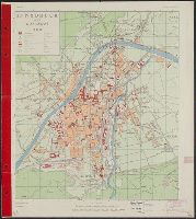
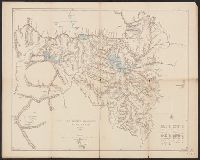
"Copied from an Austrian plan. Drafting and reproduction by 654th Engineers, U.S. Army.", Alpha-numeric grid overlay., and Index to public buildings and streets on verso.
G.S.G.S. no. 2555, G.S.G.S. no. 2555., and International Map Europe 1,000,000
Description:
"Drawn and printed at the War offi, Include notes, adjoining-sheet index diagram, coverage map, pronunciation glossary, list of source-materials, and "Agents for the sale of maps.", and Shows "Line claimed by M. Venizelos" and "Line of Franco-British Proposal."
Publisher:
G.S.G.S.,
Subject (Geographic):
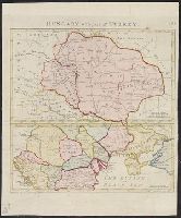
Balkan Peninsula--Maps
Subject (Topic):
World War, 1914-1918--Balkan Peninsula--Treaties--Maps and World War, 1914-1918--Territorial questions--Balkan Peninsula--Maps
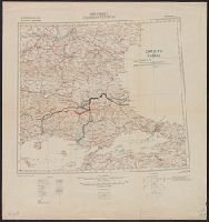
Carte No. 2, G.S.G.S. no. 2555, G.S.G.S. no. 2555., International Map Europe 1 000 000, and Thrace
Description:
"War Office, Jan.y. 1912. Revised Jan.y. 1916. Boundary revised Nov.r. 1918.", Include notes, adjoining-sheet index diagram, coverage map, pronunciation glossary, list of source-material "Authorities", and hypsometric tint diagram in margins., and Shows "Fronti
Publisher:
G.S.G.S.,
Subject (Geographic):
Balkan Peninsula--Maps
Subject (Topic):
World War, 1914-1918--Balkan Peninsula--Treaties--Maps and World War, 1914-1918--Territorial questions--Balkan Peninsula--Maps
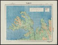
"Note: This map has been prepared from the Topographical map of the Japanese Empire, published by the Imperial Geological Survey of Japan..." and Inset map showing part of Kotsuke and Shimotsuke provinces, scale 1:800,000.