Search
You Searched For
Search Results
- Published / Created:
- [between 1840 and 1849?]
- Call Number:
- BrSides Folio 2018 146
- Image Count:
- 1
- Resource Type:
- Maps, Atlases & Globes
- Found in:
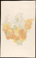
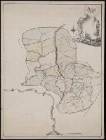
- Beinecke Rare Book and Manuscript Library > [Manuscript map of the regions in northern Italy].
- Published / Created:
- [1846?]
- Call Number:
- 54635 K836 1846
- Container / Volume:
- BRBL_00707
- Image Count:
- 1
- Resource Type:
- Maps, Atlases & Globes
- Found in:
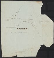
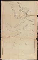
- Beinecke Rare Book and Manuscript Library > [Manuscript map showing part of the Bering Island or Komandor Islands and the position of the wreck of the ship "Baltic" out of New Bedford].
- Published / Created:
- [1830]
- Call Number:
- 42 Sa39 1830
- Container / Volume:
- BRBL_00706
- Image Count:
- 1
- Resource Type:
- Maps, Atlases & Globes
- Found in:
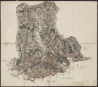
- Beinecke Rare Book and Manuscript Library > [Manuscript map showing part of the province of Salzburg]. Gezeichnet Franz Weys.
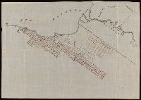
- Published / Created:
- [1920?]
- Call Number:
- 515 1920
- Container / Volume:
- BRBL_00707
- Image Count:
- 13
- Resource Type:
- Maps, Atlases & Globes
- Found in:
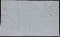
- Beinecke Rare Book and Manuscript Library > [Manuscript maps showing ruin sites etc. in the Transjordan and adjacent areas].
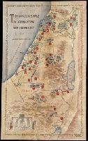
- Creator:
- Paucker, Fred
- Published / Created:
- 1957
- Call Number:
- 51 1957
- Image Count:
- 1
- Resource Type:
- Maps, Atlases & Globes
- Found in:
- Beinecke Rare Book and Manuscript Library > [Map of Israel] / Fred Paucker.
- Published / Created:
- [1872?]
- Call Number:
- BrSides Folio 2018 139
- Image Count:
- 1
- Resource Type:
- Maps, Atlases & Globes
- Found in:
- Beinecke Rare Book and Manuscript Library > [Map of Thunder Bay District, Canada, showing silver lands owned by Peter Mitchell & others, Sept. 7th, 1872].
- Creator:
- Loginov, Matveĭ
Логинов, Матвей
- Published / Created:
- [between 1750 and 1800?]
- Call Number:
- BrSides Double Folio 2019 79
- Image Count:
- 1
- Resource Type:
- Maps, Atlases & Globes
- Found in:
- Beinecke Rare Book and Manuscript Library > [Map of the Central and Southern Ural Mountains].
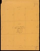
- Published / Created:
- [1848?]
- Call Number:
- Small Manuscript 766 N46 1848
- Image Count:
- 4
- Resource Type:
- Maps, Atlases & Globes
- Found in:
- Beinecke Rare Book and Manuscript Library > [Map of the Nine Squares of New Haven, showing dimensions].
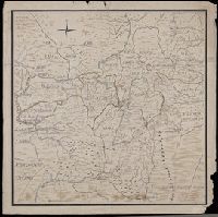
- Published / Created:
- [1780?]
- Call Number:
- BrSides Folio 2019 54
- Image Count:
- 1
- Resource Type:
- Maps, Atlases & Globes
- Found in:
- Beinecke Rare Book and Manuscript Library > [Map of the Perm province].
- Published / Created:
- [between 1790 and 1799?]
- Call Number:
- BrSides Folio 2017 123
- Image Count:
- 1
- Resource Type:
- Maps, Atlases & Globes
- Found in:
- Beinecke Rare Book and Manuscript Library > [Map of the confluence of Saint Marys and Amelia Rivers on the border between Georgia and Florida].