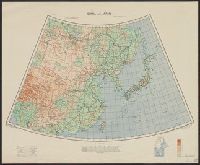
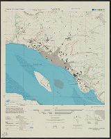
Great Britain. War Office. General Staff. Geographical Section
Published / Created:
1943
Call Number:
56cbf 1942
Container / Volume:
BRBL_00297
Image Count:
1
Resource Type:
Maps, Atlases & Globes
Alternative Title:
Great Britain. War Office. General Staff. Geographical Section. G.S.G.S. ; 4304. and Its [G.S.G.S.] ; 4304
Description:
"Drawn and reproduced by 512 (A. Fd. svy.) coy., R.E., Dec. 1941. Compiled from G.S.G.S. 4065 and 2957.", "Published by W.O. 1942.", Elevations shown by altitude tints., Marginal map: Index to adjoining sheet [Malaya] and boundaries., and Relief shown by contours
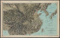
Great Britain. War Office. General Staff. Geographical Section
Published / Created:
1945
Call Number:
56 P36 1945
Container / Volume:
BRBL_00297
Image Count:
1
Resource Type:
Maps, Atlases & Globes
Alternative Title:
G.S.G.S. ; 3789
Description:
"9-45.", "Geographical Section, General Staff, No. 3789. Published at the War Office 1927. First GSGS Edition (AMS 1), 1926; Third GSGS Edition (AMS 2), 1944; AMS Revisions (AMS 3), 1944.", "Peking N3949-E11610/11x21"--Lower right margin., Includes legend., and R
"1-45.", "A.M.S. L991.", Includes glossary, index map to boundaries, and coverage diagram., and Relief shown variously by contours, hachures, form lines, and spot heights.
"11-44.", "A.M.S. L991.", Includes glossary, index map to boundaries, and coverage diagram., and Relief shown variously by contours, hachures, form lines, and spot heights.
"1-45.", "A.M.S. L991.", Includes glossary, index map to boundaries, and coverage diagram., and Relief shown variously by contours, hachures, form lines, and spot heights.
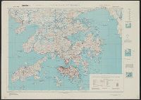
Great Britain. War Office. General Staff. Geographical Section
Published / Created:
1945
Call Number:
5681 1945
Container / Volume:
BRBL_00300
Image Count:
2
Resource Type:
Maps, Atlases & Globes
Alternative Title:
GSGS (Series), Hong Kong and Lema Islands, Hong Kong and Lema Islands., and Hong Kong and New territory.
Description:
"7-45.", "8-45.", "Reproduced under the direction of the Chief of Engineers by the Army Map Service (AM), U.S. Army ... 1945, from Kodalines of GSGS Second Edition 1945...", and North sheet. Hong Kong and New territory -- South sheet. Hong Kong and Lema Islands.
Publisher:
Army Map Service, U.S. Army,
Subject (Geographic):
Hong Kong (China)--Maps and New Territories (China)--Maps
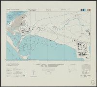
Great Britain. Army. Royal Engineers. Fd. Survey Coy., 512
Published / Created:
1943
Call Number:
493 1943
Container / Volume:
BRBL_00270
Image Count:
2
Resource Type:
Maps, Atlases & Globes
Alternative Title:
Geographical Section, General Staff ; no. 3859, Great Britain. Army. Middle East Forces. M.D.R ; 582., and GSGS (Series) ; 3859.
Description:
"[Gt. Brit. Army. Middle East Forces.] M.D.R. 582.", Includes glossary., Inset on sheet 2: Island of Fifia., Marginal maps: Reliability diagram -- Actual position of Fifia., Relief shown by contours, "interval 25 feet" ; depths shown by isolines., and Shows five c
Publisher:
Army Map Service, U.S. Army,
Subject (Geographic):
Gozo Island (Malta)--Maps and Malta--Maps
Subject (Name):
Great Britain. War Office. General Staff. Geographical Section and United States. Army Map Service
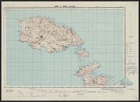
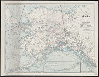
National Geographic Society (U.S.). Cartographic Division
Published / Created:
1914
Call Number:
848 1914D
Container / Volume:
BRBL_00631
Image Count:
1
Resource Type:
Maps, Atlases & Globes
Alternative Title:
National Geographic Magazine map of Alaska
Description:
"The Matthews-Northrup Works, Buffalo, N.Y.", At head of title: The National Geographic Magazine., Includes inset of "Western extension of Aleutian Islands" (scale l:7,500,000)., and Supplement to February, 1914 issue of The National Geographic Magazine.