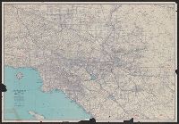
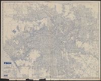
"428-S 8-CC" and "7-CC 799-S.", Copyright: H.M. Gousha Company., Includes index and inset of "Downtown Los Angeles interchange.", Index and map of "Los Angeles and vicinity" (scale [ca. 1:285,120]) on verso., and Relief shown by hachures.
Publisher:
The Company,
Subject (Geographic):
Los Angeles (Calif.)--Maps and Los Angeles Metropolitan Area (Calif.)--Maps
Subject (Name):
Richfield Oil Corporation
Subject (Topic):
Roads--California--Los Angeles Metropolitan Area--Maps and Streets--California--Los Angeles--Maps
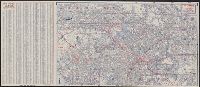
Copyright: Rand McNally & Company., In lower right: Y.3897., Includes inset of "Pacific Palisades.", and Indexes, "Los Angeles and vicinity (recreational map)," (scale [ca. 1:323,136]), and ill. on verso.
Publisher:
Rand McNally & Co.,
Subject (Geographic):
Los Angeles (Calif.)--Maps and Los Angeles Metropolitan Area (Calif.)--Maps
Subject (Name):
Union Oil Company of California
Subject (Topic):
Roads--California--Los Angeles Metropolitan Area--Maps and Streets--California--Los Angeles--Maps
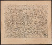
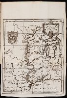
Bar scales given in "miliaria Germanica" and "milliaria Gallica"., Caption title., From the 1635 Latin ed. of Willem and Joan Blaeu's Theatrum orbis terrarum., In Latin on verso; with signature 2L., Includes coat of arms., Oriented with north to the right., and Rel
Publisher:
Apud Guiljelmum Blaeuw,
Subject (Geographic):
Lorraine (France)--Maps--Early works to 1800
Subject (Name):
Blaeu, Joan, 1596-1673. Theatrum orbis terrarum and Blaeu, Willem Janszoon, 1571-1638. Theatrum orbis terrarum
Appears in Justus Danckerts's first two Atlas editions; see Koeman, C. Atlantes Neerlandici, vol. III, Dan 1, Dan 2., Backed with paper. Ms. no. "59" in upper right-hand corner. Sheet measures 53.8 x 62.8 cm. No. 54 of 87 maps bound together., Bar scales given in "milliaria Germanica communia" and "milliaria Gallica communia"., Prime meridian: Ferro., and Relief shown pictorially.
Publisher:
Theodore Danckerts,
Subject (Geographic):
Alsace (France)--Maps--Early works to 1800., Baden-Württemberg (Germany)--Maps--Early works to 1800., Lorraine (France)--Maps--Early works to 1800., and Saarland (Germany)--Maps--Early works to 1800.