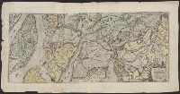
Descriptio ac delineatio geographica detectionis freti, sive, transitus ad occasum supra terras
Image Count:
1
Alternative Title:
Caerte van’t noorderste Russen, Samojeden, ende Tingoesen landt
Description:
Bound in after p. [30]., Description of Siberia by Isaac Abrahamszoon Massa., Map cut and folded irregularly., Map has multiple small ink stains on verso at the top., Printed on recto in lower right corner: D3., and Scale not given.
Subject (Geographic):
Barents Sea --Maps --Early works to 1800
Subject (Name):
Massa, Isaac, 1587-1635
Collection Created:
Amsterodami Ex officina Hesse lij Gerardi. Anno 1613
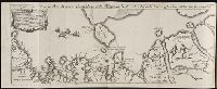
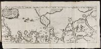
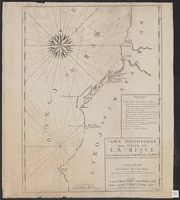
De i commentarii del viaggio in Persia di m. Caterino Zeno il K. & delle guerre fatte nell’ imperio
Image Count:
1
Alternative Title:
Carta da navegar de Nicolo et Antonio Zeni furono III Tramontana lano MCCCLXXX
Description:
Following p. 58., Map is linen backed., Map paper mutilated at lower right edge of margin revealing linen backing with no loss of text., Scale not given., and Teaching resource: Professor John Mack Faragher, History 141: The American West.
Subject (Geographic):
America --Discovery and exploration --Italian --Early works to 1800 and Greenland --Discovery and exploration --Early works to 1800
Subject (Name):
Zeno, Antonio, d. ca. 1405, Zeno, Niccolo, 1515-1565, and Zeno, Niccolo, d. ca. 1395
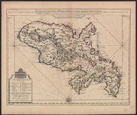
Bar scales given in "Lieues Marines et d'Espagne de 17 1/2 au Degré" and "Lieues Com. de France dont 25 font un Degré.", From Guillaume de L'Isle's Atlas nouveau, contenant toutes les parties du monde. Amsterdam : Chez Jean Cóvens & Corneille Mortier, [1742]., and Prime meridian: Ferro.
Publisher:
Chez Jean Covens et Corneille Mortier, geographes,
Subject (Geographic):
Martinique--Maps--Early works to 1800
Subject (Name):
Buache, Philippe, 1700-1773, Cóvens et Mortier, printer, and L'Isle, Guillaume de, 1675-1726. Atlas nouveau
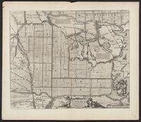
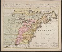
Kaart van de Engelsche en Fransche bezittingen in het vaste land van Noord America. and Possessions angloises & françoises du continet de l'Amérique septentrionale.
Description:
Based on Jean Palairet's Carte des possessions angloises françoises du continent de l'Amérique septentrionale, 1755., Hand colored., LC copy 2 accompanied by Jean Palairet's Beknopte beschr, Prime meridian: London and Île de Fer., and Relief shown pictorially.
Publisher:
Chez R. et J. Ottens, geográphes,
Subject (Geographic):
North America--Maps--Early works to 1800
Subject (Name):
Ottens, J. (Josua), 1704-1765 and Palairet, Jean, 1697-1774. Carte des possessions angloises françoises du continent de l'Amérique septentrionale