Skip to search
Skip to main content
Skip to first result
Search
You Searched For
Genre
Atlases
Genre
Engravings
Creator
Homann, Johann Baptist, 1663-1724
New Search
Search Results
Creator:
Published / Created:
1743
Call Number:
1975 Folio 31
Collection Title:
[Atlas factice of 42 maps, produced by the Homann Erben firm]
Image Count:
1
Alternative Title:
Staat von der Republic Genova, nach seiner Eintheilung in die ost- u. west-Revier
Publisher:
Homann Erben
Subject (Geographic):
Genoa (Italy) --Maps --Early works to 1800
Subject (Topic):
Atlases, German --Early works to 1800
Collection Created:
[Nuremberg,
Found in:
Beinecke Rare Book and Manuscript Library > Carta Geographica, la quale rappresenta lo Stato della Republica di Genova partita nella Riviera di Levante et di Ponente / [cartographic material] / data in publico per gli Heredi d'Homann ; con privil. imp le 1743 = Staat von der Republic Genova, nach s
Creator:
Published / Created:
1715?
Call Number:
1973 Folio 30
Collection Title:
[Atlas factice of 32 maps and 1 distance table, produced by the Homann Erben firm]
Image Count:
2
Publisher:
[Johann Baptist Homann]
Subject (Geographic):
Saxony (Germany) --Maps --Early works to 1800
Subject (Topic):
Atlases, German --Early works to 1800
Collection Created:
[Nuremberg : s.n., 1701-1760]
Found in:
Beinecke Rare Book and Manuscript Library > Circulus Saxoniae inferioris in omnes suos status et principatus / [cartographic material] / accurate divisus ex conatibus Io. Bapt. Homanni
Creator:
Published / Created:
1720?
Call Number:
1975 Folio 31
Collection Title:
[Atlas factice of 42 maps, produced by the Homann Erben firm]
Image Count:
1
Publisher:
Johann Baptist Homann
Subject (Geographic):
Italy, Northern --Maps --Early works to 1800 and Veneto (Italy) --Maps --Early works to 1800
Subject (Topic):
Atlases, German --Early works to 1800
Collection Created:
[Nuremberg,
Found in:
Beinecke Rare Book and Manuscript Library > Dominii Veneti cum vicinis Parmae, Mutinae, Mantuae, et Mirandolae statibus nova descriptio / [cartographic material] / edita a Ioh. Baptista Homanno, sacrae caes. majestatis geographo
Creator:
Published / Created:
1730?
Call Number:
1975 Folio 31
Collection Title:
[Atlas factice of 42 maps, produced by the Homann Erben firm]
Image Count:
1
Publisher:
Homann
Subject (Geographic):
Milan (Italy : Province) --Maps --Early works to 1800
Subject (Topic):
Atlases, German --Early works to 1800
Collection Created:
[Nuremberg,
Found in:
Beinecke Rare Book and Manuscript Library > Ducatus Mediolani una cum confinyes accurata tabula / [cartographic material] / exhibitus auctus et eme[n]datus per Ioh. Bapt. Homannum
Creator:
Published / Created:
1730
Call Number:
1975 Folio 31
Collection Title:
[Atlas factice of 42 maps, produced by the Homann Erben firm]
Image Count:
1
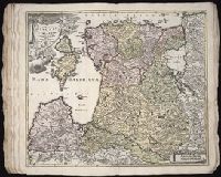
Alternative Title:
Ducatuum Livoniae et Curlandiae cum vicinis insulis
Publisher:
Johann Baptist Homann
Subject (Geographic):
Estonia --Maps --Early works to 1800 and Latvia --Maps --Early works to 1800
Subject (Topic):
Atlases, German --Early works to 1800
Collection Created:
[Nuremberg,
Found in:
Beinecke Rare Book and Manuscript Library > Ducatvvm Livoniae et Cvrlandiae cum vicinis insulis [cartographic material] : nova exhibitio geographica / editore Ioh. Baptista Homanno
Creator:
Published / Created:
1720?
Call Number:
1975 Folio 31
Collection Title:
[Atlas factice of 42 maps, produced by the Homann Erben firm]
Image Count:
1
Publisher:
Johann Baptist Homann
Subject (Geographic):
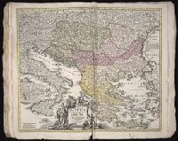
Balkan Peninsula --Maps --Early works to 1800
Subject (Topic):
Atlases, German --Early works to 1800
Collection Created:
[Nuremberg,
Found in:
Beinecke Rare Book and Manuscript Library > Fluviorum in Europa principis Danubii [cartographic material] : cum adiacentibus regnis nec non totius Graeciae et archipelagi novissima tabula / authore Joh. Baptista Homanno
Creator:
Published / Created:
1720?
Call Number:
1973 Folio 30
Collection Title:
[Atlas factice of 32 maps and 1 distance table, produced by the Homann Erben firm]
Image Count:
2
Publisher:
Johann Baptist Homann
Subject (Geographic):
Balkan Peninsula --Maps --Early works to 1800
Subject (Topic):
Atlases, German --Early works to 1800
Collection Created:
[Nuremberg : s.n., 1701-1760]
Found in:
Beinecke Rare Book and Manuscript Library > Fluviorum in Europa principis Danubii [cartographic material] : cum adiacentibus regnis nec non totius Graeciae et archipelagi novissima tabula / authore Joh. Baptista Homanno
Creator:
Published / Created:
1715?
Call Number:
1975 Folio 31
Collection Title:
[Atlas factice of 42 maps, produced by the Homann Erben firm]
Image Count:
1
Publisher:
Johann Baptist Homann
Subject (Geographic):
Ireland --Maps --Early works to 1800
Subject (Topic):
Atlases, German --Early works to 1800
Collection Created:
[Nuremberg,
Found in:
Beinecke Rare Book and Manuscript Library > Hiberniae regnum tam in praecipuas Ultoniae, Connaciae, Laceniae et Momoniae [cartographic material] : quam in minores earundem provincias et ditiones divisum ex prototype Guil. Petty-Vischeriano deductu et exhibitum / a Joh. Bapt. Homanno
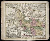
Creator:
Published / Created:
ca. 1724
Call Number:
1975 Folio 31
Collection Title:
[Atlas factice of 42 maps, produced by the Homann Erben firm]
Image Count:
1
Publisher:
Johann Baptist Homann
Subject (Geographic):
Iran --Maps --Early works to 1800 and Middle east --Maps --Early works to 1800
Subject (Topic):
Atlases, German --Early works to 1800
Collection Created:
[Nuremberg,
Found in:
Beinecke Rare Book and Manuscript Library > Imperii Persici in omnes suas provincias (tam veteribus quam modernis earundem nominibus signatas) [cartographic material] : exacte divisi nova tabula geographica / quam ex praecipuis Olearii, Tavernieri, Relandi aliorumque recentium authoreum scriptis co
Creator:
Published / Created:
[1746?]
Call Number:
1973 Folio 30
Collection Title:
[Atlas factice of 32 maps and 1 distance table, produced by the Homann Erben firm]
Image Count:
2
Alternative Title:
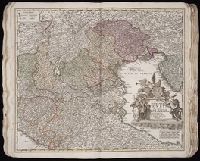
Allemagne distinguee en ses cercles & subdivisee en ses etats, contenant son etendue presente rectifiee & methodiquement enluminee suivant les elements de geographie de Mr. Schatz and Imperii Romano Germanici in suos status et circulos divisi tabula generalis
Publisher:
[Homann Erben?]
Subject (Geographic):
Austria --Maps --Early works to 1800, Czechoslovakia --Maps --Early works to 1800, Germany --Maps --Early works to 1800, Hungary --Maps --Early works to 1800, and Poland --Maps --Early works to 1800
Subject (Topic):
Atlases, German --Early works to 1800
Collection Created:
[Nuremberg : s.n.,
Found in:
Beinecke Rare Book and Manuscript Library > Imperii Romano Germanici in svos statvs et circvlos divisi tabvla generalis in ufus iuventutis erundiendae accommodata / [cartographic material] / a Ioh Bapt Homanno, S.C.M. Geographo, Reg. Boruss. Societ. Scient. Sodali
Branch:v1.61.8 ,Deployed:2024-06-20T11:14:48-04:00