[Atlas nouveau contenant toutes les parties du monde ou sont exactement marques les empires
Image Count:
1
Resource Type:
Maps, Atlases & Globes
Abstract:
Factitious collection of about 549 maps taken from the atlases of the 17th and the beginning of the 18th century, put together with the title "Atlas" and bound in 6 volumes. These volumes originally bore the imprint: Amstelaedamii apvd Reiniervm & Josvam Ottens. Over these words on the title pages of volumes 1-2 and 4-6 is the name of Henrik de Leth who painted them.
Description:
Verso blank.
Subject (Geographic):
British Isles --Maps --Early works to 1800
Subject (Name):
Leth, Hendrik de, 1703-1766, Reiner et Josua Ottens (Firm), Schenck, Peter, 1661-1715, Schenck, Peter, ca. 1698-1752, Valck, G. (Gerard), 1651 or 2-1726, and Wit, Frederik de
Subject (Topic):
Atlases --Early works to 1800
Collection Created:
[A Amsterdam, chez J. Covens & C. Mortier, ca. 1730-ca. 1800]
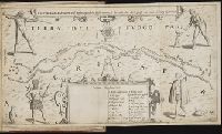
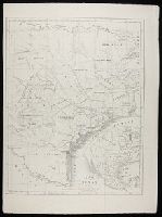
Bound in after p. 92., Map folded irregularly., Map has multiple small brown stains on both the recto and verso., Place names in multiple languages including Italian, Latin, Portuguese, and Spanish., and Scale [ca. 1:6,500,000].
Subject (Geographic):
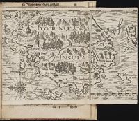
Borneo --Maps --Early works to 1800
Collection Created:
Gedruckt zu Franckfurt / Durch Matthaeum Becker, 1602
"Beylage des Projects, welches die Sorbonne Anno 1717. dem Czaren wegen Vereinigung der Römisch-Catholischen und Russisch-Griechischen Religion übergeben, und wovon im vorhergehenden Tractat gedacht worden": p. 433-444 (vol. 1)., "Das Leben und die Gewohnheiten der Ostiaken, eines Volcks, das bis unter dem Polo Arctico wohnet; wie selbiges seit Anno 1712 aus dem Heydenthum zur Christlichen Griechischen Religion gebracht worden, mit etlichen curieusen Anmerkkungen vom Königreiche Siberien und dem Freto Nassovio oder Waigats in der Gefangenschaft beschrieben von Johann Bernhard Müllern": p. [169]-214 (vol. 1)., "Journal von Lorentz Langens Reise nach China": p. 72-87 (vol. 1)., and Map of St. Petersburg (34.5 x 41 cm.) bound in between p. 432-433, with added directory following.
Publisher:
Bey Nicolai Försters und Sohnes ... ,
Subject (Geographic):
Russia--Description and travel and Saint Petersburg (Russia) -- Maps -- Early works to 1800
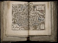
[Atlas factice of 96 maps by Blaeu, Visscher, Jansson, Hondius and others]
Image Count:
2
Description:
A set of 9 maps (no. IIII-XII) are from the Stumpf-Chronik., Hand col. Sheet measures 38.8 x 50 cm. Ms. notes in 19th century hand at bottom. Reinforced along edges with manuscript waste. No. 45 of 92 maps bound together., and Numbered 49 on verso.
Publisher:
[Christoffel Froschauer]
Subject (Geographic):
Germany, Southern --Maps --Early works to 1800 and Switzerland --Maps --Early works to 1800
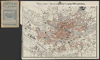
Neuester Plan der k. bayr. Stadt Nürnberg. and Neuester Plan von Nürnberg, mit Verzeichniss der Strassen und Zusammenstellung der Sehensẅurdigkeiten, Hôtels etc
Description:
Map accompanied by cover and street directory, not digitized.
Publisher:
Verlag ... der Joh. Ph. Raw'schen Buch- u. Kunsthandlung (J. Braun),
Contents (on title page) lists 27 maps numbered Ia-XX., Included are maps XXI-XXV, which form the supplement to the atlas; they are not listed in the Inhalt on t.p. but are also cited in the Nachricht., Relief shown by hachures., The subscriber to the 22d edition was allowed to order gratis, one map any from the publisher's Atlas der deutschen Bundes-Staaten which might make the entire work more useful to the teacher or pupil; this copy includes map VIII (Preussische Rhein-Provinz) and map IX (Preussische Provinz Westphalen) cf. Nachricht on t.p. verso., and Variations in numbering: no. XVIIb is used twice, for Ostindien mit den Inseln, and for Vorder-Asien und Nil-Land; XIXb is repeated, for Vereinigte Staaten von Nord-America und Canada, and for Vereinigte Staaten von Nord-America und Mexico.