New commercial atlas map of Utah and Utah automobile road map.
Description:
"Utah automobile road map" (scale [ca. 1:965,485]) and advertisement on verso., In lower right margin: 253c., Indexed., Relief shown by hachures., and Shows railroads and counties.
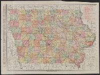
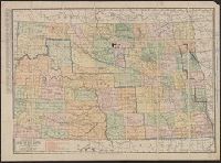
New commercial atlas map of Kansas and Rand, McNally & Co.'s new business atlas map of Kansas.
Description:
"260" and "261.", Also shows railroads., In lower right corner: Rand, McNally & Co.'s new business atlas map of Kansas. Copyright 1903 by Rand McNally & Co., In top margin: Commercial atlas of America, Kansas., Inde, Indexed on verso., and Relief shown by hachures.
Publisher:
Rand McNally,
Subject (Geographic):
Kansas--Maps
Subject (Name):
Rand McNally and Company. Commercial atlas of America
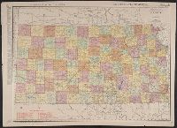
Also shows railroads., Date inferred from estimated 1914 population on verso., In lower right: 217A., Indexed on verso., Indexed., and Relief shown by hachures.
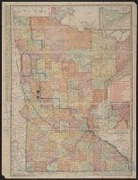
annotated in color pencil; verso index covered by backing., Includes insets of "N.E. corner of Minnesota, showing Cook Co." and "Minneapolis, St. Paul and vicinity.", Indexed on verso., and Shows railroads, counties, townships, etc.
Philadelphia and vicinity [cartographic material]. and Rand McNally & Co.'s map showing one hundred miles around Philadelphia.
Description:
Inset map on recto: Philadelphia and vicinity. Scale [ca. 1:116 000]., Map on verso: Rand McNally & Co.'s map showing one hundred miles around Philadelphia. Scale [ca. 1:506 880]. Eight miles to one inc, and Sheet measures 54 x 72 cm. Ms. no. on verso: Egk76 2.
Publisher:
Rand, McNally & Co.,
Subject (Geographic):
Middle Atlantic States--Maps, Philadelphia (Pa.)--Maps, and Philadelphia Metropolitan Area (Pa.)--Maps