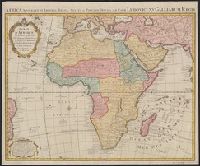
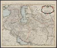
Africa accurate in imperia, regna, status & populos divisa, ad usum Ludovici XV Galliarum Regis and Africa accurate in imperia, regna, status et populos divisa, ad usum Ludovici XV Galliarum Regis
Description:
In French and Latin.
Publisher:
Chez I. Covens et C. Mortier,
Subject (Geographic):
Africa--Maps--Early works to 1800
Subject (Name):
Condet, Johannes, 1711-1781 and Cóvens et Mortier
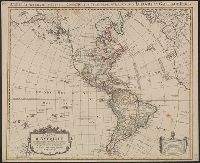
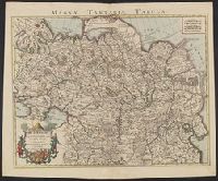
America accurate in imperia, regna, status, et populos divisa, ad usum Ludovici XV. Galliarum Regis
Description:
In French, with additional title in Latin., Includes "Avertissement"., Relief shown pictorially., and Sheet measures 51.5 x 63 cm. Numbered "108" in ink ms. Franklin Collection.
Publisher:
Chez Covéns & Mortier & Covéns Junior,
Subject (Geographic):
America--Maps--Early works to 1800
Subject (Name):
Anville, Jean Baptiste Bourguignon d', 1697-1782, Condet, Johannes, 1711-1781, engraver, and Covens et Mortier et Covens, junior
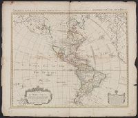
America accurate in imperia, regna, status, et populos divisa, ad usum Ludovici XV. Galliarum Regis
Description:
In French, with additional title in Latin., Includes "Avertissement"., Relief shown pictorially., and Sheet measures 58.5 x 69 cm. Stamp on verso: "Yale Horace Brown 1900S".
Publisher:
Chez Covéns & Mortier & Covéns Junior,
Subject (Geographic):
America--Maps--Early works to 1800
Subject (Name):
Anville, Jean Baptiste Bourguignon d', 1697-1782, Condet, Johannes, 1711-1781, engraver, and Covens et Mortier et Covens, junior
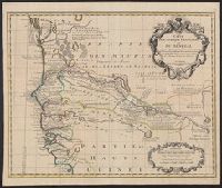
Covers portion of western Africa from Mauritania to Guinea., Includes text and ornamental cartouche., Prime meridian: Ferro., Relief shown pictorially., and Verso: stamped "Map Collection Yale Univ. Library" and numbered "46" in ink in upper right corner.
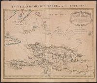
"Lieues marines Fr, Also shows southern part of Bahamas and Turks and Caicos Islands., Appears in de L'Isle's Atlas nouveau., Cross Collection no. 268., Ms. no. on verso: 10A., and Relief shown pictorially. Depths shown by shading.
Publisher:
Chez Jean Cóvens et Corneille Mortier, geographes,
Subject (Geographic):
Bahamas--Maps--Early works to 1800, Hispaniola--Maps--Early works to 1800, and Turks and Caicos Islands--Maps--Early works to 1800
Subject (Name):
Cóvens et Mortier, Frézier, Amédée François, 1682-1773, and L'Isle, Guillaume de, 1675-1726. Atlas nouveau
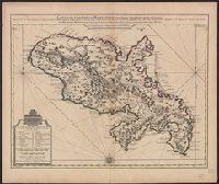
Bar scales given in "Lieues Marines et d'Espagne de 17 1/2 au Degré" and "Lieues Com. de France dont 25 font un Degré.", From Guillaume de L'Isle's Atlas nouveau, contenant toutes les parties du monde. Amsterdam : Chez Jean Cóvens & Corneille Mortier, [1742]., and Prime meridian: Ferro.
Publisher:
Chez Jean Covens et Corneille Mortier, geographes,
Subject (Geographic):
Martinique--Maps--Early works to 1800
Subject (Name):
Buache, Philippe, 1700-1773, Cóvens et Mortier, printer, and L'Isle, Guillaume de, 1675-1726. Atlas nouveau