Skip to search
Skip to main content
Skip to first result
Search
You Searched For
Resource Type
Maps, Atlases & Globes
New Search
Search Results
Published / Created:
Undated
Call Number:
1981 Folio 10
Collection Title:
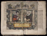
Gerardi Mercatoris Atlas, sive, Cosmographicae meditationes de fabrica mundi et fabricati figura
Image Count:
1
Resource Type:
Maps, Atlases & Globes
Subject (Topic):
Atlases --Early works to 1800, Atlases, Dutch, and Geography --Early works to 1800
Collection Created:
[Amsterdam] : Sumptibus & typis aeneis Judoci Hondij, Amsterodami, 1613
Found in:
Beinecke Rare Book and Manuscript Library > Gerardus Mercator natus Iudocus Hondius natus ...
Creator:
Published / Created:
undated
Call Number:
WA MSS 328
Image Count:
1
Resource Type:
Maps, Atlases & Globes
Abstract:
The map shows the Klamath River and Cottonwood Creek Mining district in Siskiyou County, California, Hornbook and Klamath City, and indicates the routes of the Yreka and Ashland stage road and the California and Oregon Railroad. Scale, 2inches = 1 mile.
Subject (Name):
California and Oregon Railroad Company --Maps and Siskiyou County (Calif.) --Maps
Subject (Topic):
Gold mines and mining--California, Northern--Maps, Gold mines and mining--California--Klamath River, and Gold mines and mining--California--Siskiyou County
Found in:
Beinecke Rare Book and Manuscript Library > Map of the ’Great Blue-Gravel Lead’ of Northern California /by J. P. Marker
Creator:
Call Number:
1978 Folio 106
Collection Title:
Maps of the Orinoco-Essequibo region, South America. Compiled for the Commission appointed by the
Image Count:
1
Resource Type:
Maps, Atlases & Globes
Subject (Geographic):
Caribbean Area--Maps--Early works to 1800, Guyana --Maps, and Orinoco River Valley (Venezuela and Colombia) --Maps
Collection Created:
Washington, 1897
Found in:
Beinecke Rare Book and Manuscript Library > Map of Guiana and Caribana by N. Sanson d'Abbeville, Paris, 1656
Creator:
Call Number:
1978 Folio 106
Collection Title:
Maps of the Orinoco-Essequibo region, South America. Compiled for the Commission appointed by the
Image Count:
1
Resource Type:
Maps, Atlases & Globes
Subject (Geographic):
Guyana --Maps and Orinoco River Valley (Venezuela and Colombia)
Collection Created:
Washington, 1897
Found in:
Beinecke Rare Book and Manuscript Library > Map of Guiana by Theodore de Bry, 1599
Creator:
Call Number:
1978 Folio 106
Collection Title:
Maps of the Orinoco-Essequibo region, South America. Compiled for the Commission appointed by the
Image Count:
1
Resource Type:
Maps, Atlases & Globes
Description:
Captions in German and English.
Subject (Geographic):
Guyana --Maps and Orinoco River Valley (Venezuela and Colombia)
Collection Created:
Washington, 1897
Found in:
Beinecke Rare Book and Manuscript Library > Chart of Guiana by Sir Walter Raleigh, [1595?]
Call Number:
1973 Folio 114
Collection Title:
The English pilot: describing the West-India navigation, from Hudson's-Bay to the river Amazones
Image Count:
1
Resource Type:
Maps, Atlases & Globes
Subject (Geographic):
Atlantic Ocean --Maps --Early works to 1800 and West Indies --Maps --Early works to 1800
Subject (Topic):
Navigation --Early works to 1800, Pilot guides --Atlantic Coast (U.S.) --Early works to 1800, and Pilot guides --Caribbean Area --Early works to 1800
Collection Created:
London : Printed for W. and J. Mount, T. Page and son, on Tower-Hill, MDCCLIX [1759]
Found in:
Beinecke Rare Book and Manuscript Library > A new and correct large chart of the tradeing part of the West Indies
Branch:v1.64.0 ,Deployed:2024-09-11T10:25:34-04:00