Skip to search
Skip to main content
Skip to first result
Search
You Searched For
Format
cartographic
New Search
Search Results
Creator:
Published / Created:
[ca. 1910].
Call Number:
51 1910
Container / Volume:
BRBL_00280
Image Count:
1
Resource Type:
Maps, Atlases & Globes
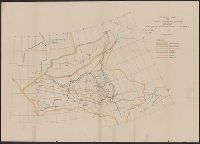
Description:
Inset: Environs of Jerusalem.
Publisher:
The Edinburgh Geographical Institute,
Subject (Geographic):
Palestine--Maps
Found in:
Beinecke Rare Book and Manuscript Library > General map of Palestine, Ancient and Modern / J.G. Bartholomew.
Creator:
Published / Created:
1905?]
Call Number:
837gce T764 1905
Container / Volume:
BRBL_00594
Image Count:
1
Resource Type:
Maps, Atlases & Globes
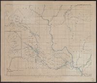
Description:
"Third annual report Reclamation Service, Pl. XXXI.", Relief shown by hachures and spot heights., and Shows irrigable lands, surveyed canal lines, and irrigation canals under construction.
Publisher:
U.S. G.P.O,
Subject (Name):
A. Hoen & Co and Geological Survey (U.S.). Reclamation Service. Annual report of the Reclamation Service
Subject (Topic):
Irrigation projects--Carson River Watershed (Nev.)--Maps, Irrigation projects--Truckee River Watershed (Calif. and Nev.)--Maps, and Irrigation--Nevada--Maps
Found in:
Beinecke Rare Book and Manuscript Library > General map of Truckee-Carson Project, Nevada / U.S. Geological Survey.
Published / Created:
190-?]
Call Number:
73GM 1909
Container / Volume:
BRBL_00376
Image Count:
1
Resource Type:
Maps, Atlases & Globes
Alternative Title:
General map northwestern Canada and General map of northwestern Canada, showing railways and navigable waters
Description:
Also shows river basins. and Relief shown by hachures.
Publisher:
s.n.,
Subject (Name):
Armstrong, John, chief engineer and Hudson Bay Railway
Subject (Topic):
Railroads--Prairie Provinces--Maps, Watersheds--Prairie Provinces--Maps, and Waterways--Prairie Provinces--Maps
Found in:
Beinecke Rare Book and Manuscript Library > General map of north-western Canada, showing railways and navigable waters / sg'd. John Armstrong, chief engineer, Hudson Bay R'y Surveys.
Creator:
Published / Created:
1863
Call Number:
BrSides Folio 2019 3
Image Count:
1
Resource Type:
Maps, Atlases & Globes
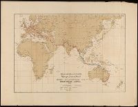
Alternative Title:
General map of telegraph lines between England and Australia
Publisher:
[publisher not identified],
Subject (Topic):
Telegraph--Eastern Hemisphere--Maps
Found in:
Beinecke Rare Book and Manuscript Library > General map of telegraph lines between England & Australia / Anglo-Australian & China Telegraph Company, Limited.
Creator:
Published / Created:
1867]
Call Number:
89 1866
Container / Volume:
BRBL_00658
Image Count:
1
Resource Type:
Maps, Atlases & Globes
Description:
"No. 1." in upper right margin., "To accompany report by Rear Admiral C.H. Davis, U.S.N., ordered by resolution of the Senate of the United States of March 19, 1866.", Copy 2 Imperfect. Mutilated with loss of text., and Relief shown by hachures.
Publisher:
Govt. Printing Office,
Subject (Name):
Waldecker, Louis
Subject (Topic):
Canals, Interoceanic--Planning--Maps, Canals--Central America--Planning--Maps, Canals--Mexico--Tehuantepec, Isthmus of--Planning--Maps, Railroads--Central America--Planning--Maps, and Railroads--Mexico--Tehuantepec,
Found in:
Beinecke Rare Book and Manuscript Library > General map of the American isthmuses : showing the various lines proposed for interoceanic communication / compiled by C.H. Davis ; drawn by Louis Waldecker.
Creator:
Published / Created:
1867]
Call Number:
89 1866
Container / Volume:
BRBL_00658
Image Count:
1
Resource Type:
Maps, Atlases & Globes
Description:
"No. 1." in upper right margin., "To accompany report by Rear Admiral C.H. Davis, U.S.N., ordered by resolution of the Senate of the United States of March 19, 1866.", and Relief shown by hachures.
Publisher:
Govt. Printing Office,
Subject (Name):
Waldecker, Louis
Subject (Topic):
Canals, Interoceanic--Planning--Maps, Canals--Central America--Planning--Maps, Canals--Mexico--Tehuantepec, Isthmus of--Planning--Maps, Railroads--Central America--Planning--Maps, and Railroads--Mexico--Tehuantepec,
Found in:
Beinecke Rare Book and Manuscript Library > General map of the American isthmuses : showing the various lines proposed for interoceanic communication / compiled by C.H. Davis ; drawn by Louis Waldecker.
Creator:
Published / Created:
1905?]
Call Number:
847 Y12 1905
Container / Volume:
BRBL_00627
Image Count:
1
Resource Type:
Maps, Atlases & Globes
Description:
In upper margin: U.S. Geological Survey, Third annual report Reclamation Service PL. LVII. and Relief shown by hachures and spot heights.
Publisher:
G.P.O.?,
Subject (Geographic):
Yakima River Watershed (Wash.)--Maps
Subject (Name):
Geological Survey (U.S.). Reclamation Service. Annual report of the Reclamation Service and Norris Peters Co
Found in:
Beinecke Rare Book and Manuscript Library > General map of the Yakima Basin, Washington.
Published / Created:
1843?]
Call Number:
51 B.C. 17
Container / Volume:
BRBL_00280
Image Count:
1
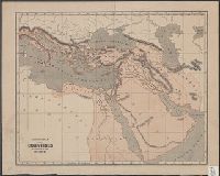
Resource Type:
Maps, Atlases & Globes
Publisher:
s. n.,
Subject (Geographic):
Middle East--Maps
Found in:
Beinecke Rare Book and Manuscript Library > General map of the counties mentioned in the Bible.
Creator:
Published / Created:
1880
Call Number:
812gbc 1880
Container / Volume:
BRBL_00556
Image Count:
1
Resource Type:
Maps, Atlases & Globes
Description:
"Plate no.XXXI"., Relief shown by hachures., and Shows ore in crevices, flats, and pitches in the Lafayette and Iowa counties in Wisconsin and the surrounding region.
Publisher:
Wisconsin Geological Survey,
Subject (Name):
Wisconsin. Geological Survey
Subject (Topic):
Lead mines and mining--Illinois--Maps, Lead mines and mining--Wisconsin--Maps, Lead--Illinois--Maps, and Lead--Wisconsin--Maps
Found in:
Beinecke Rare Book and Manuscript Library > General map of the lead region showing the distribution of the lodes / by James Wilson, Jr.
Published / Created:
1913
Call Number:
825 L487 1913
Container / Volume:
BRBL_00574
Image Count:
1
Resource Type:
Maps, Atlases & Globes
Description:
Shows railroad lines through portions of Nebraska, Iowa, Kansas, and Missouri.
Publisher:
s.n.],
Subject (Topic):
Railroads--Kansas--Leavenworth Region--Maps
Found in:
Beinecke Rare Book and Manuscript Library > General map of vicinity of Leavenworth.
Branch:v1.61.6 ,Deployed:2024-06-12T09:55:19-04:00