Skip to search
Skip to main content
Skip to first result
Search
You Searched For
Extent of Digitization
Partially digitized
Format
cartographic
Genre
Hand coloring
New Search
Search Results
Published / Created:
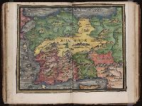
[1542]
Call Number:
Taylor 86
Collection Title:
Rvdimenta cosmographica
Image Count:
1
Subject (Geographic):
Turkey
Subject (Topic):
Cosmography, Early maps, and Geography, Medieval
Collection Created:
Impressvm in inclyta Transylvaniae Corona 1542
Found in:
Beinecke Rare Book and Manuscript Library > Asia Minor
Creator:
Published / Created:
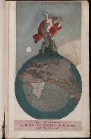
[1703?]
Call Number:
1975 Folio 55
Image Count:
6
Description:
Colophon: Amstelodami, apud Theodorus Danckerts ..., Engraved t.-p., col., with imprint on mounted slip; imprint on verso of t.-p.: Amstelodami, apud Fredericum de Wit ..., and Maps signed by Justus, Cornelis, Theodore or Johann Danckerts, Frederick de Wit and others.
Publisher:
Bij Iustus Danckers in de Calverstraet in de Dancbaerheijt
Subject (Topic):
Atlases--Early works to 1800
Found in:
Beinecke Rare Book and Manuscript Library > Atlas
Creator:
Published / Created:
[178-?]
Call Number:
1973 Folio 113
Image Count:
2
Resource Type:
Maps, Atlases & Globes
Alternative Title:
New and curious set of sixty two maps.
Description:
"The United States of North America, with the British & Spanish territories": no. 46. and Title-page engraved.
Publisher:
Printed for R. Wilkinson, at No. 58 in Cornhill
Subject (Topic):
Atlases--Early works to 1800 and Geography--Early works to 1800
Found in:
Beinecke Rare Book and Manuscript Library > Atlas minor: or A new and curious set of sixty two maps, in which are shewn all the empires, kingdoms, countries, states in all the known parts of the earth ... by Herman Moll ...
Published / Created:
1756
Call Number:
1973 Folio 119
Collection Title:
Atlas universel, par M. Robert ... et par M. Robert de Vaugondy son fils ...
Image Count:
1
Resource Type:
Maps, Atlases & Globes
Description:
Stamped on verso: "Lorraine" on right and left sides.
Subject (Geographic):
Lorraine (France) --Maps --Early works to 1800
Subject (Name):
Robert de Vaugondy, Didier, 1723-1786
Subject (Topic):
Atlases --Early works to 1800
Collection Created:
Paris, Chez les auteurs, quay de l’Horloge du Palais; Boudet libraire imprimeur du roi, rue St. Jacques, 1757[-58]
Found in:
Beinecke Rare Book and Manuscript Library > Carte de la Lorraine et Du Barrois dans laquelle se trouvent la generalite de metz et autres enclaves; dresseepour la lecture du memoire de M. Durival l'aine, et dediee au Roy de Pologne Duc de Lorraine et de bar par le Sr. Robert de Vaugondy ...
Published / Created:
1753
Call Number:
1973 Folio 119
Collection Title:
Atlas universel, par M. Robert ... et par M. Robert de Vaugondy son fils ...
Image Count:
1
Resource Type:
Maps, Atlases & Globes
Description:
Stamped on verso: "Egypte" on right and left sides.
Subject (Geographic):
Egypt --Maps --Early works to 1800
Subject (Name):
Robert de Vaugondy, Didier, 1723-1786
Subject (Topic):
Atlases --Early works to 1800
Collection Created:
Paris, Chez les auteurs, quay de l’Horloge du Palais; Boudet libraire imprimeur du roi, rue St. Jacques, 1757[-58]
Found in:
Beinecke Rare Book and Manuscript Library > Carte de la l'Egypte ancienne et moderne, dressee sur celle du R.P. Sicard et autres, assujielles aux observations astronomiques par le Sr. Robert de Vaugondy ...
Published / Created:
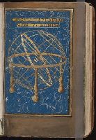
[1542]
Call Number:
Taylor 86
Collection Title:
Rvdimenta cosmographica
Image Count:
1
Subject (Topic):
Cosmography, Early maps, Geography, Medieval, and Scientific apparatus and instruments
Collection Created:
Impressvm in inclyta Transylvaniae Corona 1542
Found in:
Beinecke Rare Book and Manuscript Library > Circvlia sphaerae
Creator:
Published / Created:
1572]-1618
Call Number:
1975 Folio 41
Image Count:
1
Resource Type:
Maps, Atlases & Globes
Alternative Title:
Civitates orbis terrarum ...
Publisher:
[Coloniae Agrippinae,
Subject (Geographic):
Rome--Antiquities--Early works to 1800 and Rome--Antiquities--Maps
Subject (Topic):
Cities and towns, Medieval and Maps, Pictorial -- (LC)
Found in:
Beinecke Rare Book and Manuscript Library > Civitates orbis terrarvm ...
Published / Created:
[ca. 1675]
Call Number:
GEN MSS VOL 4
Collection Title:
Atlas of the world
Image Count:
1
Resource Type:
Maps, Atlases & Globes
Collection Created:
[Germany?, ca. 1675]
Found in:
Beinecke Rare Book and Manuscript Library > Die gantse welt
Published / Created:
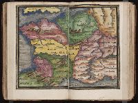
[1542]
Call Number:
Taylor 86
Collection Title:
Rvdimenta cosmographica
Image Count:
1
Subject (Geographic):
Europe and France
Subject (Topic):
Cosmography, Early maps, and Geography, Medieval
Collection Created:
Impressvm in inclyta Transylvaniae Corona 1542
Found in:
Beinecke Rare Book and Manuscript Library > Gallia
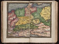
Published / Created:
[1542]
Call Number:
Taylor 86
Collection Title:
Rvdimenta cosmographica
Image Count:
1
Subject (Geographic):
Europe and Germany
Subject (Topic):
Cosmography, Early maps, and Geography, Medieval
Collection Created:
Impressvm in inclyta Transylvaniae Corona 1542
Found in:
Beinecke Rare Book and Manuscript Library > Germania
Branch:v1.61.6 ,Deployed:2024-06-12T09:55:37-04:00