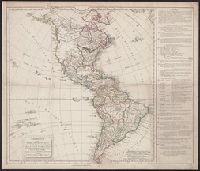
Anville, Jean Baptiste Bourguignon d', 1697-1782, cartographer
Published / Created:
[1748]
Call Number:
90 1748
Collection Title:
[Atlas général]. [Paris : Jean Baptiste Bourguignon d'Anville, 1771].
Container / Volume:
BRBL_00698
Image Count:
3
Resource Type:
Maps, Atlases & Globes
Description:
"Gravé par Guill? Delahaye.", Cross Collection no. 330., From Anville's Atlas général., Include 4 bar scales., Prime meridian: Ferro., Relief shown pictorially., Title in ms. on verso. Sheets numbered in ms. on verso: 115; 117; 119., and Watermarks.
Publisher:
Chez l'auteur, aux Galeries du Louvre,
Subject (Geographic):
South America--Maps--Early works to 1800
Subject (Name):
Anville, Jean Baptiste Bourguignon d', 1697-1782. Atlas général and Haye, G. de la, engraver
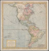
First impression of 3d French ed., Includes text and inset "Nouvelle carte de la baye d'Hudson et de Labrador selon les dernieres cartes levées sur les lieux.", Prime meridian: London., Relief shown pictorially., and Title in French and German.
Subject (Geographic):
North America--Maps--Early works to 1800
Subject (Name):
Hawkins, M., fl. 1776-1792 and Le Rouge, Georges-Louis
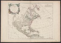
4th impression of 3d French ed. Cf. Ristow, W.W. A la carte, p. 112., Includes text and inset "Nouvelle carte de la baye d'Hudson et de Labrador selon les dernieres cartes levées sur les lieux.", Prime meridian: London., Relief shown pictorially., and Title in F
Publisher:
Le Rouge?,
Subject (Geographic):
North America--Maps--Early works to 1800
Subject (Name):
Hawkins, M., fl. 1776-1792 and Le Rouge, Georges-Louis
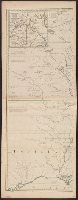
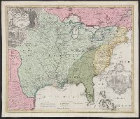
Appears in Homann Erben's Atlas geographicus major [1759 or 1763?]., Includes ill. and text., Relief shown pictorially., Some text in French., and Yale's card catalog notes "Fock catalogue no. 731 (fr. wh. acquired) gives date as ca. 1730"; and "In Homann J.B. Ne
Publisher:
[Homannianis heredibus?,
Subject (Geographic):
Louisiana--Maps--Early works to 1800 and North America--Maps--Early works to 1800
Subject (Name):
Hennepin, Louis, 17th cent and Homann Erben (Firm). Atlas geographicvs maior
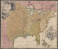
Includes ill. and text., Lowery refers to this version appearing in Homann's Atlas geographicvs maior exhibens tellurem seu globum terraqueum in mappis generalibus & specialibus ... (1759-[1781]), described in Phillips 622. Cf. Lowery 475., and Reference: Antiq
Publisher:
[s.n.,
Subject (Geographic):
Louisiana--Maps--Early works to 1800, Mississippi River Valley--Maps--Early works to 1800, and North America--Maps--Early works to 1800
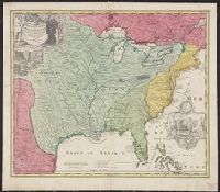
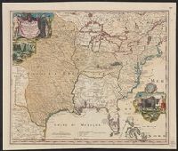