Search
You Searched For
Search Results
- Call Number:
- 1989 +19
- Collection Title:
- A collection of voyages and travels, some now first printed from original manuscripts, others now
- Image Count:
- 1
- Resource Type:
- Maps, Atlases & Globes
- Found in:
- Beinecke Rare Book and Manuscript Library > A chart and map of the Gold Coast of Guinea from Rio da Corsa to Ro da Volta. vol. V [5], pl. K
- Published / Created:
- Undated
- Call Number:
- 1973 Folio 56
- Collection Title:
- The American pilot, containing the navigation of the sea coast of North America, from the Streights
- Image Count:
- 1
- Resource Type:
- Maps, Atlases & Globes
- Found in:
- Beinecke Rare Book and Manuscript Library > A chart of South Carolina and Georgia
- Published / Created:
- 1739
- Call Number:
- WeInd Ehc 739
- Collection Title:
- A description of the Windward Passage, and Gulf of Florida, with the course of the British trading
- Image Count:
- 1
- Resource Type:
- Maps, Atlases & Globes
- Found in:
- Beinecke Rare Book and Manuscript Library > A chart of the Bahamas Islands with a description of the Gulf of Florida and Windward passage &c. referr'd from the figures here set down, to the general index annexed ... by J.C
- Call Number:
- 1973 Folio 114
- Collection Title:
- The English pilot: describing the West-India navigation, from Hudson's-Bay to the river Amazones
- Image Count:
- 1
- Resource Type:
- Maps, Atlases & Globes
- Found in:
- Beinecke Rare Book and Manuscript Library > A chart of the sea coast of Newfoundland, New Scotland, New England, New York, New Jersey, with Virginia and Maryland
- Creator:
- Cook, James, 1728-1779
Gulielmus Whitchurch
- Published / Created:
- 1776
- Call Number:
- 1977 +300
- Collection Title:
- A voyage towards the South pole, and round the world. Performed in His Majesty’s ships the
- Image Count:
- 1
- Resource Type:
- Maps, Atlases & Globes
- Found in:
- Beinecke Rare Book and Manuscript Library > A chart of the southern hemisphere; shewing the tracks of some of the most distinguished navigators
- Creator:
- Gaudy Iohn
Parker, S
- Call Number:
- 1973 Folio 114
- Collection Title:
- The English pilot: describing the West-India navigation, from Hudson's-Bay to the river Amazones
- Image Count:
- 1
- Resource Type:
- Maps, Atlases & Globes
- Found in:
- Beinecke Rare Book and Manuscript Library > A chart shewing part of the sea coast of New Foundland from ye Bay of Bulls to little Plecentia ...
- Creator:
- Price, Charles, fl. 1700-1707
- Call Number:
- 1973 Folio 114
- Collection Title:
- The English pilot: describing the West-India navigation, from Hudson's-Bay to the river Amazones
- Image Count:
- 1
- Resource Type:
- Maps, Atlases & Globes
- Found in:
- Beinecke Rare Book and Manuscript Library > A correct chart of Hispaniola with the Windward Passage
- Call Number:
- 1973 Folio 114
- Collection Title:
- The English pilot: describing the West-India navigation, from Hudson's-Bay to the river Amazones
- Image Count:
- 1
- Resource Type:
- Maps, Atlases & Globes
- Found in:
- Beinecke Rare Book and Manuscript Library > A correct chart of the Caribbee Islands
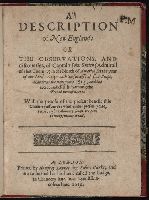
- Creator:
- Smith, John, 1580-1631
- Published / Created:
- 1616
- Call Number:
- Taylor 269
- Image Count:
- 3
- Resource Type:
- Books, Journals & Pamphlets
- Found in:
- Beinecke Rare Book and Manuscript Library > A description of New-England: or The observations and discoueries, of Captain Iohn Smith, (admirall of that country) in the north of America in the year of our Lord 1614, with the successe of sixe ships that went the next yeare 1615; and the accidents befell him among the French men of warre: with the proofe of the present benefit this countrey affoords: whither this present yeare, 1616, eight voluntary ships are gone to make further tryall.
- Creator:
- Moll, Herman, d. 1732
- Published / Created:
- [1732]
- Call Number:
- E1015 M66 1732
- Collection Title:
- Atlas minor: or a set of sixty-two new and correct maps, of all parts of the world. All composed
- Image Count:
- 1
- Found in:
- Beinecke Rare Book and Manuscript Library > A description of the Bay of Fundy showing ye coast, islands, harbours, creeks, coves, rocks, sholes, soundings & anchorings &c... Observed by Nat. Blackmore in ye yeare 1711 and 1712 ...