The discoveries of John Lederer : in three several marches from Virginia, to the west of Carolina
Image Count:
1
Description:
Engraved by Cross. and Preceding title page.
Subject (Geographic):
North Carolina --Description and travel, North Carolina --Maps --Early works to 1800, Virginia --Description and travel, and Virginia --Maps --Early works to 1800
Subject (Name):
Talbot, William
Subject (Topic):
Indians of North America --North Carolina and Indians of North America --Virginia
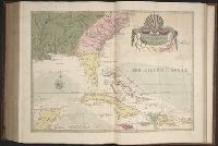
The American military pocket atlas : being an approved collection of correct maps, both general and
Image Count:
1
Description:
Augst. 5th. 1776., Inset: A particular plan of Lake George. surveyed in 1756. By Capt. Jackson., and Teaching resource: Professor John Mack Faragher, History 141: The American West.
Publisher:
Printed for Robt. Sayer & Jno. Bennett, Map & Sea Chartsellers No. 53 Fleet Street, as the Act directs
Subject (Geographic):
North America --Maps --Early works to 1800 and United States --History --Revolution, 1775-1783 --Maps
Collection Created:
London : Printed for R. Sayer and J. Bennet, [1776]
Atlas minor: or a set of sixty-two new and correct maps, of all parts of the world. All composed
Image Count:
1
Description:
Autograph of Gravely. Autograph of Baldock. Autograph of Aston. Autograph of W. Alington. and Teaching resource: Professor John Mack Faragher, History 141: The American West.
Subject (Geographic):
America--Maps--Early works to 1800 and Fundy, Bay of--Maps
Atlas minor: or a set of sixty-two new and correct maps, of all parts of the world. All composed
Image Count:
1
Resource Type:
Maps, Atlases & Globes
Description:
Autograph of Gravely. Autograph of Baldock. Autograph of Aston. Autograph of W. Alington. and Teaching resource: Professor John Mack Faragher, History 141: The American West.
Subject (Geographic):
America--Maps, Europe, Northern--Maps--Early works to 1800, Great Britain--Maps--Early works to 1800, and Ireland--Maps--Early works to 1800
Delaware --Maps --Early works to 1800, New Jersey --Maps --Early works to 1800, New York (State) --Maps --Early works to 1800, and Pennsylvania --Maps --Early works to 1800
Subject (Name):
Mifflin, Thomas, 1744-1800 and Wallis, John, 1734-1793
Subject (Topic):
Canals --Pennsylvania --Maps --Early works to 1800 and Roads --Pennsylvania --Maps --Early works to 1800
The natural history of Carolina, Florida, and the Bahama Islands : containing the figures of birds
Image Count:
1
Description:
Following p. 100.
Subject (Geographic):
Bahamas --Natural history, Florida --Natural history, North Carolina --Natural history, and South Carolina --Natural history
Subject (Topic):
Natural history --Bahamas, Natural history --North Carolina, Natural history --Pictorial works, Natural history --Pre-Linnean works, Natural history --South Carolina, and Natural history --Southern States