Search
You Searched For
Search Results
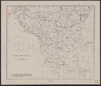
- Creator:
- Briesemeister, William A
- Published / Created:
- [1914?]
- Call Number:
- 44ak 1914A
- Container / Volume:
- BRBL_00256
- Image Count:
- 1
- Resource Type:
- Maps, Atlases & Globes
- Found in:
- Beinecke Rare Book and Manuscript Library > Balkan peninsula / drawn by Wm. Briesemeister.
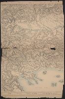
- Creator:
- American Geographical Society of New York
- Published / Created:
- [1918]
- Call Number:
- 11hcf 1919C-2
- Container / Volume:
- BRBL_00010T
- Image Count:
- 2
- Resource Type:
- Maps, Atlases & Globes
- Found in:
- Beinecke Rare Book and Manuscript Library > Block diagram showing terrain of the Balkan Peninsula.
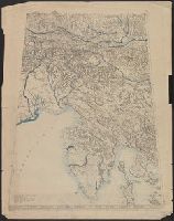
- Creator:
- American Geographical Society of New York
- Published / Created:
- 1918
- Call Number:
- 11hcf 1919E
- Image Count:
- 1
- Resource Type:
- Maps, Atlases & Globes
- Found in:
- Beinecke Rare Book and Manuscript Library > Block diagram showing terrain of the Trieste-Isonzo region.
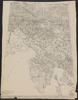
- Creator:
- American Geographical Society of New York
- Published / Created:
- [ca. 1914]
- Call Number:
- 403cbd 1900A
- Container / Volume:
- BRBL_00234
- Image Count:
- 1
- Resource Type:
- Maps, Atlases & Globes
- Found in:
- Beinecke Rare Book and Manuscript Library > Block diagram showing terrain of the Trieste-Isonzo region.
- Creator:
- Sanborn Map Company
- Published / Created:
- August, 1923.
- Call Number:
- 776 B764 1923
- Container / Volume:
- BRBL_00502
- Image Count:
- 4
- Resource Type:
- Maps, Atlases & Globes
- Found in:
- Beinecke Rare Book and Manuscript Library > Bridgeville, Sussex County, Delaware.
- Published / Created:
- [ca. 1880]
- Call Number:
- 771 N49 1880A
- Container / Volume:
- BRBL_00488
- Image Count:
- 1
- Resource Type:
- Maps, Atlases & Globes
- Found in:
- Beinecke Rare Book and Manuscript Library > Bridgman's map of the suburbs of New York City embracing the territory occupied by the homes of New York businessmen.
- Published / Created:
- 1858
- Call Number:
- 811cea Sa245 1858A
- Container / Volume:
- BRBL_00554
- Image Count:
- 1
- Resource Type:
- Maps, Atlases & Globes
- Found in:
- Beinecke Rare Book and Manuscript Library > Chart of East Neebish rapids, River St. Mary : showing the improved west channel, dredged and surveyed in 1858 under the direction of Capt. A.W. Whipple, T.E. / J.H. Foster U.S. Sub. Agt., James T. Foster, draughtsman.
- Published / Created:
- [1894?]
- Call Number:
- BrSides Double Folio 2018 93
- Image Count:
- 1
- Resource Type:
- Maps, Atlases & Globes
- Found in:
- Beinecke Rare Book and Manuscript Library > Chart of the world showing distances saved by the interoceanic canal of Nicaragua and Costa Rica [cartographic material].
- Creator:
- H.H. Lloyd & Co
- Published / Created:
- c1858.
- Call Number:
- 21gmh 1858
- Image Count:
- 1
- Resource Type:
- Maps, Atlases & Globes
- Found in:
- Beinecke Rare Book and Manuscript Library > Chart showing the track of the great submarine Atlantic telegraph : with the principal land & submarine telegraph lines in Europe & America, also the tracks of steamships, and the depth of the ocean.
- Published / Created:
- 1834
- Call Number:
- 806gmb C43 1834
- Container / Volume:
- BRBL_00549
- Image Count:
- 1
- Resource Type:
- Maps, Atlases & Globes
- Found in:
- Beinecke Rare Book and Manuscript Library > Chicago. Drwn by J.S.Wright, according to survey.