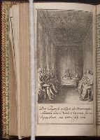
Allgemeines historisches Taschenbuch, oder, Abriss der merkwurdigsten neuen Welt-Begebenheiten
Image Count:
1
Description:
Facing p. 99.
Subject (Geographic):
United States --History --Revolution, 1775-1783, United States --History --Revolution, 1775-1783 --Congresses, and United States. Continental Congress, 1776
Baeck, Elias, called Heldenmuth Koning, Wilhelm, fl. 1715 Saffe, J. van, fl. 1715
Published / Created:
1715]
Call Number:
Zg17 C14 +715
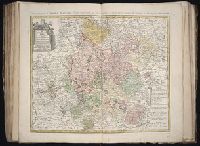
Image Count:
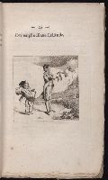
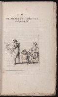
17
Description:
Bound with Il Callotto resuscitato. [Augsburg? 1715?]., Engraved throughout by Wilh. Koning or possibly by Elias Baeck, called Heldenmuth, after designs by J. van Saffe., Plate for August is dated 1715., The plates represent the months and have German verses; each is surrounded by an ornamental border., and The plates seem to have no subject connection with t.p.
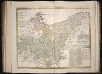
Gussefeld, F. L. (Franz Ludwig), 1744-1807 Homann Erben (Firm)
Published / Created:
1786
Call Number:
1983 Folio 23
Collection Title:
[Atlas factice of 50 maps, primarily by Johann Baptist Homann and/or issued by the Homann Erben
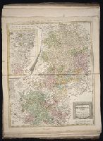
Image Count:
1
Alternative Title:
Carte geographique du Cercle de Haut-Rhin and Charte ueber die am Ober-Rhein zerstreut liegende Laender des Ober-Rheinischen Kreise
Publisher:
Bey denen Homaennischen Erben
Subject (Geographic):
Baden-Wu?rttemberg (Germany) --Maps --Early works to 1800, Hesse (Germany) --Maps --Early works to 1800, North Rhine-Westphalia (Germany) --Maps --Early works to 1800, and Rhineland-Palatinate (Germany) --Maps --Early works to 1800
Gussefeld, F. L. (Franz Ludwig), 1744-1807 Homann Erben (Firm) Schmidt, I. M.
Published / Created:
1783
Call Number:
1983 Folio 23
Collection Title:
[Atlas factice of 50 maps, primarily by Johann Baptist Homann and/or issued by the Homann Erben
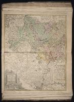
Image Count:
1
Alternative Title:
Carte geographique contenant le cours du Rhin, de la Meuse, & de la Moselle avec les cercles du haut- & bas-Rhin, le Duchee de Lorraine & d’Elsas & cc
Publisher:
Bey denen Homaen[n]ischen Erben
Subject (Geographic):
Germany, Southern --Maps --Early works to 1800, Hesse (Germany) --Maps --Early works to 1800, and Rhineland-Palatinate (Germany) --Maps --Early works to 1800