Skip to search
Skip to main content
Skip to first result
Search
You Searched For
Genre
Maps
Publication Place
[S.l. :
New Search
Search Results
Published / Created:
1919?]
Call Number:
11hcf 1919C-3-17
Container / Volume:
BRBL_00010U
Image Count:
1
Resource Type:
Maps, Atlases & Globes
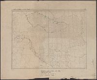
Description:
In upper right and bottom left: 610.
Publisher:
s.n.,
Subject (Geographic):
Balkan Peninsula--Maps and Europe, Eastern--Maps
Found in:
Beinecke Rare Book and Manuscript Library > Austria-Hungary.
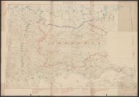
Published / Created:
1919?]
Call Number:
11hcf 1919C-3-16
Container / Volume:
BRBL_00010U
Image Count:
1
Resource Type:
Maps, Atlases & Globes
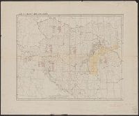
Description:
Ms. notes: Divided into land area, giving populations of various ethnic groups.
Publisher:
s.n.,
Subject (Geographic):
Balkan Peninsula--Maps and Europe, Eastern--Maps
Subject (Topic):
Ethnology--Balkan Peninsula--Maps and Ethnology--Europe, Eastern--Maps
Found in:
Beinecke Rare Book and Manuscript Library > Austria-Hungary.
Published / Created:
1919?]
Call Number:
11hcf 1919C-3-8
Container / Volume:
BRBL_00010U
Image Count:
1
Resource Type:
Maps, Atlases & Globes
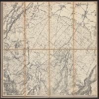
Description:
Hand colored regions and borders.
Publisher:
s.n.,
Subject (Geographic):
Balkan Peninsula--Maps and Europe, Eastern--Maps
Found in:
Beinecke Rare Book and Manuscript Library > Austria-Hungary.
Published / Created:
1880?]
Call Number:
3627 B14 1880
Image Count:
2
Resource Type:
Maps, Atlases & Globes
Description:
Dissected and mounted on linen. and Panel title.
Publisher:
s.n. ,
Subject (Geographic):
Bavaria (Germany)--Maps
Found in:
Beinecke Rare Book and Manuscript Library > Baierbrunn.
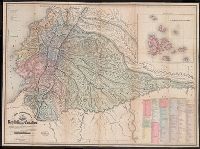
Published / Created:
1886
Call Number:
44 1886
Container / Volume:
BRBL_00255
Image Count:
2
Resource Type:
Maps, Atlases & Globes
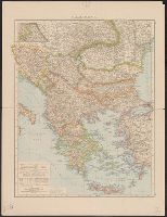
Alternative Title:
Konstantinopel und das Marmarameer, Völkerkarte der Balkanhalbinsel, and Vorderasien und Persian
Description:
"Sept. 1886." and Possibly from Richard Andree's allgemeiner Handatlas.
Publisher:
s.n.],
Subject (Geographic):
Balkan Peninsula--Maps
Found in:
Beinecke Rare Book and Manuscript Library > Balkanhalbinsel.
Published / Created:
1859]
Call Number:
40hc 1859J
Container / Volume:
BRBL_00231
Image Count:
1
Resource Type:
Maps, Atlases & Globes
Description:
Inset map: Fatto d'arme di Milazzo, 20 Luglio 1860.
Publisher:
s.n.,
Subject (Geographic):
Italy, Southern--Maps
Found in:
Beinecke Rare Book and Manuscript Library > Battaglia del Volturno.
Creator:
Published / Created:
1864
Call Number:
801hc N17 1864
Container / Volume:
BRBL_00541
Image Count:
1
Resource Type:
Maps, Atlases & Globes
Alternative Title:
[Sherman map collection ; no. 170]
Description:
For another copy see entry no. 433., From "39th Cong., 1st Sess. [1866]-Report of the Chief Engineer, U.S.A.", and Legend in the upper left corner contains a brief resume of each day's action while the map shows troop positions, roads, railroads, hachures, drainage, vegetation, and rural houses. Streets and houses of Nashville are not indicated.
Publisher:
s.n.],
Subject (Geographic):
Nashville (Tenn.)--History--Civil War, 1861-1865--Maps
Found in:
Beinecke Rare Book and Manuscript Library > Battlefields in front of Nashville where the United States forces commanded by Major General Geo. H. Thomas defeated and routed the Rebel army under General Hood, December 15th & 16th 1864 / surveyed and drawn under the direction of Gen: Tower by M. Peseu
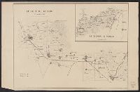
Published / Created:
1919]
Call Number:
11hcf 1919B-14
Container / Volume:
BRBL_00010O
Image Count:
1
Resource Type:
Maps, Atlases & Globes
Description:
"Fonds dressé par le Service Géographique de L'Armée Britannique.", In lower right: S.G.A. le 9/9/19 ; SGA 196 197., and Legend in French, English, and Italian.
Publisher:
s.n.,
Subject (Geographic):
Balkan Peninsula--Maps
Found in:
Beinecke Rare Book and Manuscript Library > Bulgarie.
Published / Created:
1870?]
Call Number:
4073cbf 1870
Container / Volume:
BRBL_00237
Image Count:
3
Resource Type:
Maps, Atlases & Globes
Description:
Foglio 61 (Parte Orientale). Napoli -- Folgio 62 (Parte Occidentale). Castellammare -- Folgio 62 (Parte Orientale). Castellammare.
Publisher:
s.n.,
Subject (Geographic):
Campania (Italy)--Maps
Found in:
Beinecke Rare Book and Manuscript Library > Campania, section of Pozzuoli, Napoli, to Castellammare.
Creator:
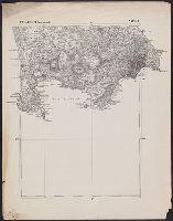
Published / Created:
1858
Call Number:
99 1858
Container / Volume:
BRBL_00679
Image Count:
1
Resource Type:
Maps, Atlases & Globes
Alternative Title:
Republica del Ecuador
Description:
"Delineada en vista de las cartas de Don Pedro Maldonado, el Baron de Humboldt, Mr. Wisse, la de las sontas de las costas por M.M. Filzroy i H. Kellet i las particular, Includes table of names of provinces, cantons, parishes, etc., and Relief shown by hachures.
Publisher:
s.n.],
Subject (Geographic):
Ecuador--Maps and Peru--Maps
Subject (Name):
Mayer, Ferdinand, b. ca. 1817
Found in:
Beinecke Rare Book and Manuscript Library > Carta corografica de la republica del Ecuador / Manuel Villavicencio ; lit. é imp. de F. Mayer y Ca.
Branch:v1.64.0 ,Deployed:2024-09-11T10:25:35-04:00