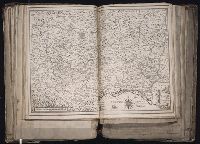
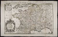
[Atlas factice of 96 maps by Blaeu, Visscher, Jansson, Hondius and others]
Image Count:
1
Description:
Imperfect: wormed in middle crease, with some loss of text. Reinforced along lower edges with manuscript waste. Sheet measures 39 x 51.5 cm. No. 36 of 92 maps bound together.
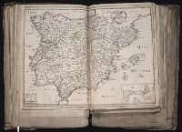
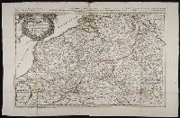
[Atlas factice of 96 maps by Blaeu, Visscher, Jansson, Hondius and others]
Image Count:
1
Description:
Imperfect: tear in upper left corner, repaired with no loss of text. Reinforced along lower edges with manuscript waste. Sheet measures 38.2 x 51.5 cm. No. 35 of 92 maps bound together.
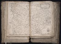
Publisher:
Christophe Tassin
Subject (Geographic):
Artois (France) --Maps --Early works to 1800 and Picardy (France) --Maps --Early works to 1800
Relief shown pictorially., Title from lower right cartouche., Originally in 4 sheets., Includes text and ill., and Insets: Les costes de la Louisiane de puis la Baye de l'Ascension jusques Acelle de St. Joseph ... Scale [ca. 1:1,000,000] -- Les environs de Québec -- Veüe de Québec.
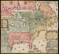
Publisher:
Chez L'Auteur
Subject (Geographic):
North America, Mississippi River Delta (La.), Gulf Coast (Miss.), Gulf Coast (Ala.), and Québec Region (Québec)
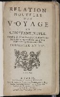
Istanbul (Turkey) --Description and travel and Marmara, Sea of (Turkey)
Subject (Name):
Aveele, Johannes van den, d. 1727, engraver, Ayasofya Muzesi--Pictorial works, Bute, John Stuart, Earl of, 1713-1792 --Bookplate, Luiken, Jan, 1649-1712, engraver, Orthodox Eastern Church, and Suleymaniye Camii (Istanbul, Turkey)--Pictorial works