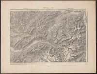
Search
You Searched For
Search Results
- Published / Created:
- 1877
- Call Number:
- 425 R119 1877
- Container / Volume:
- BRBL_00246
- Image Count:
- 2
- Resource Type:
- Maps, Atlases & Globes
- Description:
- Title supplied by cataloger.
- Publisher:
- [K.u.k. militär-geographischen Institut],
- Subject (Geographic):
- Austria--Maps
- Found in:
- Beinecke Rare Book and Manuscript Library > [Specialkarte des österr. Alpengebietes 1:75.000.] Zone 16 Col. IX, Radstadt.
- Published / Created:
- 1876
- Call Number:
- 425 H676 1876
- Container / Volume:
- BRBL_00246
- Image Count:
- 2
- Resource Type:
- Maps, Atlases & Globes
- Description:
- Title supplied by cataloger.
- Publisher:
- [K.u.k. militär-geographischen Institut],
- Subject (Geographic):
- Austria--Maps
- Found in:
- Beinecke Rare Book and Manuscript Library > [Specialkarte des österr. Alpengebietes 1:75.000.] Zone 17 Col. VIII, Hof-Gastein.
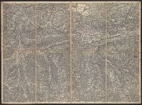
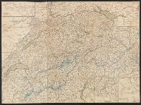
- Published / Created:
- 1820?]
- Call Number:
- 37 1820A
- Image Count:
- 2
- Resource Type:
- Maps, Atlases & Globes
- Description:
- 5 insets in border.
- Publisher:
- Heinrich Keller,
- Subject (Geographic):
- Switzerland--Maps
- Found in:
- Beinecke Rare Book and Manuscript Library > [Switzerland]
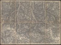
- Published / Created:
- 1864
- Call Number:
- 37 1907B
- Container / Volume:
- BRBL_00149
- Image Count:
- 1
- Resource Type:
- Maps, Atlases & Globes
- Description:
- "Blatt XLII", "Interlachen", "Sarnen Stanz".
- Publisher:
- Swiss Government],
- Subject (Geographic):
- Switzerland--Maps
- Found in:
- Beinecke Rare Book and Manuscript Library > [Switzerland] / G.H. Dufour direxit; H. Müllhaupt sculpsit.
- Published / Created:
- [1940?]
- Call Number:
- 456 1918
- Container / Volume:
- BRBL_00259
- Image Count:
- 1
- Resource Type:
- Maps, Atlases & Globes
- Description:
- Red lines connecting some towns printed over base map.
- Publisher:
- Kgl. Ung. Staatl. Kartographischen Institutes,
- Subject (Geographic):
- Transylvania (Romania)--Maps
- Found in:
- Beinecke Rare Book and Manuscript Library > [Transylvania] / Entworfen von Robert Csallner.
- Published / Created:
- [1940?]
- Call Number:
- 456 1918A
- Container / Volume:
- BRBL_00259
- Image Count:
- 1
- Resource Type:
- Maps, Atlases & Globes
- Description:
- Red lines connecting some towns printed over base map. and Relief shown by shading.
- Publisher:
- Kgl. Ung. Staatl. Kartographischen Institutes,
- Subject (Geographic):
- Transylvania (Romania)--Maps
- Found in:
- Beinecke Rare Book and Manuscript Library > [Transylvania] / Entworfen von Robert Csallner.
- Published / Created:
- [1940?]
- Call Number:
- 456 1940A
- Container / Volume:
- BRBL_00259
- Image Count:
- 1
- Resource Type:
- Maps, Atlases & Globes
- Description:
- In lower left corner: "M.224/935L." and Relief shown by shading.
- Publisher:
- Kgl. Ung. Staatl. Kartographischen Institutes,
- Subject (Geographic):
- Transylvania (Romania)--Maps
- Found in:
- Beinecke Rare Book and Manuscript Library > [Transylvania] / Entworfen von Robert Csallner.
- Published / Created:
- 1823
- Call Number:
- 89 1823
- Container / Volume:
- BRBL_00657
- Image Count:
- 1
- Resource Type:
- Maps, Atlases & Globes
- Description:
- Texts on borders of map.
- Publisher:
- Geographisches Institut,
- Subject (Geographic):
- Central America--Maps
- Found in:
- Beinecke Rare Book and Manuscript Library > geographisch-statistische charte von Guatemala.