Search
You Searched For
Search Results
- Published / Created:
- 1768
- Call Number:
- 755 1768A
- Container / Volume:
- BRBL_00429
- Image Count:
- 1
- Resource Type:
- Maps, Atlases & Globes
- Found in:
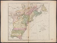
- Beinecke Rare Book and Manuscript Library > A new and Accurate map of North America drawn ... Mr. D'Anville with improvements from the best English maps ... Also the new divisions according to the late Treaty of Peace by Peter Bell ... Engraved by R.W. Seale.
- Published / Created:
- 1768
- Call Number:
- 755 1768
- Container / Volume:
- BRBL_00429
- Image Count:
- 1
- Resource Type:
- Maps, Atlases & Globes
- Found in:
- Beinecke Rare Book and Manuscript Library > A new and Accurate map of North America drawn from the famous Mr. D'Anville with improvements from the best English maps ... Also the new divisions according to the late Treaty of Peace by Peter Bell ... Engraved by R.W. Seale.
- Published / Created:
- [1756?]
- Call Number:
- 36 1756
- Container / Volume:
- BRBL_00118
- Image Count:
- 1
- Resource Type:
- Maps, Atlases & Globes
- Found in:
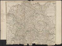
- Beinecke Rare Book and Manuscript Library > A new and accurate map of Germany ... By Eman. Bowen ...
- Published / Created:
- 1771
- Call Number:
- 755 1771A
- Container / Volume:
- BRBL_00429
- Image Count:
- 1
- Resource Type:
- Maps, Atlases & Globes
- Found in:
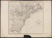
- Beinecke Rare Book and Manuscript Library > A new and accurate map of North America, Drawn from the famous Mr. D'Anville with improvements from the best English maps; and engraved by R.W. Seale; Also the New Divisions according to the late treaty of Peace, by Peter Bell Geor.
- Published / Created:
- 1759
- Call Number:
- 327cea C81 1759
- Container / Volume:
- BRBL_00074
- Image Count:
- 1
- Resource Type:
- Maps, Atlases & Globes
- Found in:
- Beinecke Rare Book and Manuscript Library > A new and correct chart of the Harbour of Corke by the Revd. J. Lindsay. J. Mynde Sculp.
- Published / Created:
- [1719?]
- Call Number:
- 32 1719
- Container / Volume:
- BRBL_00043
- Image Count:
- 1
- Resource Type:
- Maps, Atlases & Globes
- Found in:
- Beinecke Rare Book and Manuscript Library > A new and correct map of England and Wales now called South Britain ...
- Creator:
- Pownall, Thomas, 1722-1805
- Published / Created:
- 1777
- Call Number:
- 71 1777B
- Container / Volume:
- BRBL_00365
- Image Count:
- 1
- Resource Type:
- Maps, Atlases & Globes
- Found in:
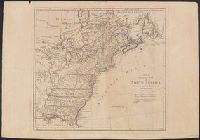
- Beinecke Rare Book and Manuscript Library > A new and correct map of North America, with the West India Islands : divided according to the last treaty of peace, concluded at Paris. 10th. Feby. 1763, wherein are particularly distinguished, the several provinces and colonies, which compose the Britis
- Creator:
- Pownall, Thomas, 1722-1805
- Published / Created:
- [1783?]
- Call Number:
- 71 1783B
- Container / Volume:
- BRBL_00366
- Image Count:
- 2
- Resource Type:
- Maps, Atlases & Globes
- Found in:
- Beinecke Rare Book and Manuscript Library > A new and correct map of North America, with the West India Islands : divided according to the preliminary articles of peace, concluded at Versailles, 20 Jan. 1783, wherein are particularly distinguished, the United States & the several provinces and colo
- Published / Created:
- 1790
- Call Number:
- 326 1790
- Container / Volume:
- BRBL_00069
- Image Count:
- 2
- Resource Type:
- Maps, Atlases & Globes
- Found in:
- Beinecke Rare Book and Manuscript Library > A new and correct map of Scotland or North Britain ... by Lieutenant Campbell.
- Published / Created:
- 1794 May 12
- Call Number:
- 755 1794G
- Container / Volume:
- BRBL_00436
- Image Count:
- 1
- Resource Type:
- Maps, Atlases & Globes
- Found in:
- Beinecke Rare Book and Manuscript Library > A new and correct map of the British colonies in North America comprehending eastern Canada with the province of Quebec, New Brunswick, Nova Scotia, and the Government of Newfoundland [cartographic material] : with the adjacent states of New England, Verm