Skip to search
Skip to main content
Skip to first result
Search
You Searched For
Format
cartographic
New Search
Search Results
Published / Created:
[1853]
Call Number:
11 1853
Container / Volume:
BRBL_00009
Image Count:
1
Resource Type:
Maps, Atlases & Globes
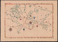
Description:
Map of the World in the Ortelius manner; more decorative than accurate. and Preliminary record.
Subject (Geographic):
World--maps
Found in:
Beinecke Rare Book and Manuscript Library > [World Map].
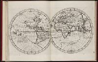
Published / Created:
[1848]
Call Number:
11 1848
Container / Volume:
BRBL_00009
Image Count:
1
Resource Type:
Maps, Atlases & Globes
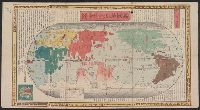
Description:
Preliminary record. and World map in two hemispheres.
Subject (Geographic):
World--maps
Found in:
Beinecke Rare Book and Manuscript Library > [World Map].
Creator:
Published / Created:
1900?]
Call Number:
11 1529
Image Count:
2
Resource Type:
Maps, Atlases & Globes
Description:
Copy 2: Col. Preliminary record. and Reprint of original at the Vatican Library.
Publisher:
W. Griggs,
Subject (Topic):
World maps--Early works to 1800
Found in:
Beinecke Rare Book and Manuscript Library > [World map]
Published / Created:
[Ca. 1612]
Call Number:
Taylor 258
Collection Title:
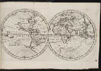
Descriptio ac delineatio geographica detectionis freti, sive, transitus ad occasum supra terras
Image Count:
1
Description:
Bound in after p. [8]., Map folded irregularly., Printed on recto in lower right corner: B., and Scale [ca. 1:160,000,000].
Subject (Name):
Quieros, Pedro Fernandes de, d. 1615
Subject (Topic):
World maps --Early works to 1800
Collection Created:
Amsterodami Ex officina Hesse lij Gerardi. Anno 1613
Found in:
Beinecke Rare Book and Manuscript Library > [World map]
Published / Created:
1606
Call Number:
Taylor 237
Collection Title:
Regimiento de navegacion mando hazer el rei nvestro senor por orden de sv conseio real de las
Image Count:
1
Description:
Right edge of map has been folded unevenly., Scale [ca. 1:141,000,000]., and Some place names appear inverted on map.
Subject (Name):
Garcia de Cespedes, Andres, d. 1611
Subject (Topic):
Navigation --Early works to 1800 and World maps --Early works to 1800
Collection Created:
Madrid, En casa de I. de la Cuesta, 1606
Found in:
Beinecke Rare Book and Manuscript Library > [World map]
Published / Created:
[Ca. 1612]
Call Number:
Pequot G325
Collection Title:
Descriptio ac delineatio geographica detectionis freti, sive, transitus ad occasum supra terras
Image Count:
1
Description:
Bound in after p. [8]., Printed on recto: "B" in lower right margin., and Scale [ca. 1:160,000,000].
Subject (Topic):
World maps --Early works to 1800
Collection Created:
Amsterodami Ex officina Hesse lij Gerardi. Anno 1613
Found in:
Beinecke Rare Book and Manuscript Library > [World map]
Creator:
Published / Created:
Anno Domini 1511]
Call Number:
11 1511A
Container / Volume:
BRBL_00732
Image Count:
1
Resource Type:
Maps, Atlases & Globes
Description:
Cordiform projection., From: "Claudii Ptholemaei Alexandrini liber geographiae cum tabulis...", From: Clavdii Ptholemaei Alexandrini Liber geographiae cvm tabvlis...1511., Lanman collection; dgvmp2008., Map is printed in two colors, red and black., Outer map border shows decorative windheads and zodiacal signs., The author's name is often given as Bernard Sylvanus (see Shirley entry 32, plate 35) or Bernardus Sylvanus., and Title supplied by cataloger.
Publisher:
Per Iacobum Pentium de Leucho,
Subject (Name):
Pencio, Jacopo, active 1486-1530 and Ptolemy, active 2nd century. Geographia
Subject (Topic):
World maps--Early works to 1800
Found in:
Beinecke Rare Book and Manuscript Library > [World map].
Branch:v1.61.6 ,Deployed:2024-06-12T09:55:19-04:00