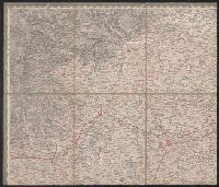
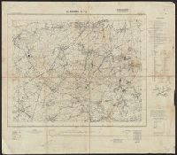
On verso: "Karte des Deutchen Reiches 1:100 000, Groβblatt 66", overstruck by black "X"., Relief shown by form lines, shading and spot heights. Depths shown on some sheets by shading., and Sheets individually subtitled with place name.
Publisher:
OKH/Gen St d H,
Subject (Geographic):
Algeria--Maps
Subject (Name):
Germany. Heer. Abteilung für Kriegskarten- und Vermessungswesen
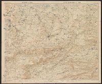
Copy 2: Imperfect: disbound; all sheets but Belluno, Trient, Padua, and Verona wanting; trimmed along neat line, with loss of marginal data. Sheets dissected and mounted on cloth. Stamps on verso: K.K. Un and Relief shown by hachures and spot heights.
Publisher:
Im Verlage der Herder'schen Kunst und Buchhandlung,
Copy 1: Imperfect: disbound; all sheets but Padua, Verona, and Milano wanting; trimmed along neat line, with loss of marginal data. Sheets dissected and mounted on cloth. and Relief shown by hachures and spot heights.
Publisher:
Im Verlage der Herder'schen Kunst und Buchhandlung,
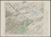
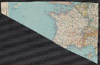
French and German., Relief shown by contours, gradient tints, and spot heights. Contours at 20 meter intervals., Sheets 2-6 wanting., and Shows hiking trails and paths.
Publisher:
Institut géographique Kümmerly & Frey,
Subject (Geographic):
Jura Mountains (France and Switzerland)--Maps
Subject (Name):
Kümmerly + Frey
Subject (Topic):
Hiking--Jura Mountains (France and Switzerland)--Maps and Trails--Jura Mountains (France and Switzerland)--Maps
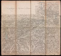
Herder, Bartholomä, 1774-1839, lithographer Woerl, Joseph Edmund Woerl, Joseph Edmund. Atlas von Central-Europa
Call Number:
30 1840B
Container / Volume:
BRBL_00031
Image Count:
1
Resource Type:
Maps, Atlases & Globes
Description:
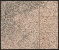
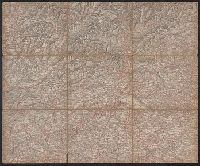
From Woerl's Atlas von Central-Europa, 1830., Imperfect: trimmed along neat line, with loss of marginal data. Dissected and mounted on cloth., Relief shown by hachures., and Title from label on verso.
Subject (Geographic):
Baden-Württemberg (Germany)--Maps, Graubünden (Switzerland)--Maps, Tyrol (Austria)--Maps, and Vorarlberg (Austria)--Maps
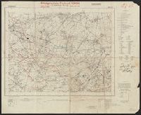
Relief shown by hachures., Sheets dated 1870 to 1874., Sheets dissected and mounted on linen. Stamp on verso of maps: Karpinski-von Wieser Map Collection. Seven sheets with labels and manuscript titles on verso., and Title supplied by cataloger.
Publisher:
[publisher not identified],
Subject (Geographic):
Tyrol (Austria)--Maps.
Subject (Name):
Karpinski, Louis Charles,--1878-1956--Ownership., Karpinski-von Wieser Map Collection., and Wieser, Franz,--Ritter von,--1848-1923--Ownership.