Skip to search
Skip to main content
Skip to first result
Yale University Library
Ask Yale Library
Reserve Rooms
Places to Study
Research
Quicksearch
Search Library Catalog (Orbis)
Search Law Library Catalog (MORRIS)
Search Borrow Direct
Search WorldCat
Search Articles+
Search Digital Collections
Search Archives at Yale
Research Guides
Find Databases by Title
Find eJournals by Title
Guide to Using Special Collections
Services
Your Personal Librarian
Subject Specialists
Research Support and Workshops
Citation Tools
OverDrive: Popular Audio and eBooks
Get It @ Yale (Borrow Direct, Interlibrary Loan, Scan & Deliver)
Course Reserves
Off-Campus Access
EliScholar
OverDrive: Popular Audio and eBooks
Bass Media Equipment
Libraries & Collections
Arts Library
Bass Library
Beinecke Library
Classics Library
Divinity Library
Film Study Center
Fortunoff Archive
Humanities Collections
International Collections
Law Library
Lewis Walpole Library
Library Collection Services
Manuscripts & Archives
Map Collection
Marx Science & Social Science Library
Medical Library
Music Library
Sterling Library
Yale Center for British Art
Information & Policies
Library Hours
Departments & Staff
Borrowing & Circulation
Services for Persons with Disabilities
Copyright Basics
Scanning, Printing & Copying
Computers & Wireless
Library Policies
About the Library
Giving to the Library
Purchase Request
Working at the Library
Terms Governing Use of Materials
Search in
All Fields
Creator
Title
Call Number
Date
Subject
Orbis ID
Full Text
Description
Full text
search for
Search
Search
Advanced Search
Digital Collections
Search
You Searched For
Extent of Digitization
Partially digitized
Resource Type
Maps, Atlases & Globes
Subject (Topic)
Atlases --Early works to 1800
New Search
« Previous
|
1
-
9
of
11
|
Next »
Sort
by relevance
relevance
Creator (A --> Z)
Creator (Z --> A)
Title (A --> Z)
Title (Z --> A)
Year (ascending)
Year (descending)
Number of results to display per page
9
per page
9
per page
30
per page
60
per page
99
per page
View results as:
List
List
Gallery
Gallery
Search Results
A new mapp of the kingdome of England, representing the princedome of Wales, and other provinces
Atlas francois ...
Carte de la Lorraine et Du Barrois dans laquelle se trouvent la generalite de metz et autres
Carte de la l'Egypte ancienne et moderne, dressee sur celle du R.P. Sicard et autres, assujielles
Comte de Namur dresse sur les memoirs les plus nouveaux presente a sa Majeste pour le service de
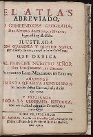
El atlas abreviado, o Compendiosa geografia, del mvndo antigvo, y nvevo, segun esta oy dividido ...
Gerardus Mercator natus Iudocus Hondius natus ...
Historia Imperii Romano-Germanici, nec non finitimarum Regionum In Mappa exhibita, ac aeri incisa a
La Generalite de Paris divisee ens ses eslections
PREVIOUS
«
1
2
»
NEXT
Limit your search
Extent of Digitization
Partially digitized
✖
[remove]
11
Access
Public
11
Repository
Beinecke Rare Book and Manuscript Library
11
Format
cartographic
7
still image
2
mixed material
1
text
1
Genre
Engravings
10
Maps
7
Hand coloring
5
Maps in books
5
Prints (Visual works)
4
Title pages
3
Illustrations
2
Resource Type
Maps, Atlases & Globes
✖
[remove]
11
Language
French
2
Latin
2
Spanish; Castilian
2
English
1
German
1
Creator
Sanson, Nicolas, 1600-1667
2
Jaillot, Alexis Hubert, 1632?-1712
1
Nolin, Jean Baptiste, 1648-1708
1
Visscher, Nicolaes, 1649-1702
1
Subject (Topic)
Atlases --Early works to 1800
✖
[remove]
11
Atlases, French.
2
Atlases, Dutch
1
Atlases, German
1
Geography --Early works to 1800
1
Subject (Name)
Laso, Francisco
2
Nicholas, Edward, d. 1726 --Bookplate and Autograph
2
Robert de Vaugondy, Didier, 1723-1786
2
Leth, Hendrik de, 1703-1766
1
Reiner et Josua Ottens (Firm)
1
Schenck, Peter, 1661-1715
1
Schenck, Peter, ca. 1698-1752
1
Valck, G. (Gerard), 1651 or 2-1726
1
Wit, Frederik de
1
Date Created
View distribution
Current results range from
1691
to
1756
Date Created range begin
Date Created range end
View larger »
[Missing]
6