Skip to search
Skip to main content
Skip to first result
Search
You Searched For
Resource Type
Maps, Atlases & Globes
Language
German
New Search
Search Results
Creator:
Published / Created:
[1916?]
Call Number:
38 1916
Container / Volume:
BRBL_00155
Image Count:
1
Resource Type:
Maps, Atlases & Globes
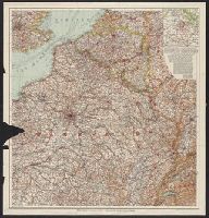
Description:
Imperfect: Frayed with loss of text. and Text in German and French.
Publisher:
Velhagen & Klasing,
Subject (Geographic):
Belgium--Maps and France--Maps
Found in:
Beinecke Rare Book and Manuscript Library > [Northeast France and Belgium].
Published / Created:
1890?]
Call Number:
366 N75 1890
Container / Volume:
BRBL_00145
Image Count:
4
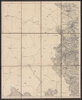
Resource Type:
Maps, Atlases & Globes
Description:
Dissected and mounted on linen. and West -- Ost.
Publisher:
s.n,
Subject (Geographic):
Swabia (Germany)--Maps
Found in:
Beinecke Rare Book and Manuscript Library > [Nördlingen].
Published / Created:
1918
Call Number:
11hc 1918-Z1
Container / Volume:
BRBL_00010F
Image Count:
1
Resource Type:
Maps, Atlases & Globes
Alternative Title:
Montcornet
Description:
"Bearbeitet und gedruckt im April 1918."
Publisher:
s.n.,
Subject (Geographic):
France--Maps
Found in:
Beinecke Rare Book and Manuscript Library > [Planmaterial der 7. Armee. 22. Montcornet.]
Published / Created:
1820?]
Call Number:
11 1820
Container / Volume:
BRBL_00007
Image Count:
1
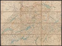
Resource Type:
Maps, Atlases & Globes
Description:
Asiatische Turkey --, Asien --, Deutschland --, Europaeisches Russland --, Frankreich --, Freye Tatarey --, Gross Britanien --, Hindostan, oder Vorderindien., Italien --, Japan --, Niederlande --, Oestreich --, Relief shown pictorially., Thibet --, Title sup, and Türkey --
Publisher:
s.n.,
Subject (Geographic):
Asia--Maps and Europe--Maps
Subject (Topic):
Playing cards--Maps
Found in:
Beinecke Rare Book and Manuscript Library > [Playing card maps of of Europe and Asia and their countries].
Published / Created:
[1915?]
Call Number:
11hcf 1919A-32
Container / Volume:
BRBL_00010N
Image Count:
1
Resource Type:
Maps, Atlases & Globes
Alternative Title:
Pola, Zara, Comacchio
Description:
"B.4." in upper left margin., "Teilweise berichtigt bis I. V. 1915.", and Stamped "American Geographical Society" above left margin and "Loaned by the American Geographical Society, Broadway at 136th St., New York to The Peace Conference at Versailles 1918-1919
Publisher:
K.u.K. Militär geographisches Institut,
Subject (Geographic):
Croatia--Maps and Italy--Maps
Subject (Topic):
World War, 1914-1918--Maps
Found in:
Beinecke Rare Book and Manuscript Library > [Regional map of the area around the Adriatic Sea : showing the cities of Pola, Zara, Comacchio] / K.u.K. Militärgeographisches Institut.
Published / Created:
[1833?]
Call Number:
37 1833
Image Count:
2
Resource Type:
Maps, Atlases & Globes
Subject (Geographic):
Switzerland--Maps
Found in:
Beinecke Rare Book and Manuscript Library > [Schweiz]
Published / Created:
1870?]
Call Number:
501 1870
Container / Volume:
BRBL_00276
Image Count:
1
Resource Type:
Maps, Atlases & Globes
Publisher:
s.n.,
Subject (Geographic):
Turkey--Maps
Found in:
Beinecke Rare Book and Manuscript Library > [Section East and South East of Smyrna].
Published / Created:
[1900?].
Call Number:
564 1900
Container / Volume:
BRBL_00299
Image Count:
1
Resource Type:
Maps, Atlases & Globes
Description:
"Blatt III" in upper right margin. and Includes inset of "Reiseroute von Kum-Tjekke nach dem Loh-nor", scale 1:1000,000.
Publisher:
s.n.,
Subject (Geographic):
Xinjiang Uygur Zizhiqu (China)--Maps
Found in:
Beinecke Rare Book and Manuscript Library > [Section of Sinkiang].
Published / Created:
191-.
Call Number:
11hc 1915R
Container / Volume:
BRBL_00010C
Image Count:
2
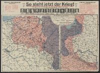
Resource Type:
Maps, Atlases & Globes
Description:
Includes 2 maps, text, and ill. and On verso: 4 anciallry maps, text, and ill.
Publisher:
Julius Hans Forkel,
Subject (Geographic):
Germany--Maps
Subject (Topic):
World War, 1914-1918--Maps
Found in:
Beinecke Rare Book and Manuscript Library > [So steht jetzt der Krieg!] : Kriegsoperationskarte über alle Kriegsschauplätze der welt.
Creator:
Published / Created:
[1876]
Call Number:
BrSides Folio 2019 105
Image Count:
10
Resource Type:
Maps, Atlases & Globes
Description:
Dissected and mounted on linen. Labels with sheet titles in manuscript on verso. Includes additional "Ausg. 1877" for southernmost sheet ("Lussina u. Osero")., Fasine & Canale della Morlacca -- Cherso u. Canale dell' Arsa -- Osero u. Lussina -- Pola., and Relief shown by hachures.
Publisher:
[K.K. Militaerisch-Geografischen Institute],
Subject (Geographic):
Hungary--Maps.
Found in:
Beinecke Rare Book and Manuscript Library > [Special-Karte des Königreichs Ungarn].
Branch:v1.61.8 ,Deployed:2024-06-20T11:15:04-04:00