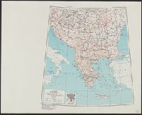
Its A.M.S. ; 6201 and Series (Standard map series designation system) ; 6201.
Description:
"Lambert conformal conic projection.", Elevations are shown by hachures and spot heights in meters., Inset shows area with detailed transportation information., and Two classes of roads and five classes of railroads are shown.
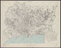
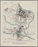
"Copied from a Spanish map, 1:14,000, Plano de Barcelona.", At head of title: Spain 1:14,000., Includes inset., Military grid., and Standard map series designation: M981.
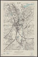
Its A.M.S. ; M961 and Series (Standard map series designation system) ; M961.
Description:
"Copied from a French map 1:6,000, Nouveau plan de Charleville-Mezieres.", At head of title: France 1:5,000., and Some streets and buildings are named.
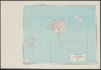
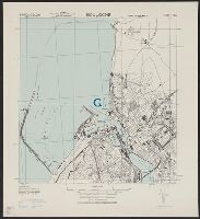
Its A.M.S. ; 6201 and Series (Standard map series designation system) ; 6201.
Description:
"Conical orthomorphic projection (Lambert conformal conic projection).", Elevations are shown by hachures and spot heights in meters., Inset shows area with detailed transportation information., and Principal roads, trails and railroads are shown.