Skip to search
Skip to main content
Skip to first result
Search
You Searched For
Extent of Digitization
Unspecified
Format
cartographic
New Search
Search Results
Creator:
Published / Created:
1785 March 1
Call Number:
1982 Folio 10
Image Count:
2
Found in:
Beinecke Rare Book and Manuscript Library > A map of the Mediterranean Sea, with the adjacent regions and seas in Europe, Asia, and Africa
Creator:
Published / Created:
175-?]
Call Number:
1977 Folio 177
Image Count:
2
Resource Type:
Maps, Atlases & Globes
Found in:
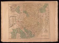
Beinecke Rare Book and Manuscript Library > A map of the circle of Westphalia comprehending the bishopricks of Liege, Munster, Paderborn & Osnabrug, the dutchies of Westphalia, Cleves, Juliers, Berg & Verden with the principalities of Minden & East Friesland and the counties of Mark, Ravensberg, Ol
Published / Created:
[1724?]
Call Number:
2003 +64
Collection Title:
Papers relating to an act of the Assembly of the province of New-York, for encouragement of the
Image Count:
1
Found in:
Beinecke Rare Book and Manuscript Library > A map of the countrey of the Five Nations belonging to the province of New York and of the lakes near which the nations of far Indians live with part of Canada taken from the map of the Louisiane done by Mr. DeLisle in 1718
Creator:
Published / Created:
1787
Call Number:
1977 Folio 177
Image Count:
2
Resource Type:
Maps, Atlases & Globes
Found in:
Beinecke Rare Book and Manuscript Library > A map of the country between Albemarle Sound, and Lake Erie [cartographic material] : comprehending the whole of Virginia, Maryland, Delaware and Pensylvania, with parts of several other of the United States of America / engraved by S.J. Neele.
Creator:
Published / Created:
1795
Call Number:
1977 Folio 177
Image Count:
2
Resource Type:
Maps, Atlases & Globes
Found in:
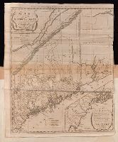
Beinecke Rare Book and Manuscript Library > A map of the district of Maine : drawn from the latest surveys and other best authorities / by Osgood Carleton ; Doolittle, sc., Newhaven.
Creator:
Published / Created:
November 29th 1755
Call Number:
2003 Folio 85
Image Count:
1
Found in:
Beinecke Rare Book and Manuscript Library > A map of the most inhabited part of New England: containing the provinces of Massachusets Bay and New Hampshire, with the colonies of Conecticut and Rhode Island : divided into counties and townships : the whole composed from actual surveys and its situat
Creator:
Published / Created:
[1755]
Call Number:
2003 Folio 85
Image Count:
1
Found in:
Beinecke Rare Book and Manuscript Library > A map of the most inhabited part of Virginia containing the whole province of Maryland: with part of Pensilvania, New Jersey and North Carolina
Creator:
Call Number:
Z6 70
Collection Title:
An enquiry into the causes of the alienation of the Delaware and Shawanese Indians from the British
Image Count:
1
Found in:
Beinecke Rare Book and Manuscript Library > A map of the province of Pensylvania. intended chiefly to illustrate the account of the several Indian purchases made by the proprietaries of the said province the claims made by the Indians, on lands settled and not purchased of them and the tract they n
Creator:
Published / Created:
1688
Call Number:
1976 1233
Collection Title:
Twenty four new and accurate maps of the several parts of Europe ... : all (except the last) new
Image Count:
1
Found in:
Beinecke Rare Book and Manuscript Library > A map of the sea coast of England France and Holland ...
Creator:
Published / Created:
1789 January 1
Call Number:
1982 Folio 10
Image Count:
1
Found in:
Beinecke Rare Book and Manuscript Library > A map of the seven united provinces, with the land of Drent, and the generality Lands
Branch:v1.60.98 ,Deployed:2024-06-05T10:04:47-04:00