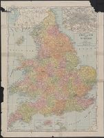
Engellandt die Insel wie sie zu unsern zeiten is beschriben mit den anstossenden Ländern Schottlandt und Irlandt
Description:
Appears in Münster's Cosmographia. 1588., Covers Great Britain and eastern Ireland., Includes text and ill., Oriented with north to the right., Other title on verso., Relief shown pictorially., and Signature mark on verso: iiii.
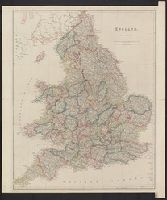
Germany. Heer. Abteilung für Kriegskarten- und Vermessungswesen. IV. Mil.-Geo Great Britain. Ordnance Survey
Published / Created:
1940
Call Number:
32eb 1940
Container / Volume:
BRBL_00075
Image Count:
1
Resource Type:
Maps, Atlases & Globes
Description:
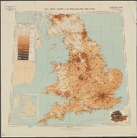
Based on Ordnance Survey map of 1934, from 1931 census., Includes insets of London County, and county boundaries., Population density shown by layer coloring., and Relief shown by spot heights.
Publisher:
Generalstab des Heeres, Abteilung für Kriegskarten- und Vermessungswesen (Mil.-Geo.),
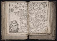
Bar scale given in Geometrical or Common Miles, British & French Leagues., Imperfect: 7 sheets wanting [upper right and upper middle sheets only]. Sheets measure 70.0 x 50.5 cm or smaller. No. 22 of 34 maps bound together., Includes explanation and scales; insets of "A map of Scotland" and "2d chart of the coast of France from Ostend to Ambleteuse.", and Relief shown pictorially.