Search
You Searched For
Search Results
- Creator:
- Rocque, John, -1762.
- Published / Created:
- 1746
- Call Number:
- 2002 Folio 94
- Image Count:
- 16
- Resource Type:
- Maps, Atlases & Globes
- Found in:
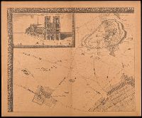
- Beinecke Rare Book and Manuscript Library > An exact survey of the city's of London and Westminster, ye borough of Southwark and the country near ten miles round : begun in 1741, finished in 1745, and published in 1746, according to act of Parliament / by John Rocque ; engrav'd by Richard Parr and printed by W. Pratt ... = Urbium maxime insignium Londini et Westmonasterii nec non municipii Sudovercencis, regionumque ad decem quasi milliaria circumjacentium : delineatio ichnographica anno 1741 incohata 1745 absoluta / a Johanne Rocque ... = Carte topographique des villes de Londres, Westminster, et bourg de Southwark et de leurs environs : levée très exactement sur les lieux, en 1741, achevée en 1745, et publieé selon un acte de Parlement en 1746 / par Jean Rocque.
- Creator:
- Jouvin, Albert, active 1672
- Published / Created:
- 1908
- Call Number:
- 38 P21 1675
- Image Count:
- 17
- Resource Type:
- Maps, Atlases & Globes
- Found in:
- Beinecke Rare Book and Manuscript Library > Paris vers 1675 [cartographic material] : grand plan de Paris et de ses environs / par Jouvin de Rochefort, dédié à Messire Simon Arnaud.
- Published / Created:
- [1750?]
- Call Number:
- 38cea 1750
- Container / Volume:
- BRBL_00169
- Image Count:
- 17
- Resource Type:
- Maps, Atlases & Globes
- Found in:
- Beinecke Rare Book and Manuscript Library > [North and East Coast of France].
- Creator:
- Wolf, Heinrich, Geologe
- Published / Created:
- 1880
- Call Number:
- 435gbc 1880
- Container / Volume:
- BRBL_00763
- Image Count:
- 17
- Resource Type:
- Maps, Atlases & Globes
- Found in:
- Beinecke Rare Book and Manuscript Library > Geologische und Gruben-Revier-Karte des Kohlbeckens von Teplitz-Dux-Brüx / nach den neuesten Aufnahmen entworfen u. herausgegeben von Heinrich Wolf, k.k. Bergrath, Chef-Geolog der k.k. Geologischen Reichsanstalt in Wien.
- Published / Created:
- 1929
- Call Number:
- WA MSS S-2611
- Collection Title:
- R. E. Blair collection of Western oil and mining investment prospectuses
- Container / Volume:
- Box 3 | Folder 60
- Image Count:
- 14
- Resource Type:
- Archives or Manuscripts
- Found in:
- Beinecke Rare Book and Manuscript Library > Mid-Tex Company
- Published / Created:
- 1838
- Call Number:
- 345ca 1838
- Container / Volume:
- BRBL_00097
- Image Count:
- 18
- Resource Type:
- Maps, Atlases & Globes
- Found in:
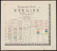
- Beinecke Rare Book and Manuscript Library > Geognostick Karta öfver Sverige, pa Bruks - Societetens anmodan, upprättad af J.H. af Forsselles under aren 1838-55. Lith. Inst. af J.F. Meyer & Co.,
- Creator:
- Cartes Taride (Firm)
- Published / Created:
- 1901-
- Call Number:
- Series 38gmb 1920
- Container / Volume:
- BRBL_00038B
- Image Count:
- 12
- Resource Type:
- Maps, Atlases & Globes
- Found in:
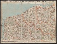
- Beinecke Rare Book and Manuscript Library > Carte routière pour automobilistes & cyclistes [cartographic material] : [France].
- Published / Created:
- 1788
- Call Number:
- 308 1788
- Container / Volume:
- BRBL_00036A
- Image Count:
- 12
- Resource Type:
- Maps, Atlases & Globes
- Found in:
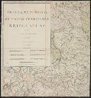
- Beinecke Rare Book and Manuscript Library > Oesterreichisch-Russischturkischer Kriegs Atlas entworfen Von Herrn Abbé Max Schimek.
- Published / Created:
- [1692?]
- Call Number:
- 32 1692
- Container / Volume:
- BRBL_00042
- Image Count:
- 12
- Resource Type:
- Maps, Atlases & Globes
- Found in:
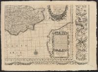
- Beinecke Rare Book and Manuscript Library > Angliae totius tabula cum distantius in itinerantium usum accomadata ... Philip Lea. Iohannes Adams ... descripsit. Thomas Burnford ... sculpsit.