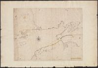
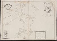
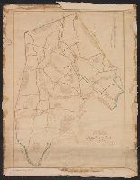
Map of the surveyed parts of Nova Scotia and Plan of Fort Cumberland at BeauSejour.
Description:
Includes "A plan of Fort Cumberland at BeauSejour" (scale [ca. 1:985]) and ill., Relief shown by hachures., and Shows area between Annapolis Basin and Minas Basin, and "Rr. Memramcook" to the north and "Cape le Have," "Margrets Bay" and "Sambro Rocks and Ledges" to the south.
Subject (Geographic):
Fort Cumberland (N.B.)--Maps, Manuscript and Nova Scotia--Maps, Manuscript
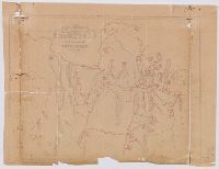
A plan of the Cove at Bassa with the adjacent roads., Entrace of the River Serra Leone vulgo Sierra Leon, 1775., Insets: Lagos and its Channels by Capt. Horsely of Liverpool 1789., and The Course of Gato or Regio Creek with the Entrance of River Benin by Capt. Archd. Dalzel, 1785.
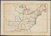
Color: ink and yellow. and Manuscript map has additions from Revolutionary War period, showing forts, etc. Note states observations are by Capn. Edmond Halley.