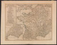
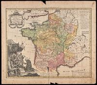
France Benedictine, ou carte generale des abbayes, & prieurez conventuels de l'Ordre de S. Benoit, tant d'hommes, que de filles, au jour a Norimberg, a 1738
Description:
Bottom left shows St. Maurice offering a book of prayers to Theodebert I, King of France who answers: "Plura Maurus precibus quam Nos Armis.", Imperfect: torn along bottom fold, with no loss of text. Watermark. Manuscript number in right corner: 19. From the Karpinski-von Wieser Map Collection., Includes note and legend., and Relief shown pictorially.
Publisher:
Recude[n]tibus Homan[n]ian. Heredib
Subject (Geographic):
France--Maps--Early works to 1800.
Subject (Name):
Homann Erben (Firm)
Subject (Topic):
Benedictine monasteries--France--Maps--Early works to 1800., Benedictine nuns--France--Maps--Early works to 1800., Convents, and Convents--France--Maps--Early works to 1800.
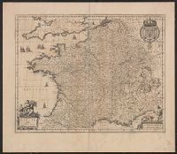
Atlas novus. and Gallia vetus ad Julij Caesaris commentaria
Description:
Latin text on recto; Dutch text on verso., Lower left corner: "Amstelodami apud Ioannem Ianβonium.", Published in Dutch editions of Jansson's Atlas novus (Dutch title: Nieuwen atlas, ofte vveerelts-beschrijvinge), vol. 6, ca. 1662, and Relief shown pictorially.
Publisher:
Jan Jansson,
Subject (Geographic):
France--History--To 987--Maps--Early works to 1800 and Gaul--Maps--Early works to 1800
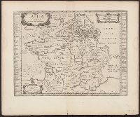
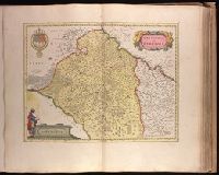
Backed with paper. Ms. no. "54" in upper-right corner. Sheet measures 53.7 x 63.1 cm. No. 49 of 87 maps bound together., Bar scale given in "milliaria Gallica"., Decorative title cartouche in upper right, coat of arms in upper left, and bar scale cartouche with one figure at the left side, with books and sun, in lower left corner., Prime meridian: Ferro., Relief shown pictorially., Verso blank., Watermark below title cartouche., and Watermark.
Publisher:
Excud. Guiljelmus Blaeu,
Subject (Geographic):
Burgundy (France)--Maps--Early works to 1800., Centre (France)--Maps--Early works to 1800., and Île-de-France (France)--Maps--Early works to 1800.