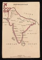
[Atlas nouveau contenant toutes les parties du monde ou sont exactement marques les empires
Image Count:
1
Resource Type:
Maps, Atlases & Globes
Abstract:
Factitious collection of about 549 maps taken from the atlases of the 17th and the beginning of the 18th century, put together with the title "Atlas" and bound in 6 volumes. These volumes originally bore the imprint: Amstelaedamii apvd Reiniervm & Josvam Ottens. Over these words on the title pages of volumes 1-2 and 4-6 is the name of Henrik de Leth who painted them.
Description:
Verso blank.
Subject (Geographic):
British Isles --Maps --Early works to 1800
Subject (Name):
Leth, Hendrik de, 1703-1766, Reiner et Josua Ottens (Firm), Schenck, Peter, 1661-1715, Schenck, Peter, ca. 1698-1752, Valck, G. (Gerard), 1651 or 2-1726, and Wit, Frederik de
Subject (Topic):
Atlases --Early works to 1800
Collection Created:
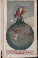
[A Amsterdam, chez J. Covens & C. Mortier, ca. 1730-ca. 1800]
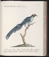
30 constellation cards; 30 country cards., Bookplate of Julia Parker Wightman in volume. From the Julia Parker Wightman Card Collection., Hand-coloured engraved playing cards are enclosed in a brown cardboard slipcase with an engraved paper label on the front and a blind-stamped decoration on the back., and Title from engraved paper label on slipcase.
Publisher:
Published by C. Hodges, 27, Portman Street, Portman Square,
Subject (Name):
Wightman, Julia P.--(Julia Parker),--1909-1994--Ownership
Subject (Topic):
Card games, Constellations, Playing cards, and Playing cards--Specimens
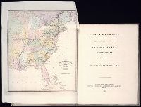
Colophon: Amstelodami, apud Theodorus Danckerts ..., Engraved t.-p., col., with imprint on mounted slip; imprint on verso of t.-p.: Amstelodami, apud Fredericum de Wit ..., and Maps signed by Justus, Cornelis, Theodore or Johann Danckerts, Frederick de Wit and others.
Publisher:
Bij Iustus Danckers in de Calverstraet in de Dancbaerheijt